
New rainfall record set in New Zealand with 1 086 mm (42.7 inches) in 48 hours
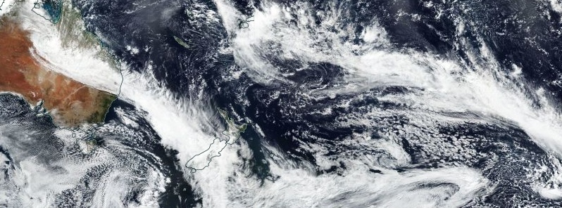
Image credit: NASA/NOAA Suomi NPP/VIIRS. Acquired March 26, 2019
The atmospheric river event affecting New Zealand over the past 3 days has set the country's new 48-hour rainfall record. The storm caused major infrastructural damage, including destroyed Waiho Bridge in South Island's Westland District. At least one person has died during the event.
Cropp waterfall recorded 1 086 mm (42.7 inches) of rain in 48 hours to March 27, setting the country's new 48-hr rainfall record. This is 176% of average annual rainfall in Christchurch, 147% in Dunedin, 97% in Hamilton and Auckland, 91% in Tauranga and 89% in Wellington.
The atmospheric river affecting New Zealand has an atmospheric 'footprint' that extends some 5000+ km, from the Timor Sea to New Zealand
Ivory Glacier is on 541 mm, Mueller Hut 538 mm, Milford Sound 527 mm, Mt Cook 432 mm, and Franz Josef 244 mm. pic.twitter.com/9GouJ9e8QD
— NIWA Weather (@NiwaWeather) March 26, 2019
1086 mm at Cropp waterfall in 48 hours, NZ's new rainfall record
What is that as a % of annual normal rainfall in the main centres
Christchurch: 176%
Dunedin: 147%
Hamilton: 97%
Auckland: 97%
Tauranga: 91%
Wellington: 89% pic.twitter.com/qLyTz4EarZ— NIWA Weather (@NiwaWeather) March 27, 2019
Updated South Island rainfall! High elevation areas have exceeded 1 metre. That's nearly Auckland's average annual rainfall
1️⃣ Cropp River: 1096 mm
2️⃣ Mueller Hut: 683.6 mm
3️⃣ Ivory Glacier: 636 mm
4️⃣ Haast River 578.5 mm
5️⃣ Mt Cook: 533.3 mm
6️⃣ Mt Philistine: 489 mm pic.twitter.com/QIIy9A0c41— NIWA Weather (@NiwaWeather) March 26, 2019
Extremely heavy rain caused a rapid rise of West Coast rivers to near-record levels. The Haast River at Roaring Billy, for example, recorded a water level of 7.423 m (24.35 feet), making it its 2nd highest water level at the station since 1968 (the highest was 7.580 m / 24.86 feet) recorded in 1978. In less than 48 hours, this location has recorded 548 mm (21.57 inches) of rain, or nearly 10% of its yearly normal.
The Waiho Bridge was destroyed by the rising and rough floodwaters of the Waiho River near Franz Josef on March 26, forcing authorities to declare a State of Emergency for the Westland District. The river was running as high as 7.6 m (24.93 feet).
According to the New Zealand Transport Agency (NZTA), hours of torrential flood waters carrying large amounts of rock and material downstream battered the bridge's support piers until it collapsed. However, one of the residents said he warned authorities three days before the collapse that the northern end of the bridge's abutment was missing rocks and needed strengthening.
According to police reports, one woman has been found dead after her body washed up on a riverbank north of the town of Hokitika. It appears she got out of the vehicle she was driving and tried to cross floodwaters on foot.
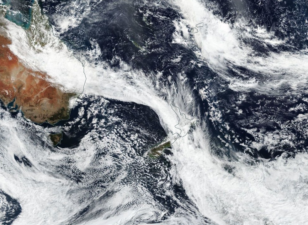
Atmospheric river event over New Zealand on March 27, 2019. Credit: NASA/NOAA Suomi NPP/VIIRS
The front which brought heavy rain to the west of the South Island on Tuesday, March 26 moves north onto the lower North Island this afternoon to lie over the central North Island at night, New Zealand's MetService said March 27. This front is likely to bring a period of heavy rain to the northern South Island and southern/western North Island.
Although thunderstorms are considered unlikely with the front as it passes over the northern South Island this morning, and southern North Island in the afternoon, there is a low risk of a few embedded thunderstorms with the front about Taranaki and coastal Waitomo from this afternoon. If any thunderstorms do occur, they will boost local rainfall rates.
A southerly change is expected to affect Canterbury from about the Banks Peninsula southwards and also North Otago and Dunedin this afternoon.
I'm a dedicated researcher, journalist, and editor at The Watchers. With over 20 years of experience in the media industry, I specialize in hard science news, focusing on extreme weather, seismic and volcanic activity, space weather, and astronomy, including near-Earth objects and planetary defense strategies. You can reach me at teo /at/ watchers.news.
Commenting rules and guidelines
We value the thoughts and opinions of our readers and welcome healthy discussions on our website. In order to maintain a respectful and positive community, we ask that all commenters follow these rules.