
Tropical Cyclone “Linda” forms between Australia and New Caledonia
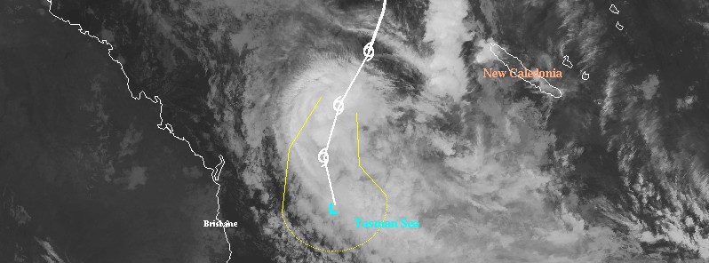
Featured image: Tropical Cyclone "Linda" at 17:30 UTC on March 13, 2018 with JTWC forecast track issued 12:00 UTC, March 13. Credit: UW-CIMSS
Tropical Cyclone "Linda" formed in the Coral Sea, east of Australia on March 13, 2018 as the 7th named storm of the 2017/18 Australian region tropical cyclone season. The cyclone is expected to stay off the coast and generate large waves and dangerous surf conditions on exposed southern Queensland beaches. Tides are also expected to be higher than normal, particularly on Thursday morning's high tide.
At 18:00 UTC on Tuesday, March 13, the center of Tropical Cyclone "Linda" was located 845 km (524 miles) NE of Brisbane, Australia and (531 miles) W of Noumea, New Caledonia.
Linda was moving SSW at 26 km/h (16 mph) with maximum 10-minute winds of 65 km/h (40 mph), maximum 3-second wind gust of 95 km/h (59 mph) and central pressure of 993 hPa, according to data provided by the Australian Bureau of Meteorology.

The cyclone has continued its south-southwest path over the past 12 hours and is now showing the results of interaction with higher shear, with low level circulation center displaced to the northeast away from the deepest convection.
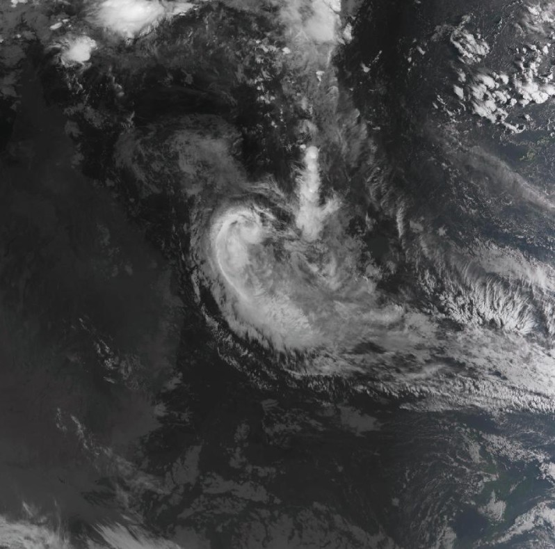
Tropical Cyclone "Linda" at 19:10 UTC on March 13, 2018. Credit: JMA/Himawari-8
The system will move into greater deep layer shear associated with an upper trough over eastern Australia on Wednesday.
The interaction with this trough is expected to cause the system to continue to lose its tropical cyclone structure and transition into a subtropical low pressure system, particularly after confirmation is obtained from visual imagery as to the position of the LLCC.
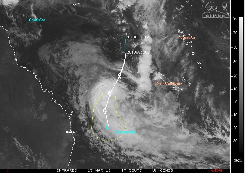
Tropical Cyclone "Linda" JTWC forecast track at 12:00 UTC, March 13, 2018 with IR image at 17:30 UTC. Credit: UW-CIMSS
At its closest approach to the coast, the remains of Tropical Cyclone "Linda" will generate large waves and dangerous surf conditions on exposed southern Queensland beaches.
Tides are also expected to be higher than normal, particularly on Thursday morning's high tide. A Severe Weather Warning is current for these conditions.
I'm a dedicated researcher, journalist, and editor at The Watchers. With over 20 years of experience in the media industry, I specialize in hard science news, focusing on extreme weather, seismic and volcanic activity, space weather, and astronomy, including near-Earth objects and planetary defense strategies. You can reach me at teo /at/ watchers.news.
Commenting rules and guidelines
We value the thoughts and opinions of our readers and welcome healthy discussions on our website. In order to maintain a respectful and positive community, we ask that all commenters follow these rules.