
Hong Kong shuts down overnight as Tropical Storm “Merbok” makes landfall
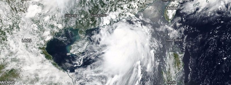
Featured image: Tropical Storm "Merbok" on June 12, 2017. Credit: NASA/NOAA Suomi NPP/VIIRS
Tropical Storm "Merbok" is expected to make landfall within 50 km (31 miles) of Hong Kong before midnight local time (16:00 UTC) June 12, 2017, bringing gales and heavy rain to parts of the territory, the Hong Kong Weather Observatory said.
At 11:00 UTC (19:00 HKT) on June 12, the center of Tropical Storm "Merbok" was located about 50 km (31 miles) SSE of Hong Kong Observatory (near 21.9 degrees north and 114.4 degrees east) and is forecast to move north-northwest at about 20 km/h (12.4 mph) in the general direction of Hong Kong.
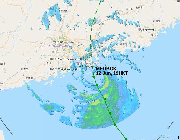
Tropical Storm "Merbok" radar image taken 11:00 UTC on June 12, 2017. Credit: Hong Kong Weather Observatory
In the past hour, the maximum sustained winds recorded at Waglan Island, Cheung Chau and Sha Chau were 87, 53 and 51 km/h (54, 33 and 31 mph) with maximum gusts 107, 69 and 66 km/h (66.4, 42.8 and 41 mph), respectively.
Local wind directions will change significantly when Merbok passes over Hong Kong, the Observatory said, adding that areas which were previously sheltered may become exposed. Members of the public should stay on the alert.
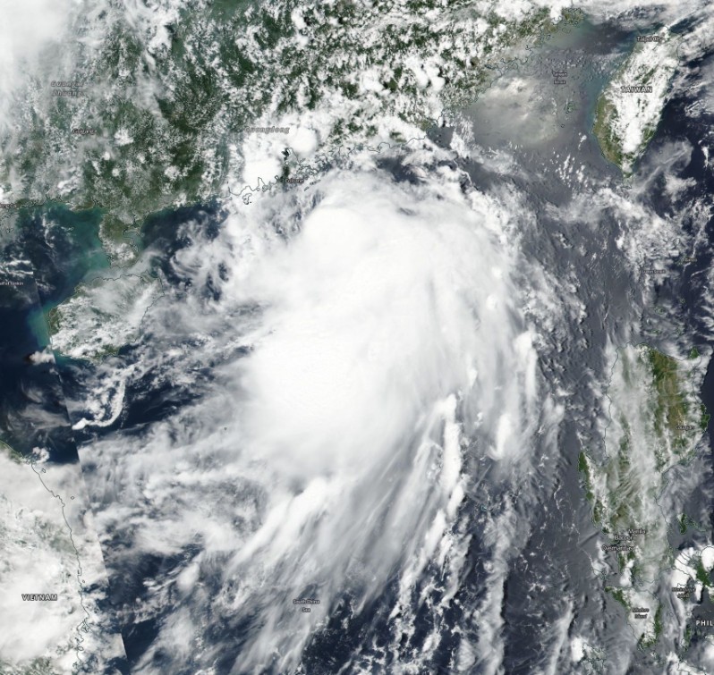
Tropical Storm "Merbok" on June 12, 2017. Credit: NASA/NOAA Suomi NPP/VIIRS
The Number 8 Gale or Storm Signal is expected to remain in force tonight, effectively shutting down the city overnight. This means that winds with mean speeds of 63 km/h (39 mph) or more are expected from the northeast quarter.
For the residents, this means they are expected to:
- Complete all precautions in homes. Lock all windows and doors, fit bars into position and insert reinforced shutters and gates if they are available. Adhesive tape fixed to large window-panes in exposed positions will reduce damage by broken glass. Storm water drains should be cleared of leaves and rubbish.
- Park cars where they are least likely to be damaged.
- Do not stand near windows on the exposed side of your home. Move all furniture and valuables away from these areas. Make sure you have a safe place to shelter, should windows be broken.
- Owners of neon signs are reminded that they should now arrange for the electricity supply to their signs to be cut off.
- Listen to radio or watch TV for the latest weather information broadcast. They can also browse the Hong Kong Observatory's website for the information.
As the sea will be very rough and there are swells, members of the public should stay away from the shoreline and not to engage in water sports.
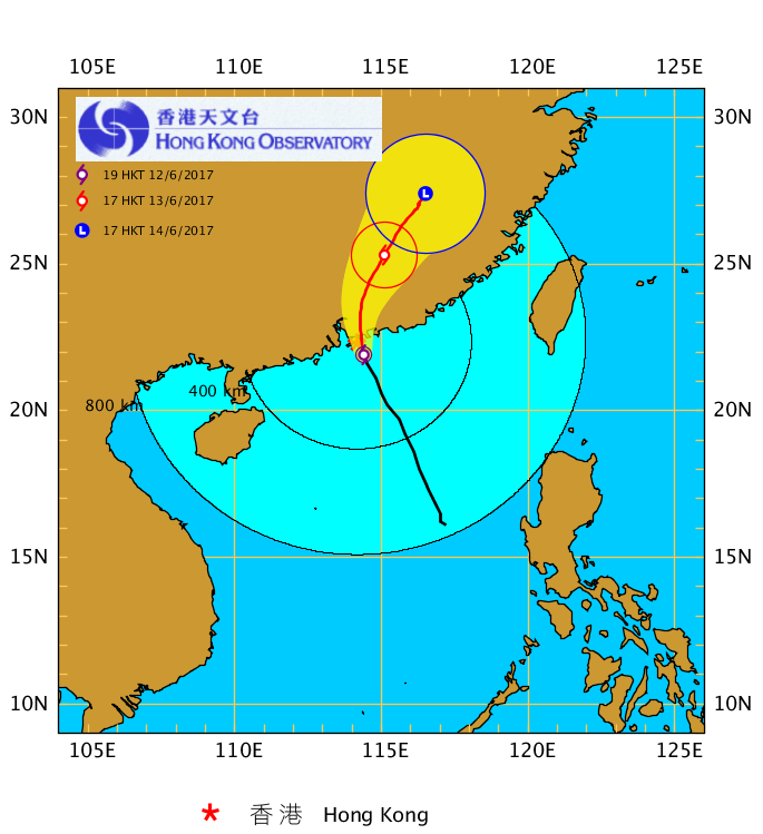
Tropical Storm "Merbok" HKWO forecast track June 12, 2017
I'm a dedicated researcher, journalist, and editor at The Watchers. With over 20 years of experience in the media industry, I specialize in hard science news, focusing on extreme weather, seismic and volcanic activity, space weather, and astronomy, including near-Earth objects and planetary defense strategies. You can reach me at teo /at/ watchers.news.
what is going on with this “huge” upper atmospheric disturbance that it just happen today? Thank you