
Tropical Cyclone “Frances” forms near Australia
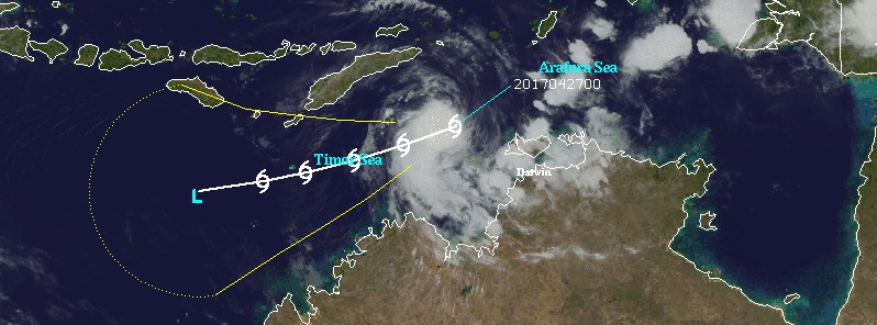
Featured image: Tropical Cyclone "Frances" on April 27, 2017. Credit: UW-CIMSS
Tropical Cyclone 17S (Frances) formed near the coast of Northern Territory, Australia on April 27, 2017, as the 7th named storm of the 2016/17 Australian region cyclone season. Frances is moving southwest and is expected to somewhat intensify over the next 24 hours, but is not expected to make landfall. The season officially ends on April 30.
As of 15:00 UTC on April 27, 2017, the center of Tropical Cyclone "Frances" was located approximately 324.1 km (201 miles) west-northwest of Darwin, Australia, and has tracked southeastward at 20 km/h (12.4 mph). Its maximum sustained winds at 12:00 UTC were 83 km/h (52 mph), according to the JTWC.
JTWC expects the system to turn toward a more westward track and intensify over the next 24 hours as favorable environmental conditions persist.
After 15:00 UTC on April 28, upper-level conditions are expected to become less favorable, with vertical wind shear increasing and divergence aloft decreasing. Frances is expected to weaken below the dissipation threshold over the next 72 hours without making a landfall.
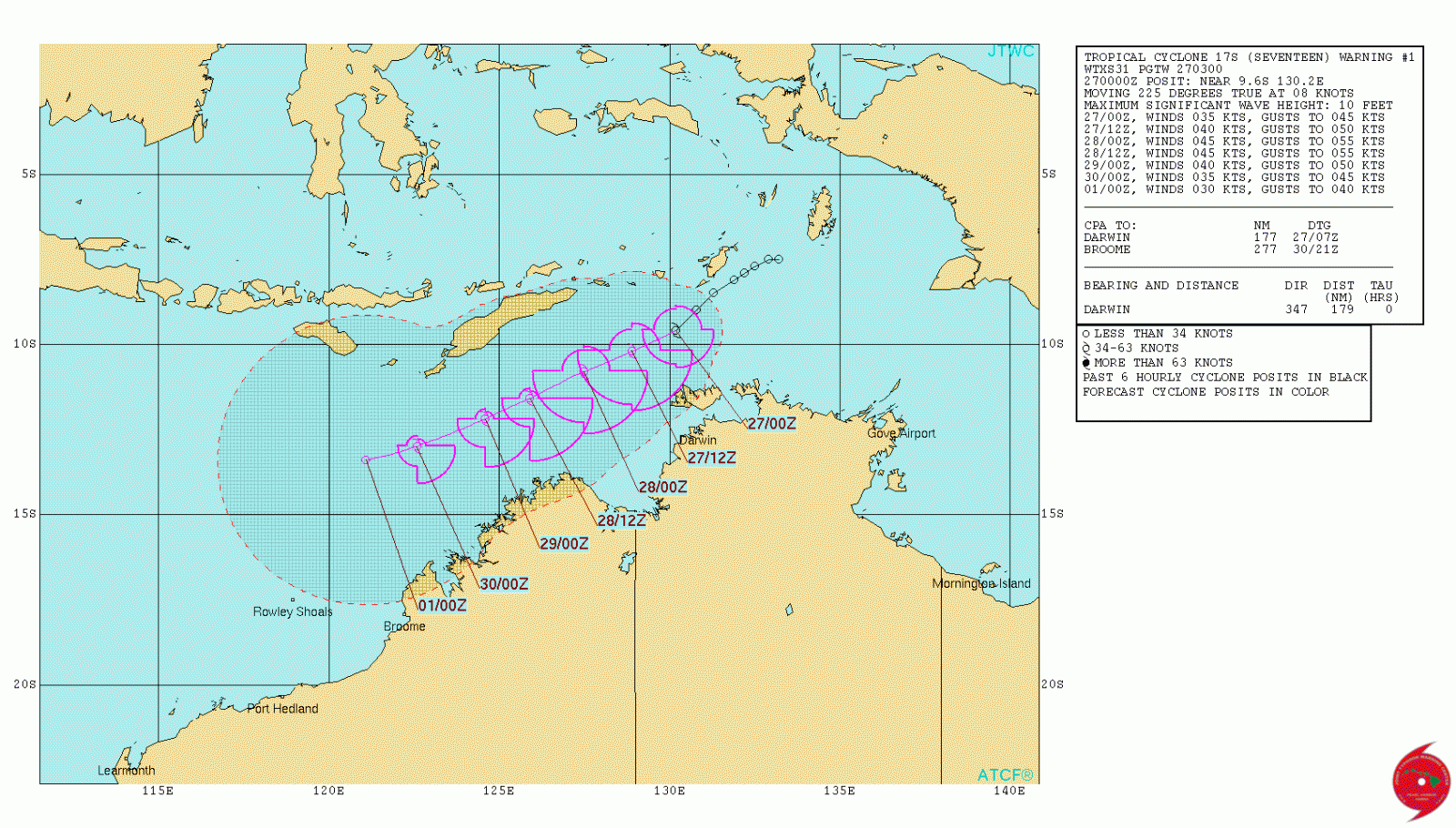
Tropical Cyclone "Frances" forecast track by JTWC at 03:00 UTC on April 27, 2017
If Frances takes a more southerly track, BOM warns, peripheral gales may affect the north Kimberly coast later on Friday (local time).
Gales with gusts to 110 km/h (68 mph) may develop late Friday in coastal parts between Kuri Bay and Wyndham, not including Wyndham.
Tides between Kalumburu and Wyndham are likely to rise above normal high tide mark with very rough seas and flooding of low-lying coastal areas.

Tropical Cyclone "Frances" BOM forecast track at 16:25 UTC on April 27, 2017
DFES-State Emergency Service advises that there are no community alerts at present. People in the Kimberley are advised to stay up to date with weather forecasts and warnings. People between Kuri Bay and Wyndham should listen for BOM's next advice.
I'm a dedicated researcher, journalist, and editor at The Watchers. With over 20 years of experience in the media industry, I specialize in hard science news, focusing on extreme weather, seismic and volcanic activity, space weather, and astronomy, including near-Earth objects and planetary defense strategies. You can reach me at teo /at/ watchers.news.
Commenting rules and guidelines
We value the thoughts and opinions of our readers and welcome healthy discussions on our website. In order to maintain a respectful and positive community, we ask that all commenters follow these rules.