
Tropical Depression “Seniang” to make landfall in Mindanao, Philippines
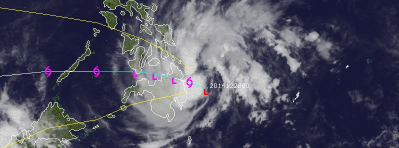
Featured image: Visible/Infrared image of Tropical Depression "Seniang" on December 28, 2014. Image credit: UW-CIMSS
Tropical Depression "Seniang" has been named by PAGASA just prior to making landfall in Mindanao early Monday, December 29, 2014. Public Storm Warning Signal #1 (PSWS#1) was issued for much of eastern Mindanao and portions of Eastern and Central Visayas.
PAGASA expects landfall to occur in the vicinity of Tandag, Surigao del Sur.
According to their latest Tropical Cyclone Warning for Seniang, estimated rainfall amount is from 7 – 15 mm per hour (moderate – heavy) within the 300 km diameter of the Tropical Depression.
Residents in low lying and mountainous areas of the provinces with PSWS#1 as well as over Eastern Visayas and the rest of Mindanao especially Caraga Region are alerted against possible flashfloods and landslides.
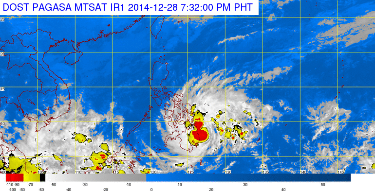
Tropical Depression "Seniang". Image credit: PAGASA
Fisherfolks and those with small seacrafts are advised not to venture out over the northern and eastern seaboards of Luzon and the eastern seaboard of Visayas and over the northern and eastern seaboards of Mindanao.
Ocean waves may reach up to 4 meters.
Video courtesy of WestPacWx
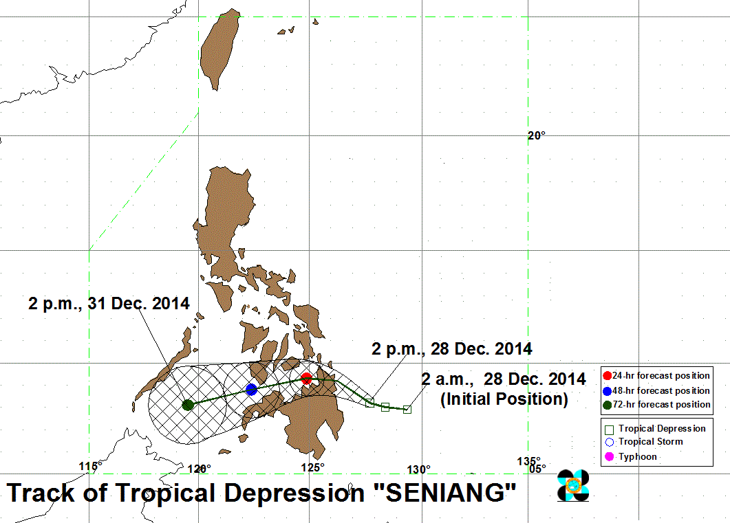
Below is the latest forecast track from PAGASA showing the storm making landfall in eastern Mindanao.
Farther to the north in North East Mindanao and Eastern Visayas the strongest winds will occur along with the heaviest rainfall. In some areas up to 200 – 300 mm is possible, Robert Speta of the WestPacWx explains.
Video courtesy of WestPacWx
The Watchers team and our contributors bring the latest on extreme weather, earthquakes, volcanic eruptions, space weather, and all things science. We're all about making sense of the natural world and keeping you informed on what’s happening. Got a tip or a question? Hit us up using the form at newstips!
Commenting rules and guidelines
We value the thoughts and opinions of our readers and welcome healthy discussions on our website. In order to maintain a respectful and positive community, we ask that all commenters follow these rules.