
Ten years of satellites watching fires worldwide
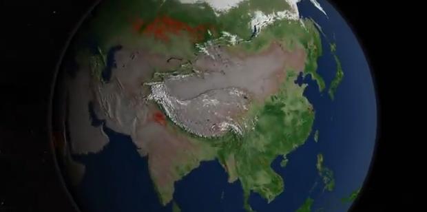
Image credit: TW
This video takes you on a narrated global tour of tens of millions of fires detected from space between July 2002 and July 2011. T
The video was created from new satellite data visualizations, and is combined with satellite views of vegetation and snow cover to show how fires relate to seasonal changes. The research helps scientists understand how fire affects our environment on local, regional and global scales.
"What you see here is a very good representation of the satellite data scientists use to understand the global distribution of fires and to determine where and how fire distribution is responding to climate change and population growth,” said Chris Justice of the University of Maryland, College Park, a scientist who leads one of NASA’s efforts to study the world’s fires.
Commenting rules and guidelines
We value the thoughts and opinions of our readers and welcome healthy discussions on our website. In order to maintain a respectful and positive community, we ask that all commenters follow these rules.