
Fires along the Rio Xingu, Brazil
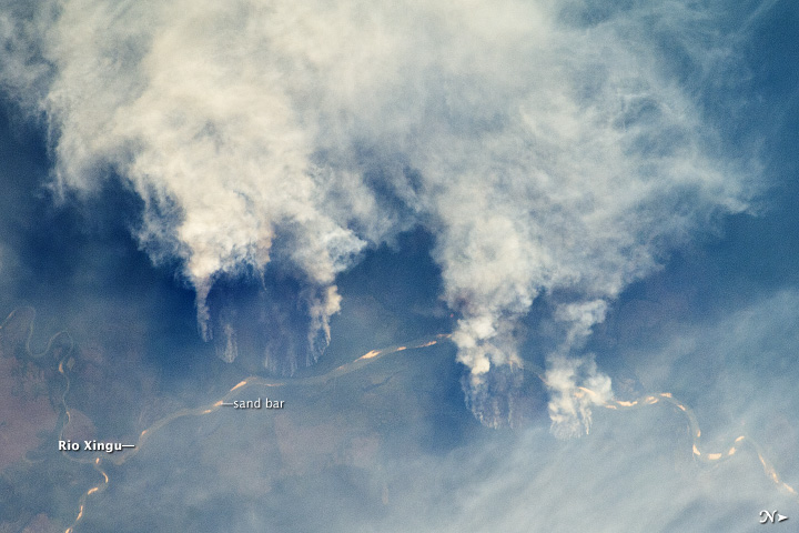
Image credit: TW
The rainforest of South America, also known as Amazonia, has been undergoing a continual and accelerated conversion process into farmlands (including pasture for livestock) since the early 1960s. This process has typically been achieved by clearing the forest using fire—“slash and burn”— followed by planting of crops.
The generally infertile soils of this rainforest—the largest such forest on Earth—make sustainable farming difficult. This drives people to convert more forest into farmland. The area of clearing can be considerable, and since the deforested regions are easily identifiable and measurable from space, the rate of deforestation is likewise easy to track.
Rivers are the natural highways in Amazonia, which may explain why the burning is occurring right next to the Xingu River, one of Amazonia’s largest.
In recent years, forest preservation has gained traction in the region as a result of new valuation of the ecosystem services provided by the forest, concerns about the impact of the burning on global climate change, and greater sensitivity to the ethnic and biological heritage of Amazonia. (EarthObservatory)
Gateway to Astronaut Photography of Earth
Commenting rules and guidelines
We value the thoughts and opinions of our readers and welcome healthy discussions on our website. In order to maintain a respectful and positive community, we ask that all commenters follow these rules.