Before and after the Christchurch earthquake
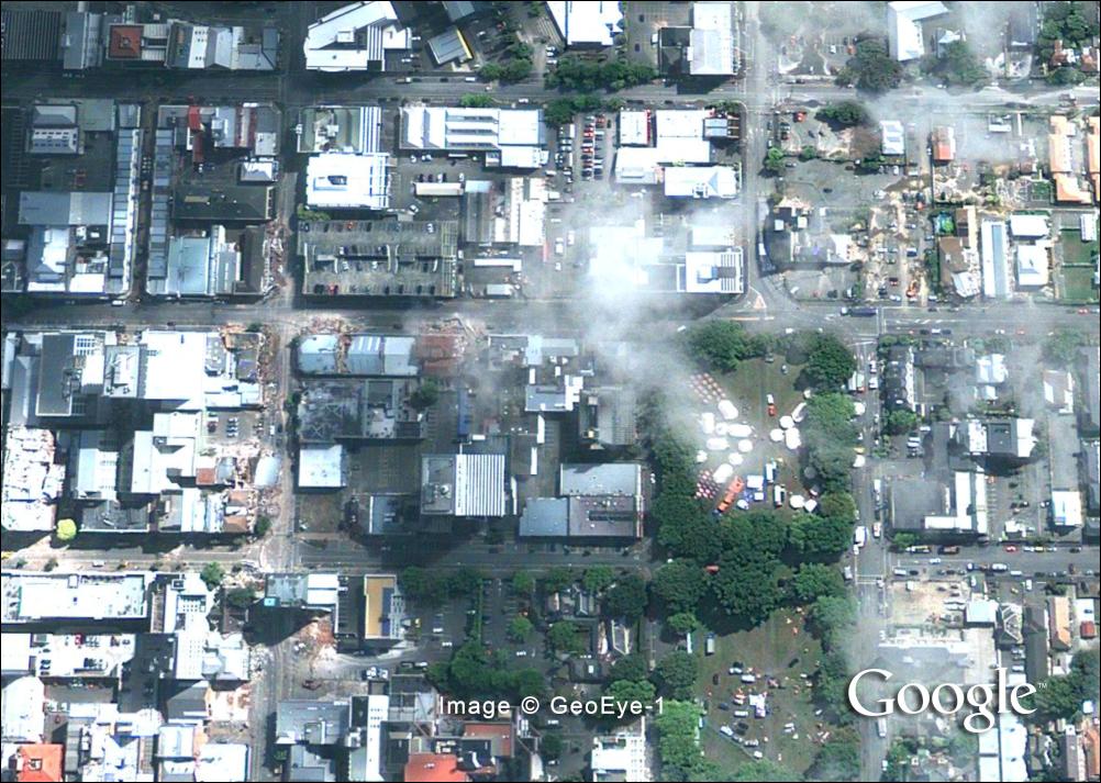
Satellite imagery has captured some of the devastation caused by the 6.3-magnitude earthquake that flattened buildings and killed scores of people in the New Zealand city of Christchurch on February 22, 2011.
Google and GeoEye took the aerial images two days after the quake. Imagery of Christchurch was taken on Thursday, February 24th from the GeoEye-1 satellite. Some parts are covered in clouds but substantial portions of the central business district are clearly visible. Remember to turn the layer on and off to compare it with previous imagery, which is from March 2009.
If you value what we do here, create your ad-free account and support our journalism.
Your support makes a difference
Dear valued reader,
We hope that our website has been a valuable resource for you.
The reality is that it takes a lot of time, effort, and resources to maintain and grow this website. We rely on the support of readers like you to keep providing high-quality content.
If you have found our website to be helpful, please consider making a contribution to help us continue to bring you the information you need. Your support means the world to us and helps us to keep doing what we love.
Support us by choosing your support level – Silver, Gold or Platinum. Other support options include Patreon pledges and sending us a one-off payment using PayPal.
Thank you for your consideration. Your support is greatly appreciated.
Sincerely,
Teo Blašković
Commenting rules and guidelines
We value the thoughts and opinions of our readers and welcome healthy discussions on our website. In order to maintain a respectful and positive community, we ask that all commenters follow these rules:
We reserve the right to remove any comments that violate these rules. By commenting on our website, you agree to abide by these guidelines. Thank you for helping to create a positive and welcoming environment for all.