
Tropical Cyclone “Yasa” expected to make landfall over Viti Levu, Fiji
Featured image: Tropical Cyclone "Yasa" at 11:50 UTC on December 14, 2020. Credit: JMA/Himawari-8, RAMMB/CIRA, TW
Tropical Cyclone "Yasa" formed on December 12, 2020, as the first named storm of the 2020/21 South Pacific Ocean cyclone season. The current forecast track takes Yasa over Viti Levu, Fiji on December 17, with maximum sustained winds between 165 km/h (100 mph) and 195 km/h (120 mph).
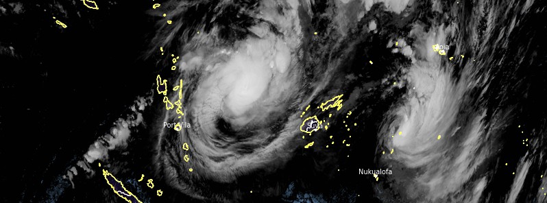
At 09:00 UTC on December 14, the center of Yasa was located about 464 km (288 miles) NNE of Port Vila, Vanuatu and 704 km (437 miles) SSE of Suva, Fiji. The system is moving SSW at 5 km/h (3 mph).
Yasu's maximum 10 minutes sustained wind speed was 95 km/h (60 mph), maximum 1 minute sustained winds 120 km/h (75 mph) gusting up to 130 km/h (80 mph). The minimum central pressure was 980 hPa.
The system is tracking along the northern periphery of a subtropical ridge positioned to the south and through an overall favorable environment with warm sea surface temperatures, low vertical wind shear, and well established poleward and equatorial outflow aloft.
Interaction between the steering subtropical ridge and an incoming midlatitude trough from the west will result in a complex steering environment, JTWC forecasters said.
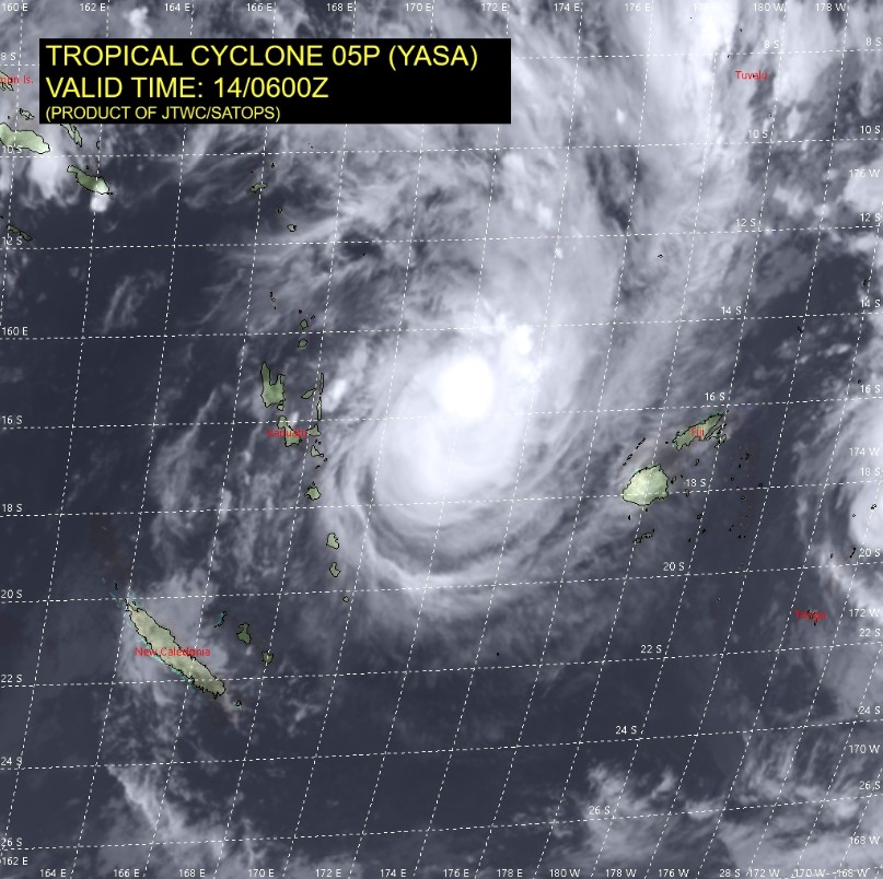
Image credit: JTWC/SATOPS
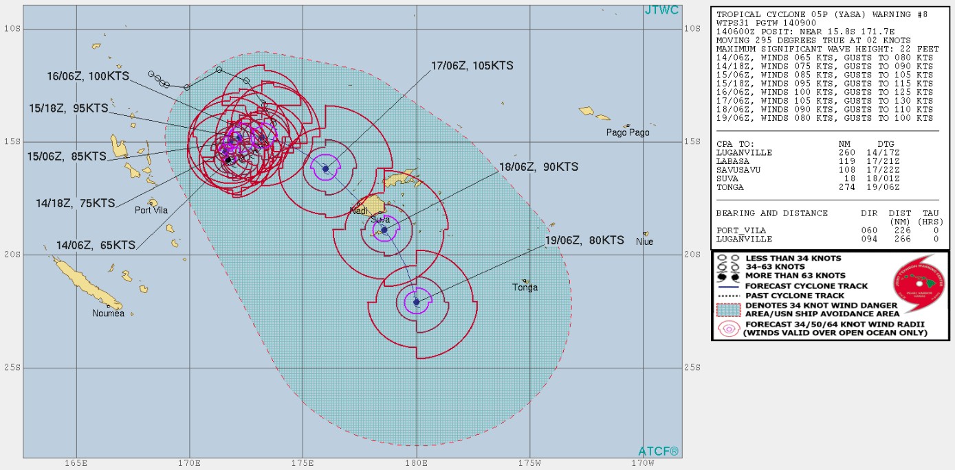
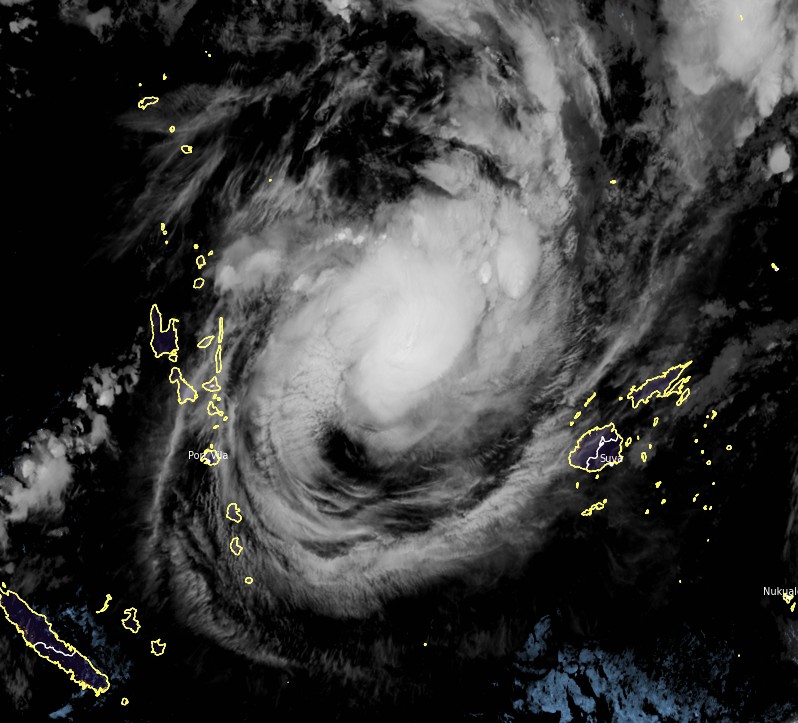
Image credit: JTWC
Over the next 12 hours, Yasa is if forecast to track generally equatorward as the steering ridge retreats to the west. By 09:00 UTC on December 15, the system will begin a generally eastward track as near-equatorial ridging to the north becomes the predominant steering mechanism.
During this initial track, Yasa will continue to intensify due to continued favorable environmental conditions.
Tropical Cyclone "Yasa" at 11:50 UTC on December 14, 2020. Credit: JMA/Himawari-8, RAMMB/CIRA, TW
By 09:00 UTC on December 16, the system will reach an intensity of 185 km/h (115 mph) and begin to track generally southwestward thereafter along an extension of building subtropical ridge positioned to the southeast.
Yasa will then reach a peak intensity of 195 km/h (120 mph) by 09:00 UTC on December 17 prior to making landfall along the northwest coast of Fiji.
Interaction with the underlying terrain of the island and moderate vertical wind shear thereafter will weaken the system to 150 km/h (90 mph) by 09:00 UTC on December 18.
I'm a dedicated researcher, journalist, and editor at The Watchers. With over 20 years of experience in the media industry, I specialize in hard science news, focusing on extreme weather, seismic and volcanic activity, space weather, and astronomy, including near-Earth objects and planetary defense strategies. You can reach me at teo /at/ watchers.news.
Commenting rules and guidelines
We value the thoughts and opinions of our readers and welcome healthy discussions on our website. In order to maintain a respectful and positive community, we ask that all commenters follow these rules.