Waterspout outbreak over the Great Lakes
More than 25 waterspouts were observed over the Great Lakes between August 23 and 24, 2025. More water spouts are expected over the lakes through August 26.

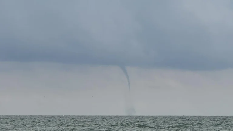
More than 25 waterspouts were observed over the Great Lakes between August 23 and 24, 2025. More water spouts are expected over the lakes through August 26.

Nearly 40 million people from Texas to Michigan are under threat of severe weather as an amplifying trough begins affecting the central United States on Wednesday, April 16, 2025. The system is forecast to bring strong thunderstorms, heavy rainfall, and damaging winds, with the associated cold front expected to dominate weather conditions through Saturday, April 19, from the Southern Plains to the Great Lakes.
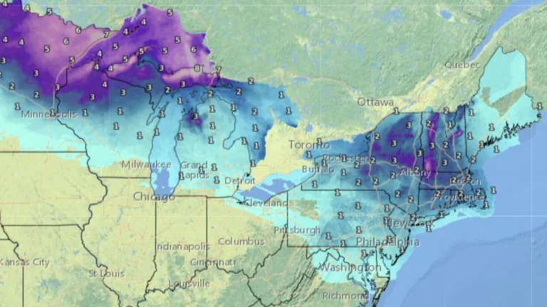
Two winter storms are set to sweep across the U.S. Midwest, Great Lakes, and Northeast starting February 5, 2025, impacting millions with power outages and treacherous icy roads, prompting several Ice Storm Warnings and Winter Weather Warnings.

A mix of freezing rain and sleet will develop across parts of the Midwest and northern Mid-Atlantic from Wednesday, February 5 through Thursday, February 6, 2025, as Arctic air lingers ahead of an approaching storm system. The greatest ice accumulation risks are expected in western Maryland, the West Virginia Panhandle, and Pennsylvania, where ice buildup may cause power outages and hazardous road conditions. Elsewhere, lighter freezing rain could still lead to travel disruptions across the Great Lakes and Ohio Valley.
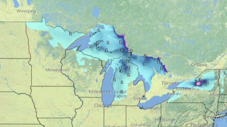
A significant threat of snow squalls is forecast to impact the Great Lakes, Mid-Atlantic, and Northeast from Monday, January 27, to Wednesday, January 29, 2025, bringing hazardous travel conditions, heavy snowfall, and gusty winds.

A potent upper-level low is forecast to bring the first significant snowfall of the season to parts of the Northeast, Great Lakes, and central Appalachians, with accumulations of up to 30.5 cm (1 foot) expected in higher elevations through Saturday, November 23, 2024, starting Thursday, November 21.

A bright fireball streaked across the twilight sky over Lake Erie at 23:00 UTC (19:00 LT) on October 21, 2024. The event lasted several seconds before the object fragmented and disintegrated, leaving a glowing vapor trail near Ashtabula, Ohio.
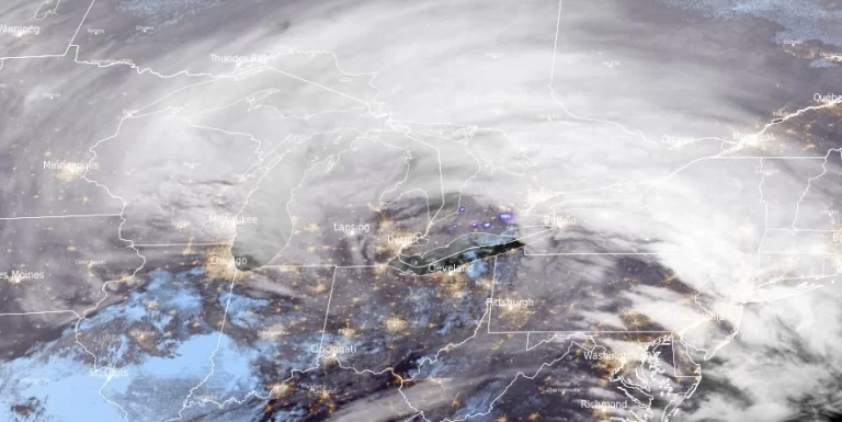
A powerful winter storm is set to bring heavy snow, strong winds, and blizzard conditions across the Midwest to the Great Lakes through Saturday, January 13, 2024. Following this storm, dangerously low temperatures are forecasted for the Rockies and Plains. This storm system is part of the same weather pattern that caused significant disruptions in southern Ontario, Canada.

As Arctic air sweeps across the Great Lakes, meteorologists are warning of the season’s first significant lake-effect snow event, poised to cause travel disruptions and potentially feet of snow in some areas. This weather phenomenon, intensifying early next week, is expected to bring hazardous conditions, particularly along I-90 and in snow-prone regions of Michigan, Ohio, and New York.

Heavy lake-effect snow hit areas around Great Lakes on November 2 and 3, 2021, dropping nearly 30 cm (1 foot) on parts of the region. A weather station in northern Michigans' Gaylord registered 29.7 cm (11.7 inches) of snow in 24 hours on November 2, making it…
