
Nearly 40 million brace for severe weather from Great Lakes to Southern Plains through Easter weekend
Nearly 40 million people from Texas to Michigan are under threat of severe weather as an amplifying trough begins affecting the central United States on Wednesday, April 16, 2025. The system is forecast to bring strong thunderstorms, heavy rainfall, and damaging winds, with the associated cold front expected to dominate weather conditions through Saturday, April 19, from the Southern Plains to the Great Lakes.
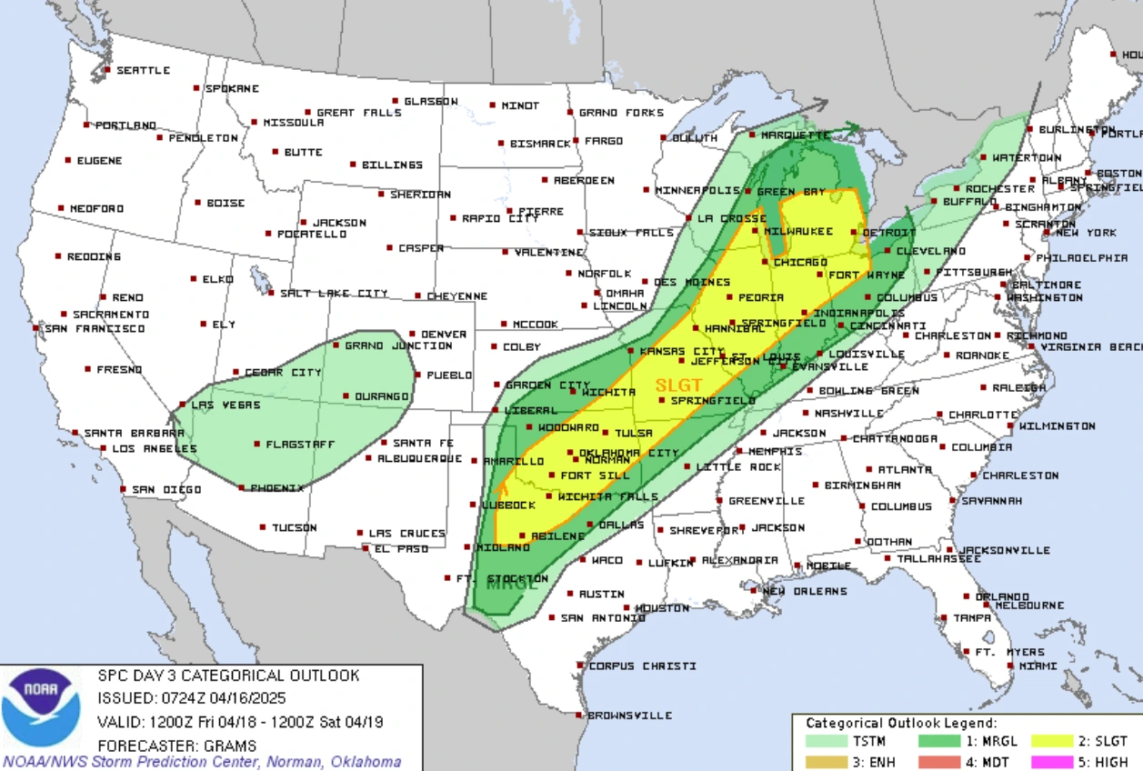
Convective outlook through Friday, April 18, 2025. Image credit: NWS
An amplifying upper level trough will interact with a low pressure system in the south to bring scattered to severe thunderstorms across the central U.S. this week, starting Wednesday night, April 16. Large hail, strong winds, and a few tornadoes are expected across the region.
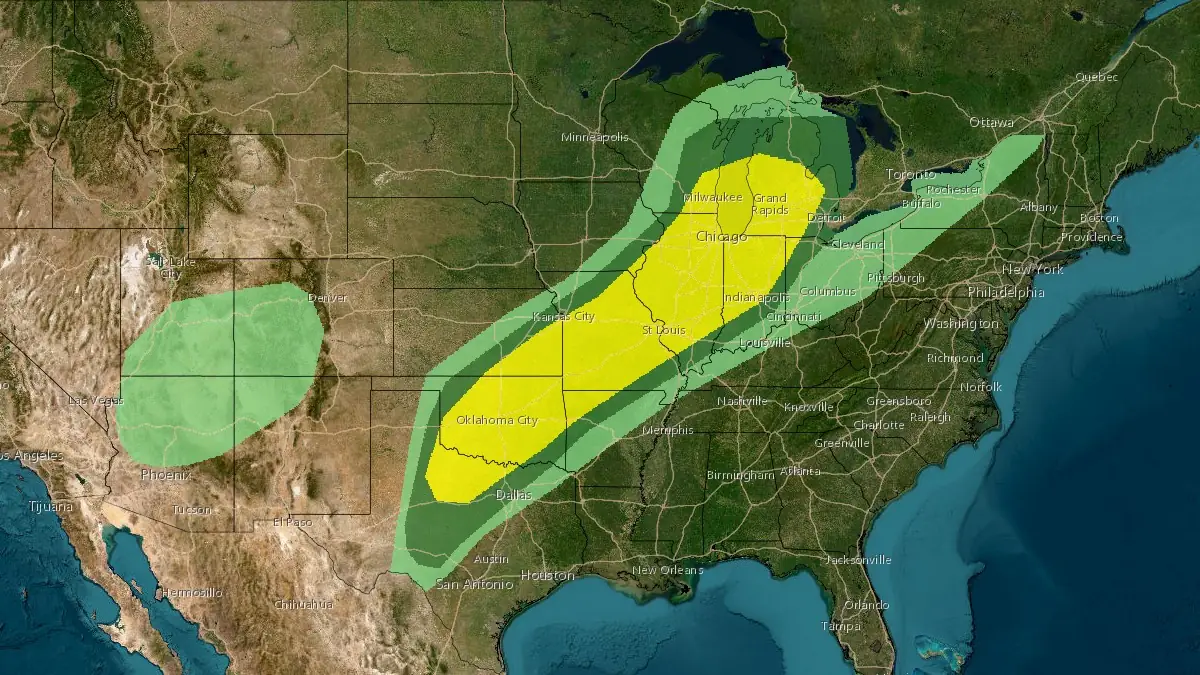
The Storm Prediction Center (SPC) has issued a Slight Risk of Severe Thunderstorms from the central Great Lakes to the southern Great Plains. The risk zone covers an area of over 647 000 km2 (250 000 mi2), affecting nearly 40 million people.
Severe weather conditions will continue to intensify through Thursday, April 17, with the worst impacts being expected through Friday, April 18. Some of the most populated areas under the risk zone include Chicago, Illinois; Detroit, Michigan; Indianapolis, Indiana; Milwaukee, Wisconsin; and Oklahoma City, Oklahoma.
The cold front associated with the severe weather system will bring in severe weather from the Great Lakes to the Southern Plains starting Saturday, April 19, with the focus for the weekend.
Heavy rains of over 76 mm (3 inches) are forecast from north-central Texas to southeastern Kansas and southwestern Illinois.
The SPC has issued a slight risk of Excessive Rainfall Outlook across the region, with the area from eastern Oklahoma to the Ozarks being likely to receive the heaviest rainfall.
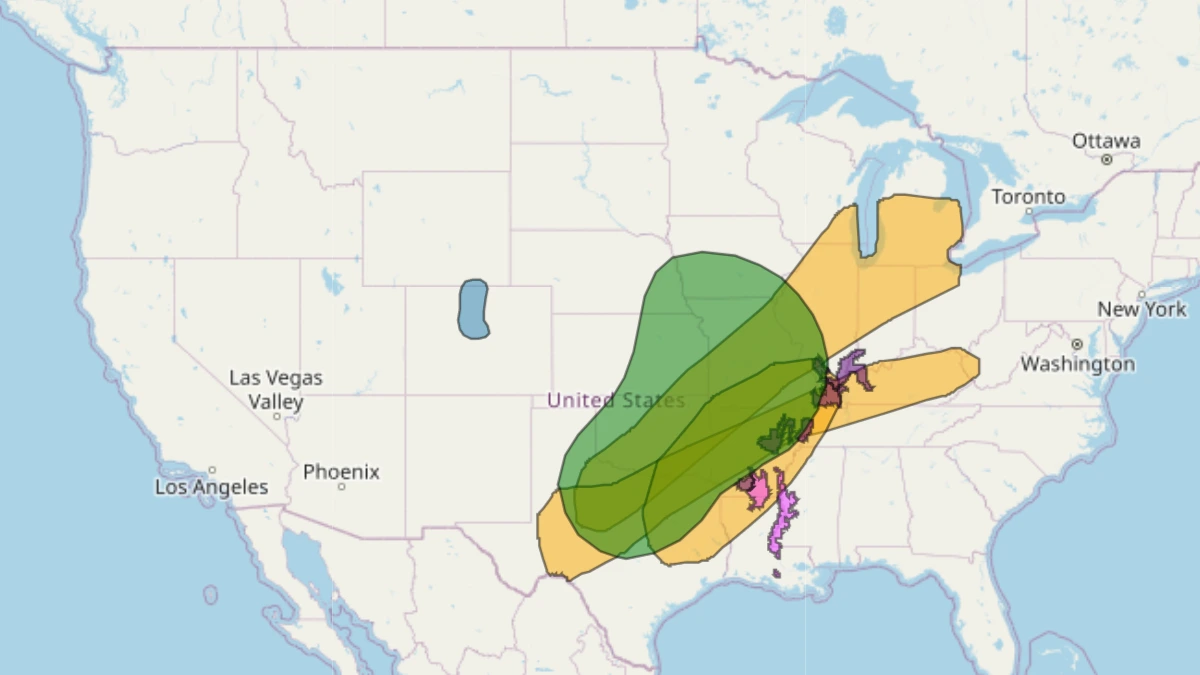
Much of the region has been constantly battered by severe weather conditions, including tornadoes and severe flooding over the past weeks. The saturated soil in the region will exacerbate the potential flooding in areas of the Mississippi and Ohio Valleys, even with relatively lower rainfall totals.
Forecasts for Sunday remain uncertain for now, but broadly, rain and thunderstorms are likely
from the southern and central Plains into much of the Mississippi Valley. More accurate forecasts will become available as the situation develops.
References:
1 Short Range Public Discussion – NWS/WPC – April 16, 2025
2 Extended Forecast Discussion – NWS/WPC – April 16, 2025

I am an Assistant Editor and Severe Weather & Science Journalist at The Watchers, specializing in real-time severe weather coverage, geophysical event reporting, and research-driven scientific analysis. You can reach me at rishav(at)watchers(.)news.
Commenting rules and guidelines
We value the thoughts and opinions of our readers and welcome healthy discussions on our website. In order to maintain a respectful and positive community, we ask that all commenters follow these rules.