
First significant snow of the season forecast for parts of the Northeast, Great Lakes, and Appalachians
A potent upper-level low is forecast to bring the first significant snowfall of the season to parts of the Northeast, Great Lakes, and central Appalachians, with accumulations of up to 30.5 cm (1 foot) expected in higher elevations through Saturday, November 23, 2024, starting Thursday, November 21.
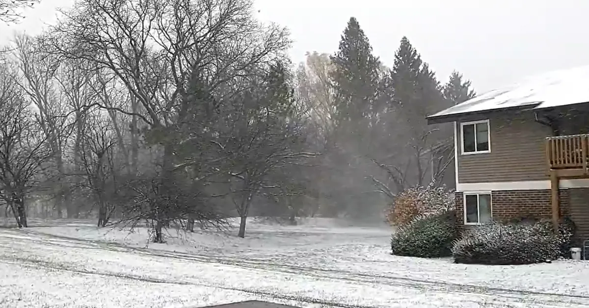
First snow cover of the season at Madison, Wisconsin. Image credit: Christopher J. Lee (stillshot)
- The first significant snowfall of the season is forecast for the northern Appalachians, starting on Thursday, November 21, and continuing into Friday, November 22.
- A low-pressure system is expected to bring up to 30.5 cm (1 foot) of snow to the central Appalachians, including higher elevations in West Virginia, Maryland, and southwestern Pennsylvania. Meanwhile, northeastern Pennsylvania and southern New York, including the Poconos and Catskills, are forecast to receive up to 15.2 cm (6 inches) of snow.
- A separate low-pressure system near Long Island is expected to produce heavy snow and rain as it tracks across the Northeast in a looping pattern through Friday, November 22.
Snowfall is forecast for parts of the Northeast and Great Lakes regions as a potent upper-level low interacts with a compact low-pressure system. This system is expected to move southward over Lake Michigan on Thursday, November 21, bringing snowfall and gusty winds.
The first significant snowfall of the season is expected across the northern Appalachians from Thursday into Friday, November 21 – 22. Higher elevations in northeastern Pennsylvania and south-central New York could see significant accumulations, while lighter snowfall is likely in lower-lying areas.
Eastern Wisconsin is forecast to receive snow and wind gusts of up to 64 km/h (40 mph), with the National Weather Service (NWS) issuing weather advisories for 7.6 to 10 cm (3 to 4 inches) of snowfall. This could result in hazardous travel conditions.
A separate low-pressure system developing near Long Island is forecast to loop across the Northeast through Friday, November 22. This system is expected to bring heavy snow to interior areas and 25.4 to 76.2 mm (1 to 3 inches) of rain to coastal regions.
At least 15.2 cm (6 inches) of snowfall is expected in northeastern Pennsylvania and southern New York, including the Pocono and Catskill Mountains.
A long-duration upslope snow event is underway across the central Appalachians and is expected to persist through early Saturday, November 23. Up to 30.5 cm (1 foot) of snow is possible in the higher terrain of West Virginia, Maryland, and southwestern Pennsylvania. Light snow may extend as far south as the higher ranges of North Carolina.
Snowfall has already begun in parts of Wisconsin, with slippery road conditions causing traffic disruptions. Drivers are advised to exercise caution, especially in areas under Winter Weather Advisories.
References:
1 Short Range Public Discussion – NWS/WPC – November 21, 2024

I am an Assistant Editor and Severe Weather & Science Journalist at The Watchers, specializing in real-time severe weather coverage, geophysical event reporting, and research-driven scientific analysis. You can reach me at rishav(at)watchers(.)news.
Commenting rules and guidelines
We value the thoughts and opinions of our readers and welcome healthy discussions on our website. In order to maintain a respectful and positive community, we ask that all commenters follow these rules.