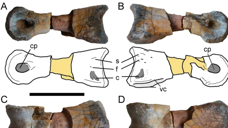
Giant Devonian scorpion identified from 400-million-year-old fossils in Britain
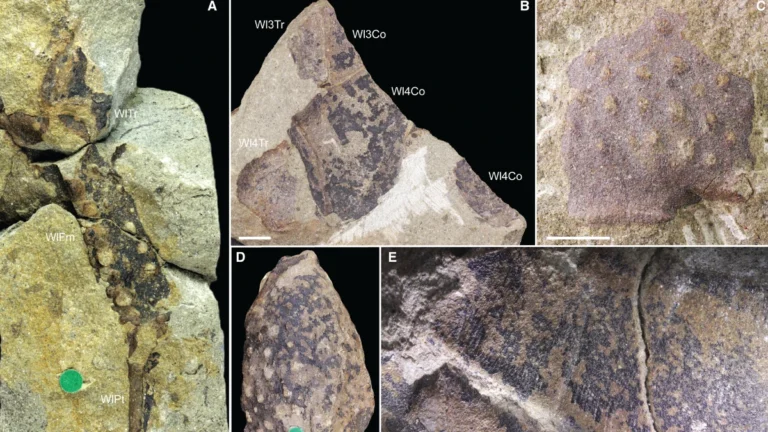
A giant scorpion that lived more than 410 million years ago may have been one of the earliest apex predators on Earth and could have spent much of its life in water, according to a new study published in Palaeontology. Researchers re-examined the fossil of the arthropod Praearcturus gigas and concluded that it was a giant scorpion rather than a crustacean, resolving a debate that has persisted for more than 150 years.