
Tornado touches down near Francis Peak in Davis County, Utah
A tornado touched down east of Fruit Heights, Utah, at approximately 13:52 LT (19:52 UTC) on September 18, 2026, as severe thunderstorms moved across Davis County and surrounding areas. Rain and damage was reported in the affected areas. The National Weather Service (NWS) had issued a tornado warning for portions of Davis, Weber, and Morgan counties just eight minutes before the reported touchdown.
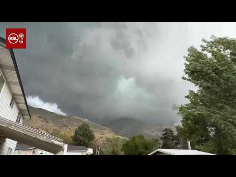
A tornado touched down on a mountain ridge east of Fruit Heights, Davis County, Utah, at approximately 13:52 LT (19:52 UTC) on September 18, 2026, the National Weather Service (NWS) reported in a preliminary Local Storm Report issued at 15:19 LT (21:19 UTC).
“Tornado seen in video shared on social media, showing rotation reaching the ground and debris being lofted into the air,” the NWS Salt Lake City said.
The NWS preliminary storm report places the tornado approximately 3 km (2 miles) east of Fruit Heights. The touchdown occurred near a summit on the ridgeline extending west from Francis Peak, at an estimated elevation of approximately 2 300 m (7 500 feet).

NWS issued a tornado warning at 13:44 LT (19:44 UTC) for northeastern Davis, south-central Weber and west-central Morgan counties.
Weather spotters had reported a funnel cloud, and the warning identified a tornado and hail up to 3.8 cm (1.5 inches) in diameter as potential hazards. The warning was scheduled to expire at 14:15 LT (20:15 UTC).
At 13:55 LT (19:55 UTC), NWS Salt Lake City issued a separate severe thunderstorm warning for portions of Weber, Davis and Morgan counties. The agency located the storm near Uintah, moving northeast at approximately 48 km/h (30 mph), and warned of radar-indicated wind gusts up to 97 km/h (60 mph) and hail up to 3.8 cm (1.5 inches) in diameter. The warning also described torrential rainfall and possible flash flooding.
FOX 13 reported rainfall damage to a store in Layton, with water entering through the ceiling, while hail damaged a vehicle’s windshield in Kaysville. Localized street flooding during the thunderstorms. Widespread tree damage and hail damage were reported across the affected areas.
References:
1 Preliminary Local Storm Report – NWS – September 18, 2026
2 Tornado confirmed to have touched down as storm rolls through Davis County – FOX 13 – September 19, 2026
Featured image: Tornado near Hankinson, North Dakota on August 21, 2025. Credit: Eric Klindt (used for representative purposes only)

Rishav Kothari is Editor-in-Chief of The Watchers, where he runs the newsroom and covers earthquakes, volcanoes, severe weather and space weather.
Published in the last 24 hours
- High Risk of excessive rainfall covers Florida’s Space Coast as St. Johns River near Cocoa reaches 5.67 m
- Male toads abandoned a pond in Italy five days before a deadly 2009 earthquake, while a scientist was counting them Epicenter
- An asteroid was spotted 19 hours before it exploded over Sudan in 2008, and students picked its pieces off the desert Epicenter
- A wave up to 3 m (10 feet) high rose out of Lake Michigan on a sunny June morning in 1954 and swept fishermen off Chicago’s piers, and when a second came 10 days later, warnings had cleared the shore Epicenter
