
Major mid-March blizzard forecast to bring potentially record snowfall to parts of the Upper Midwest and Great Lakes
A major winter storm is forecast to develop over Wyoming on Saturday, March 14, 2026, before expanding into the northern Plains and Upper Midwest by Sunday, March 15, and reaching the Great Lakes by Monday, March 16. WPC said embedded snow bands could produce snowfall rates of 2.5–7.6 cm (1–3 inches) per hour, with blizzard or near-blizzard conditions possible as wind gusts reach about 80 km/h (50 mph), and parts of the core snow band could receive more than 60 cm (24 inches) of snow.
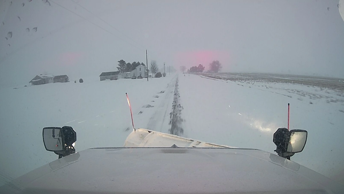
Credit: ODOT
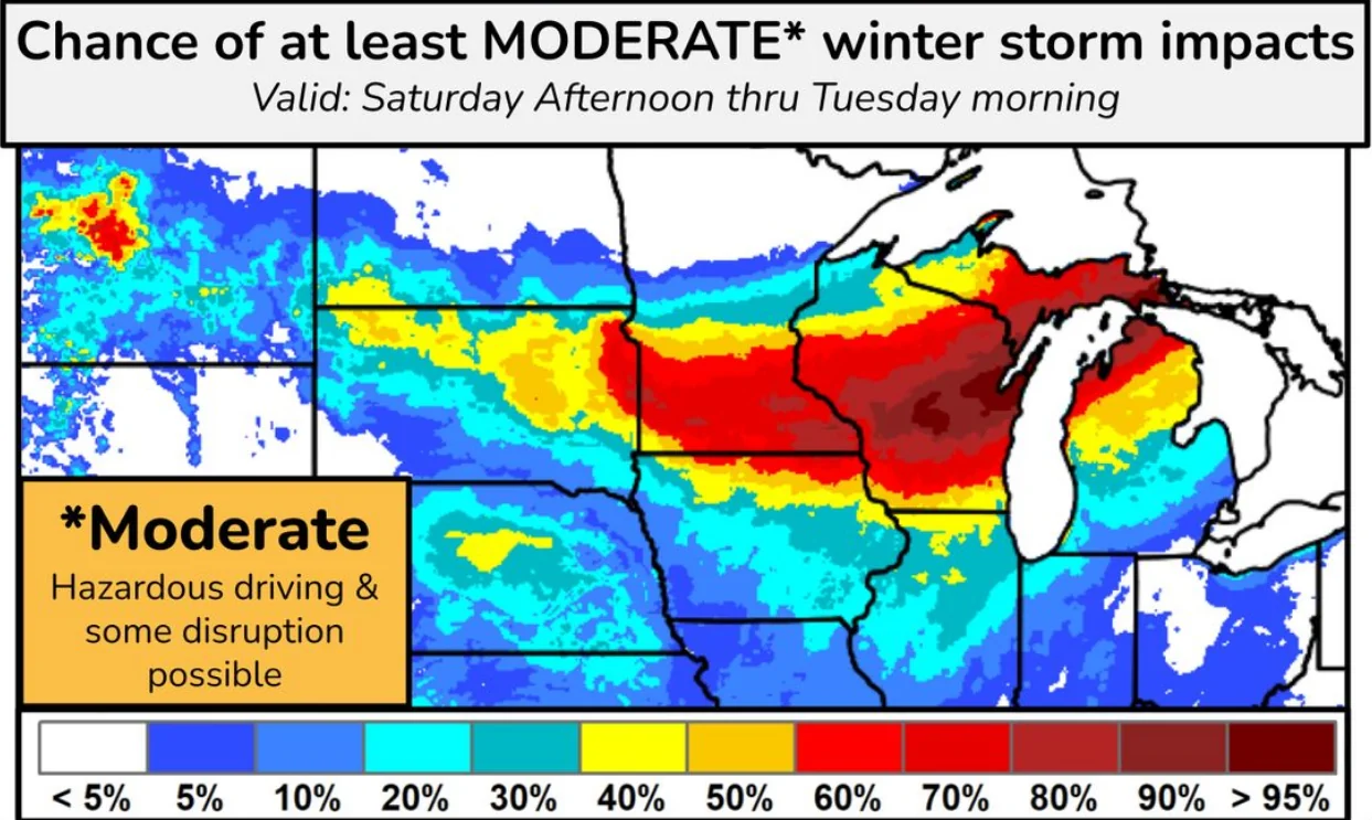
- A major winter storm is forecast to develop across the northern High Plains into Saturday, then intensify into the Great Lakes on Sunday, with heavy snow and blowing snow continuing into Monday.
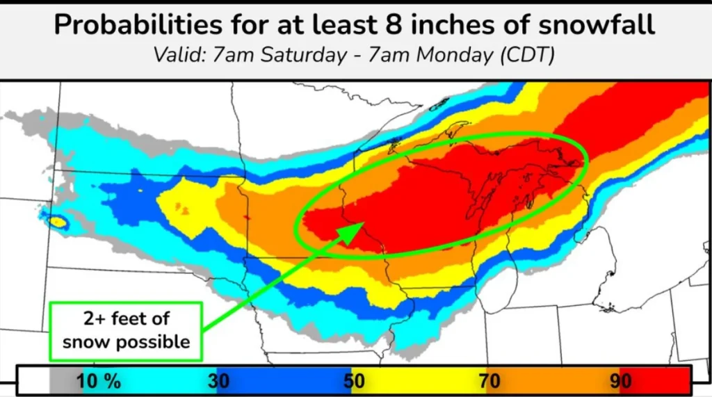
- The heaviest snow band may produce rates of 2.5–7.6 cm (1–3 inches) per hour and widespread totals of 30–60 cm (1–2 feet), with locally higher amounts and possible 2-day snowfall records in some areas.
- Strong winds of 50–80 km/h (30–50 mph) are expected to create blizzard conditions and dangerous to impossible travel, while areas south of the main snow band face a risk of significant icing, especially across northern lower Michigan.
A major mid-March winter storm is forecast to develop across the northern High Plains through Saturday, March 14. It is expected to intensify as it expands into the Upper Midwest on Sunday, March 15, and into the Great Lakes by Monday, March 16, with heavy snow and blowing snow continuing into early next week.
The storm is forecast to develop as the Pacific jet associated with a long-duration atmospheric river moves inland and interacts with Arctic air arriving from Canada. WPC said that interaction would expand snow from the northern Rockies into the northern High Plains before the system deepens downstream.
This interaction will spread snow across the northern Rockies into the northern High Plains through Friday, March 13, before a low-pressure system develops over Wyoming on Saturday, March 14.
Heavy snowfall is forecast from parts of Montana and the northern Plains into the Upper Midwest and Great Lakes, with the greatest potential for record or near-record 2-day snowfall centered from eastern Minnesota through Wisconsin into northern Michigan. Snowfall rates of 2.5–7.6 cm (1–3 inches) per hour are possible in the strongest bands.
Snowfall totals of up to 60 cm (24 inches) with locally higher totals are forecast across the region and could break multiple two-day snowfall records, according to the Weather Prediction Center (WPC).
Heavy snowfall combined with wind gusts reaching about 80 km/h (50 mph) could create blizzard or near-blizzard conditions, with dangerous to impossible travel in the hardest-hit corridor. WPC also warned that strong winds and heavy, relatively dense snow could lead to power outages in some areas.
Mixed precipitation, including freezing rain, is forecast south and southeast of the main snow band, creating hazardous travel conditions. WPC said lower Michigan had a 30–50% probability of receiving at least 6 mm (0.25 inches) of ice.
References:
1 Short Range Forecast Discussion – NWS/WPC – March 13, 2026

I am an Assistant Editor and Severe Weather & Science Journalist at The Watchers, specializing in real-time severe weather coverage, geophysical event reporting, and research-driven scientific analysis. You can reach me at rishav(at)watchers(.)news.
Commenting rules and guidelines
We value the thoughts and opinions of our readers and welcome healthy discussions on our website. In order to maintain a respectful and positive community, we ask that all commenters follow these rules.