
Winter Storm Warnings remain in effect from Idaho and Montana to the Upper Midwest
Winter Storm Warnings remained in effect across parts of Montana, Idaho, Wisconsin, Michigan, Minnesota, and Wyoming on Friday, March 13, 2026, as a broad winter storm brought heavy snow, blowing snow, and hazardous travel conditions from the northern Rockies into the Upper Midwest. Forecast totals ranged from several cm in some lower elevations to 150 cm (5 feet) in parts of Idaho’s higher terrain, while parts of Montana’s mountain ranges were forecast to receive up to 120 cm (4 feet).
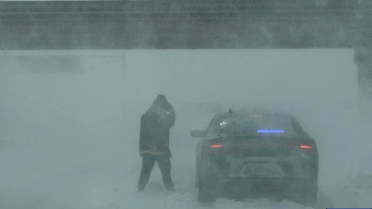
Whiteout conditions in Iowa. Image credit: ISP
Winter Storm Warnings remain in effect across multiple northern U.S. states as a widespread winter storm brings heavy snowfall, gusty winds, and hazardous travel conditions from the northern Rockies into the Upper Midwest. Forecast snowfall totals vary sharply by elevation, ranging from several centimeters in some lower-elevation Midwest locations to more than 1 m (3 feet), and locally more, in mountain areas of Idaho and Montana.
Strong winds accompanying the snowfall are expected to produce blowing snow and sharply reduced visibility in several regions, increasing the risk of dangerous travel conditions. Wind gusts of 50–80 km/h (30–50 mph) are forecast in parts of the warned area, with the strongest winds expected in portions of the Upper Midwest and in exposed mountain terrain.
Wisconsin
A Winter Storm Warning remains in effect for Taylor County, including the city of Medford, until 13:00 CDT on March 13, 2026.
Additional snowfall of up to 2.5 cm–7.5 cm (1–3 inches) is expected, accompanied by strong winds gusting between 65 and 80 km/h (40–50 mph). These conditions may produce blowing snow capable of significantly reducing visibility.
Travel conditions could become very difficult to impossible, particularly during the morning and evening commuting periods. Strong winds may also bring down tree branches and contribute to hazardous road conditions.
Forecasters also indicate that a second storm system later in the weekend could produce 30–45 cm (12–18 inches) of snowfall across parts of the region, with localized totals approaching 60 cm (24 inches) depending on the placement of the heaviest snowfall band.
Montana
In western and mountainous regions, including the Potomac–Seeley Lake region, Butte–Blackfoot region, West Glacier region, Bitterroot–Sapphire Mountains, and Lower Clark Fork region, warnings remain in effect until 12:00 MDT on March 14, 2026.
Snowfall totals in these areas are forecast to reach 15–30 cm (6–12 inches) in many locations, while mountainous terrain may receive 30–90 cm (1–3 feet) of snow. Wind gusts may reach 65 km/h (40 mph), contributing to blowing snow and reduced visibility.
In central and south-central parts of the state, including areas such as Musselshell, Northern Stillwater, Golden Valley, Judith Gap, Northern Sweet Grass, and parts of Yellowstone County, warnings remain in effect until 06:00 MDT on March 15, 2026. Snowfall totals of 18–36 cm (7–14 inches) are expected, with the heaviest snowfall likely from Friday night through Saturday evening.
In the Absaroka–Beartooth and Crazy Mountains, prolonged heavy snowfall could produce totals of 30–120 cm (1–4 feet) with locally higher amounts possible. These conditions are expected to significantly increase avalanche danger and severely impact travel and recreation in high-elevation terrain.
Idaho
Winter Storm Warnings are in effect for mountainous regions of north-central Idaho, including the Southern and Northern Clearwater Mountains, through 11:00 PDT on March 14.
Snowfall totals are forecast to reach 8–20 cm (3–8 inches) in lower elevations, while areas above 1 500 m (5 000 feet) may receive 60–150 cm (2–5 feet) of snow.
Strong winds with gusts up to 65 km/h (40 mph) may produce blowing snow and rapidly changing visibility conditions along mountain passes such as Lolo Pass and Dixie. Authorities warn that travel conditions in these areas could become extremely dangerous or impossible during periods of heavy snowfall.
Michigan
Winter Storm Warnings remain in effect across large portions of Michigan’s Upper Peninsula, including counties such as Keweenaw, Houghton, Alger, Luce, Schoolcraft, Delta, Ontonagon, Baraga, Gogebic, Iron, Dickinson, Menominee, and Marquette.
Most warnings remain in effect through the afternoon or evening of March 13, depending on location.
Additional snowfall totals across the region are forecast to range from 10–30 cm (4–12 inches), accompanied by wind gusts reaching 55–90 km/h (35–55 mph).
These conditions are expected to produce widespread blowing snow capable of significantly reducing visibility. Travel conditions may become very difficult to impossible, particularly during the morning and evening commutes. Strong winds may also damage trees and lead to isolated power outages in some areas.
Forecasters also issued Winter Storm Watches for later in the weekend, warning that another system could bring 30–90 cm (1–3 feet) of snow to parts of the Upper Peninsula.
Minnesota
A Winter Storm Warning remains in effect across parts of northern Minnesota, including Koochiching, North Itasca, Central and North St. Louis, and Northern Cook and Lake counties, until 13:00 CDT on March 13, 2026.
Additional snowfall of 5–10 cm (2–4 inches) is expected, with higher terrain potentially receiving 8–20 cm (3–8 inches). Wind gusts may reach 65 km/h (40 mph).
Strong winds combined with intense snowfall rates may produce sharply reduced visibility and slippery road conditions, especially during the morning commute.
Wyoming
A Winter Storm Warning also affects the Northeast Bighorn Mountains of Wyoming, where heavy snowfall is expected through 06:00 MDT on March 15, 2026.
Snow accumulations of 30–60 cm (1–2 feet) are forecast across high elevations, which may create dangerous travel conditions along mountain routes, including U.S. Highway 14 near Burgess Junction. Blowing snow and reduced visibility are likely in exposed areas, particularly at higher elevations.
References:
1 Winter Storm Warning – NWS – March 13, 2026

I am an Assistant Editor and Severe Weather & Science Journalist at The Watchers, specializing in real-time severe weather coverage, geophysical event reporting, and research-driven scientific analysis. You can reach me at rishav(at)watchers(.)news.
Commenting rules and guidelines
We value the thoughts and opinions of our readers and welcome healthy discussions on our website. In order to maintain a respectful and positive community, we ask that all commenters follow these rules.