
Water rescues and landslides reported in California as next Pacific storm aims West Coast
A potent Pacific storm is bringing heavy snow and flooding to much of the U.S. West Coast, prompting water rescues. Road closures were reported across the region through February 16, as the storm triggered landslides, whiteout conditions, and localized flash floods. Another Pacific system will move onshore on Wednesday.
Tree downed in Santa Cruz County on February 17, 2026 due to severe storms in California. Credit: CalFire
A powerful Pacific storm continues to bring heavy rainfall and mountain snow across much of California, the Sierra Nevada, and the Pacific Northwest.
The initial storm moved inland overnight on Monday, February 16, and continued into February 17, bringing precipitation to the Intermountain West. Meanwhile, a second storm system is forecast to move in on Wednesday, February 18.
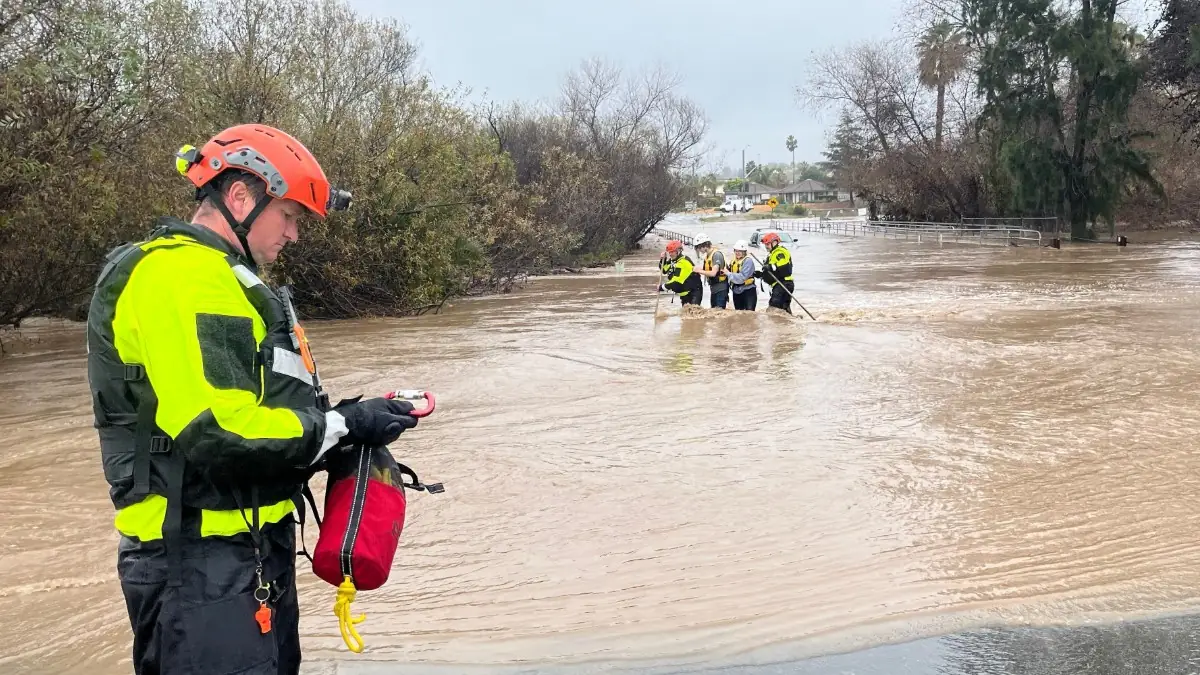
Heavy snow and flooding have been reported across the state, with rivers rising due to heavy rains.
Firefighters rescued two rafters passing through the Henry Cowell Redwoods State Park on the San Lorenzo River.
“After an accident on the water, the man and woman became stranded on a remote bank with no road or trail access,” CalFire officials said.
A woman in her 50s sustained an injury during the incident. Following a coordinated search of the upper and lower riverbanks, crews successfully located the duo.
Felton firefighters hiked through the rough terrain to reach the two patients on the opposite side of the river. CA State Parks deployed rescue swimmers who reached them and safely escorted them across the river for care.
Heavy rains from the storm triggered landslides in parts of California on February 16. Caltrans shut down Highway 1 from Ragged Point to Big Sur, a roughly 72 km (45 miles) stretch along California’s Central Coast, due to rockslides and debris in the roadway at multiple locations.
Meanwhile, Highway 89 was closed in both directions around Emerald Bay due to unstable snow.
Traffic was temporarily halted in both directions on I-80 near the Nevada state line after spinouts and crashes caused by heavy snow and blinding conditions. In Santa Barbara County, a large tree toppled onto US-101, shutting down southbound lanes.
State Route 27, commonly known as Topanga Canyon Boulevard, is closed in both directions due to mud and debris slides caused by powerful storms.
Caltrans District 7 said the road is closed from the Pacific Coast Highway to Grand View Drive until further notice.
State Route 88 is closed to traffic due to avalanche control measures in the Sierra Nevada mountains.
Chain control is already in effect for SR-168 at Shaver Lake Marina, Highway 50, Interstate 80, Lewis Creek, and the San Bernardino mountains.
452 flights were delaye,d and 9 were canceled at Los Angeles International Airport on February 16. Meanwhile, the Las Vegas airport reported 444 delays and 15 cancellations.
While the heaviest rainfall has decreased, a cold front and energy from the disturbance will move southward along the West Coast, bringing more rain to central and southern California. Lower elevations are expected to receive 25–51 mm (1-2 inches) of rain, while higher elevations could see 51–102 mm (2–4 inches).
The storms are expected to continue affecting much of the U.S. West Coast through February 18, with up to 2.4 m (8 feet) of snow being forecast in parts of the Sierra Nevada.
Winter Storm Warnings and Advisories are in effect across the Sierra Nevada, along with parts of northern California and the Pacific Northwest.

I am an Assistant Editor and Severe Weather & Science Journalist at The Watchers, specializing in real-time severe weather coverage, geophysical event reporting, and research-driven scientific analysis. You can reach me at rishav(at)watchers(.)news.
Commenting rules and guidelines
We value the thoughts and opinions of our readers and welcome healthy discussions on our website. In order to maintain a respectful and positive community, we ask that all commenters follow these rules.