
Over 30 weather-related crashes, one fatality reported as extreme cold and snow hit Iowa
The Iowa State Patrol responded to 31 crashes during extreme winter weather on December 28, 2025, as snow, high winds, and whiteout conditions spread across the state. One person was killed, and several others were injured while visibility dropped to near zero on major highways, including Interstate 35.
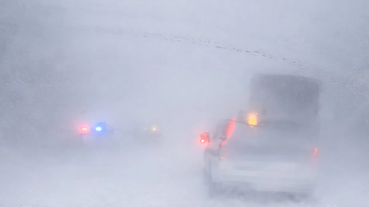
Multi-vehicle crash scene on I-35 near Hwy 20 in Iowa shows zero visibility on December 28, 2025. Credit: Lieutenant Jeremy Schaffer
The Iowa State Patrol (ISP) reported 158 calls for service and 31 crashes between 06:00 and 20:00 local time on December 29 as snow and strong winds created treacherous travel conditions across Iowa. Of the total crashes, 22 caused property damage, eight resulted in injuries, and one was fatal.
Authorities temporarily closed several sections of Interstate 35 between Ames and Clear Lake as whiteout conditions and drifting snow made travel impossible.
The Iowa Department of Transportation (DOT) and Iowa Department of Public Safety urged drivers to stay off the roads. In neighboring Minnesota, the Minnesota Department of Transportation (MnDOT) also closed parts of southbound I-35 between Owatonna and Clarks Grove because of numerous weather-related crashes.
KCCI and KCRG reported multiple spin-outs and jackknifed semitrailers as visibility dropped to less than 200 m (650 feet).
The National Weather Service (NWS) recorded snowfall totals up to 180 mm (7 inches) in northern parts of the state, with temperatures remaining well below freezing. Wind gusts reached 65–90 km/h (40–55 mph), producing blizzard-like conditions across large areas of central and northern Iowa.
The NWS issued Blizzard Warnings and Winter Storm Warnings for several counties through Sunday night, advising against non-essential travel. ISP troopers and local emergency crews also assisted dozens of stranded motorists as blowing snow continued into the evening.
By early Monday, Iowa DOT teams had reopened most primary routes, though some stretches of I-35 and U.S. 18 remained closed or restricted due to drifting snow and icy surfaces. Authorities cautioned that wind-driven snow and low visibility would continue into Monday night as the storm system moved east.
The same winter system affected neighboring states across the Upper Midwest, including southern Minnesota and northern Missouri, where transportation agencies reported similar travel disruptions and multi-vehicle collisions.

Teo Blašković founded The Watchers in 2011 and edited it until 2026, covering seismic and volcanic activity, extreme weather, space weather and near-Earth objects. Articles on this page are his archive.
Earlier reporting
Nothing on Watchers was published in the last 24 hours. These are older articles.
- 2 atmospheric rivers to bring heavy Sierra snow and California flood risk
- Florida's east coast faces a moderate flash flood risk Wednesday through Friday, with 4 to 8 inches of rain forecast and the St. Johns River near Cocoa already in major flood at 17.13 feet
- El Niño floods kill 2 in Guayaquil as 172.8 mm of rain swamps Milagro, Ecuador's toll rises to 14
- Southern Thailand braces for heavy rain, 15 provinces on flood and landslide alert for November 18-22
