
Rapidly deepening nor’easter forecast to bring heavy snow and strong winds across the U.S. Northeast
The first nor’easter of the season is forecast to rapidly intensify by Wednesday, December 3, 2025, bringing 25–38 cm (10–15 inches) of snow, violent winds, and whiteout conditions across parts of the U.S. Northeast and Nova Scotia, and Newfoundland, Canada.
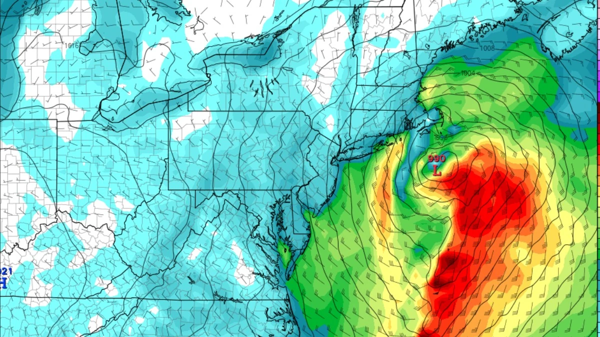
Image credit: GFS/TropicalTidbits. Forecast model valid for 00:00 UTC on December 3, 2025
A powerful nor’easter is developing over the Gulf Coast and is forecast to move through the Mid-Atlantic and the Northeast through the early part of the week.
Forecast analysis suggests that Arctic air will spread across the central U.S. with a large upper-level wave. This wave will clash with the jet stream on Monday night, December 1, triggering a new disturbance.
This disturbance will lead to the rapid development of a secondary wave. Surface cyclogenesis will then take place along the U.S. East Coast on Tuesday as the wave and the cold air move east.
The Arctic air will then clash with tropical moisture over the Atlantic, potentially triggering bombogenesis. This means forecasters expect the central pressure of the storm system to drop by 24 hPa in 24 hours, creating what’s called a bomb cyclone on Wednesday morning, December 3.
This bomb cyclone will be the first nor’easter storm of the season. A nor’easter simply refers to a storm along the East Coast of North America, named so because the winds over the coastal area are typically from the northeast.
“The central pressure is forecast to fall from around 1002 to 983 hPa over about 12–15 hours, from Tuesday evening through Wednesday morning, so more rapidly than the bomb cyclone criteria require,” according to Marko Korosec of Severe Weather Europe.
The central pressure could drop to the mid-970s as the storm fully develops while moving south of Nova Scotia towards Newfoundland on Wednesday. The steep pressure gradient will bring along violent winds and heavy snow across the affected regions.

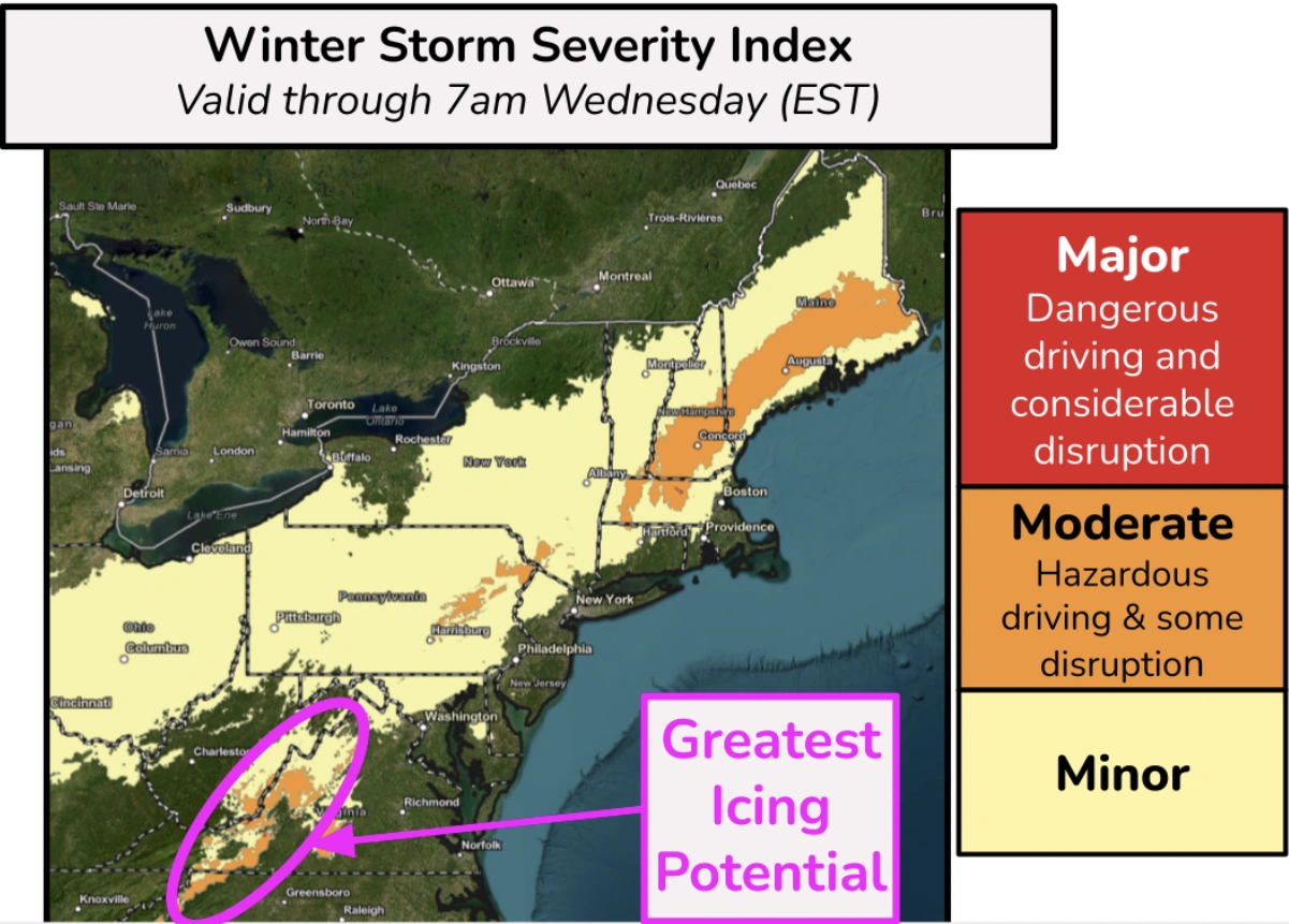
Heavy snow accumulations are forecast across the interior Northeast, including parts of the northern Mid-Atlantic and New England. Areas west and north of the I-95 have over 50% chance of more than 153 mm (6 inches) of snow through Tuesday.
Treacherous icing across the southern and central Appalachians will create dangerous travel conditions, especially on untreated roads and elevated surfaces, according to the Weather Prediction Center (WPC).
Extreme snow, blizzards, whiteouts, and dangerous winter weather are possible across Nova Scotia and Newfoundland during the closest approach of the center low along the coast.
25–38 cm (10–15 inches) of accumulated snow and locally severe to hurricane-force winds could leave roads impassable, causing delays and life-threatening conditions if trapped outside. Wind gusts are forecast to reach 129–145 km/h (80–90 mph), blasting Newfoundland during intense snowfall.

I am an Assistant Editor and Severe Weather & Science Journalist at The Watchers, specializing in real-time severe weather coverage, geophysical event reporting, and research-driven scientific analysis. You can reach me at rishav(at)watchers(.)news.
Commenting rules and guidelines
We value the thoughts and opinions of our readers and welcome healthy discussions on our website. In order to maintain a respectful and positive community, we ask that all commenters follow these rules.