
Post-Thanksgiving winter storm forecast to drop over 15 cm (6 inches) of snow across the Upper Midwest, U.S.
A second winter storm is forecast to follow the Thanksgiving winter storm, bringing heavy snow across the Upper Midwest starting Friday, November 28, 2025. Snowfall totals are forecast to reach more than 152 mm (6 inches) through Sunday, November 30, as the storm moves across the region.
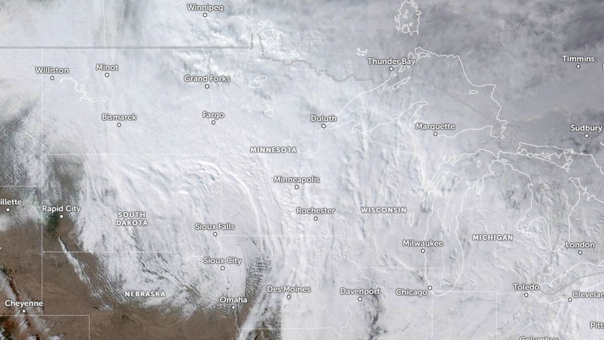
Satellite image of the Thanksgiving winter storm over the Midwest at 20:10 UTC on November 25, 2025. Credit NOAA/GOES-19, Zoom Earth, The Watchers
The Thanksgiving week winter storm began impacting the Midwest on Tuesday night and is forecast to spread across the Great Lakes through Friday, November 28.
However, that will not be the end of stormy winter weather for the Upper Midwest. According to the Weather Prediction Center (WPC), another winter storm is forecast to bring heavy snow across the Upper Midwest through the weekend, starting Friday.
Currently, the storm is forecast to develop over the northern and central Rockies and track across the Central Plains into the Upper Midwest early this weekend.
Heavy snowfall will begin to spread across the northern Rockies on Friday night and spread through the central Rockies and Central Plains through Saturday, November 29. The Upper Midwest should begin to see snowfall by late Saturday into Sunday, November 30.
There is a 50% chance of over 152 mm (6 inches) of snow across the region, including cities like Marquette, Michigan; Milwaukee, Wisconsin; Rochester, Minnesota; and Mason City, Iowa.
The snowfall is likely to create dangerous travel conditions across the region, with icy roads, blowing snow, and low visibility.

Meanwhile, the Thanksgiving winter storm has already caused hundreds of crashes, prompting road closures along key routes, including the I-94 and I-29 in Minnesota and North Dakota. These conditions are likely to persist as the storm spreads to the Great Lakes by Friday.
And as the first storm exits, the next one will bring a fresh white coat to the Upper Midwest.
Read more:

I am an Assistant Editor and Severe Weather & Science Journalist at The Watchers, specializing in real-time severe weather coverage, geophysical event reporting, and research-driven scientific analysis. You can reach me at rishav(at)watchers(.)news.
Commenting rules and guidelines
We value the thoughts and opinions of our readers and welcome healthy discussions on our website. In order to maintain a respectful and positive community, we ask that all commenters follow these rules.