
Weak La Niña and rare November SSW could drive winter pattern shift across the U.S.
A combination of the ongoing weak La Niña, the Madden–Julian Oscillation (MJO), and a rare November Sudden Stratospheric Warming (SSW), could bring colder winter-conditions across parts of the U.S. during late November and early December 2025.

Satellite image of the USA at 21:50 UTC on November 14, 2025. Credit: NOAA/GOES-19, RAMMB/CIRA, The Watchers
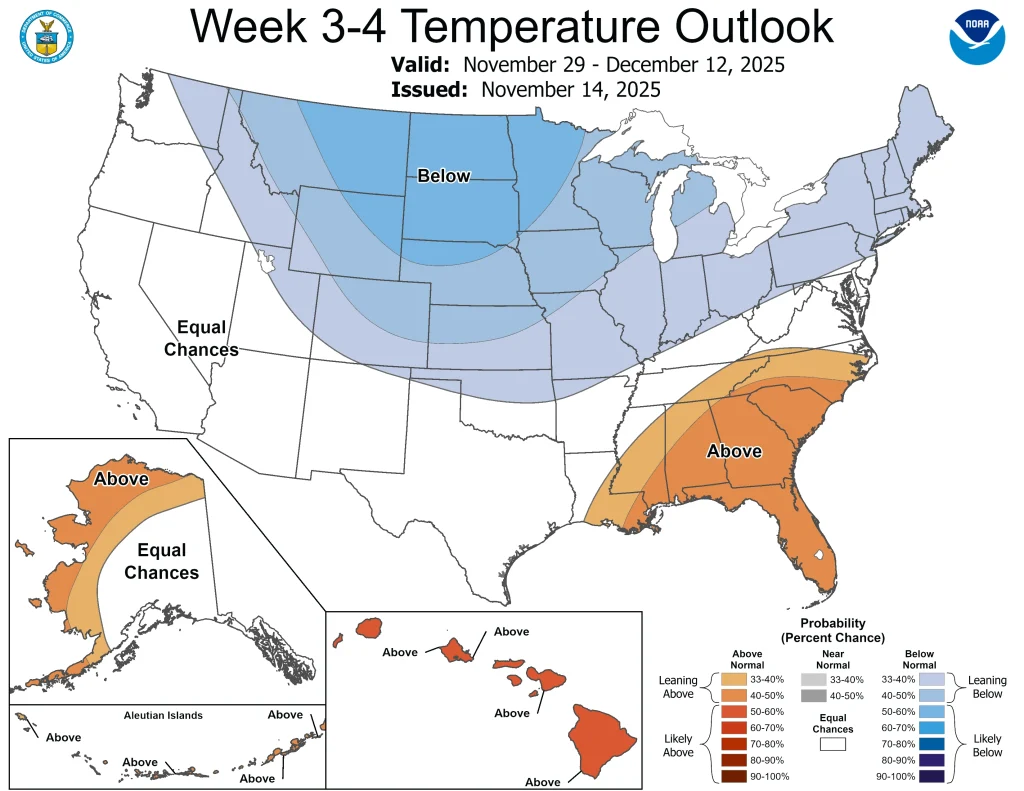
The Climate Prediction Center (CPC) reported that a large-scale pattern change is increasingly likely across the United States between November 22 and December 12.
This will be driven by the interactions of the La Niña, the current phase of the Madden–Julian Oscillation (MJO), and the possibility of a rare November SSW
A colder weather pattern is forecast across the western U.S. around the Thanksgiving period, while milder conditions are expected to persist across much of the East.
Later in November, ensemble guidance and the CPC Week-3/4 outlook show increasing probabilities for much-below-normal temperatures across portions of the northern Plains, Upper Midwest and adjacent central regions.
Elevated probabilities for heavier snowfall are also being seen over the mountainous West and sections of the northern Plains, where model support is strongest.
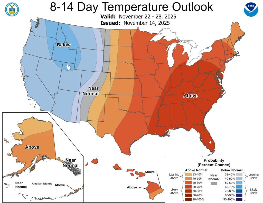
According to the CPC, MJO convection currently positioned in RMM Phase 6 tends to favor anomalous cold in the northern and eastern lower 48 states during this time of year.
The MJO is a large, eastward-moving tropical atmospheric wave that modulates convection and can influence temperature patterns across the mid-latitudes on two- to four-week timescales. Its present configuration supports increased variability in the early-winter pattern.
A possible Sudden Stratospheric Warming (SSW) remains a secondary factor in the late-November outlook. CPC and operational stratospheric analyses note that a November SSW is uncommon, and any downward influence on surface conditions depends on the timing of stratosphere–troposphere coupling.
If coupling occurs, a negative Arctic Oscillation (AO) phase becomes more probable, increasing the likelihood of cold-air intrusions into mid-latitude North America. However, the magnitude and timing of any surface impacts remain uncertain.
Weak La Niña conditions continue in the equatorial Pacific, with Niño 3.4 sea-surface-temperature anomalies expected to remain near –0.5°C to–0.9°C (32.9–33.6 °F) according to CPC model guidance. The agency notes that impacts during a weak La Niña can be highly variable across the United States.
National Weather Service (NWS) offices across the central U.S. have forecast increased sub-seasonal variability, and said that precise timing of any cold-air outbreaks cannot yet be determined.

I am an Assistant Editor and Severe Weather & Science Journalist at The Watchers, specializing in real-time severe weather coverage, geophysical event reporting, and research-driven scientific analysis. You can reach me at rishav(at)watchers(.)news.
Commenting rules and guidelines
We value the thoughts and opinions of our readers and welcome healthy discussions on our website. In order to maintain a respectful and positive community, we ask that all commenters follow these rules.