
First heavy Sierra Nevada snow of the season causes multiple spin-outs along I-80 near Truckee
Multiple spin-outs were reported along the I-80 near Truckee through the night of October 16, 2025, as a Pacific storm dropped the first heavy snow of the season over the Sierra Nevada. Chain control has been implemented at the Donner Summit, along the I-80, and US 50.
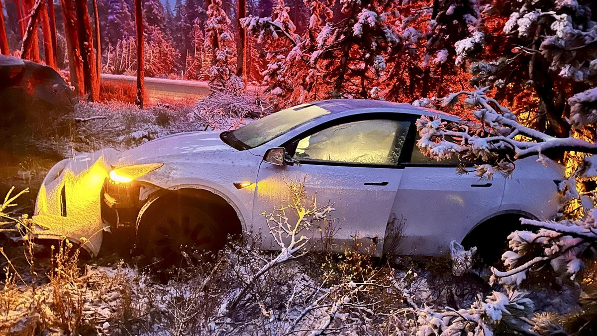
Car spinout near Truckee caused by the first snow of the season in Sierra Nevada on October 16, 2025. Credit: CHP Truckee
A Pacific storm moved ashore along the U.S. West Coast on October 14–15, drawing moist subtropical air into California and dropping the first heavy snow of the season. Snowfall had begun affecting higher elevation areas like Donner Summit as early as October 13.
The National Weather Service (NWS) issued winter storm warnings for the Sierra Nevada crest from Lassen County southward through Yosemite, where forecasters warned of periods of heavy snowfall and near-zero visibility.
Forecasts showed 30–50 cm (12–20 inches) of snow through October 16 at elevations above 2 000 m (6 500 feet) and up to 60–90 cm (2–3 feet) along the highest summits above 2 700 m (9 000 feet).
Strong south-westerly winds created near-blizzard conditions across exposed ridgelines and highway passes, with gusts around 110–130 km/h (70–80 mph).
Widespread rainfall totals of 25–75 mm (1–3 inches) were also recorded across the lower elevation areas of the Central Valley and the coastal ranges.
California Highway Patrol (CHP) in Truckee implemented chain control over the Donner Summit as the snow created hazardous travel conditions.
Multiple spinouts were reported along the I-80 near Truckee through the night of October 16, causing minor injuries. One spinout was also reported earlier on October 13, when the first snow of the season hit the region.


“We had more than a few spin-outs like this throughout the night, but thankfully, only very minor injuries were reported. Chain control remains in effect over Donner Summit, and yes, it’s still snowing! Winter driving isn’t a sprint… slow and steady keeps you out of the ditch,” said CHP Truckee on Facebook on October 15.
R2 chain restrictions are in place for the I-80 eastbound from Kingvale to Truckee and the I-80 westbound from Donner Lake Interchange to Rainbow. Meanwhile, trucks will remain under minimum restrictions.
According to NWS Reno and Sacramento forecasts, precipitation should begin to taper by late October 16 as the frontal boundary moves eastward. Colder post-frontal air was projected to keep freezing levels within the high-mountain zone through the weekend, helping preserve the initial snowpack on upper slopes.

Rishav Kothari is Editor-in-Chief of The Watchers, where he runs the newsroom and covers earthquakes, volcanoes, severe weather and space weather.
Earlier reporting
Nothing on Watchers was published in the last 24 hours. These are older articles.
- 2 atmospheric rivers to bring heavy Sierra snow and California flood risk
- Florida's east coast faces a moderate flash flood risk Wednesday through Friday, with 4 to 8 inches of rain forecast and the St. Johns River near Cocoa already in major flood at 17.13 feet
- El Niño floods kill 2 in Guayaquil as 172.8 mm of rain swamps Milagro, Ecuador's toll rises to 14
- Southern Thailand braces for heavy rain, 15 provinces on flood and landslide alert for November 18-22
