
Heavy rain and flooding risk as coastal low stalls over North Carolina and Virginia
A slow-moving coastal low is forecast to track northwestward into the Mid-Atlantic through September 18, 2025, bringing multiple hazards including heavy rainfall, gusty winds, shallow coastal flooding, rip currents, and large surf.
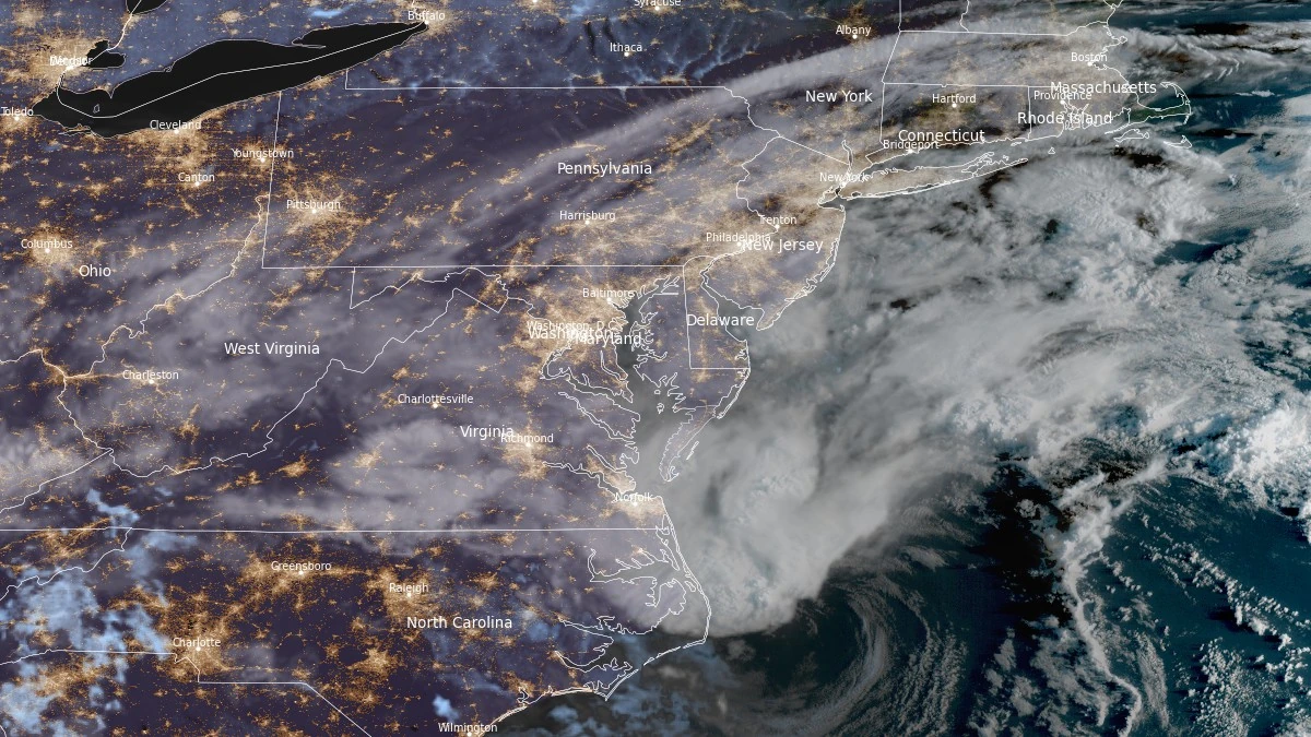
Satellite image of the U.S. East Coast at 11:10 UTC on September 16, 2025. Credit: NOAA/GOES-East, RAMMB/CIRA, The Watchers
Moderate to heavy rain bands were already affecting coastal North Carolina and Virginia early on September 16, with deeper thunderstorms developing offshore near the circulation center. The storms are forecast to move onshore during the day, increasing rainfall intensity and coverage.
The system is expected to stall over eastern North Carolina and Virginia tonight into September 17.
Forecast models from the National Weather Service (NWS) Weather Prediction Center indicate rainfall totals of 50–125 mm (2–5 inches) across northeast North Carolina, southeast Virginia, and the southern Delmarva Peninsula over a two-day period.
The slow and meandering track will prolong rainfall duration and increase the risk of localized flooding in low-lying and poorly drained areas.
Despite the flood risk, the affected region has been in abnormally dry (D0) conditions for the past one to two months. The incoming rainfall may provide short-term drought relief, particularly in agricultural zones, although rapid runoff in urban areas could still cause localized flooding.
In addition to rainfall, the system is expected to generate gusty winds along the Mid-Atlantic coast, leading to shallow coastal flooding, rip currents, and large surf. The National Weather Service has advised caution in coastal zones, including eastern North Carolina and southeast Virginia, where rip current hazards and rough surf are likely to persist through midweek.
By September 18, the system is forecast to weaken gradually while lingering near the Mid-Atlantic coast, keeping conditions unsettled before drier weather resumes later in the week.
References:
1 Short Range Forecast Discussion – NWS/WPC – September 16, 2025
2 U.S. Drought Monitor – Drought Monitor – Accessed September 16, 2025.
I'm a dedicated researcher, journalist, and editor at The Watchers. With over 20 years of experience in the media industry, I specialize in hard science news, focusing on extreme weather, seismic and volcanic activity, space weather, and astronomy, including near-Earth objects and planetary defense strategies. You can reach me at teo /at/ watchers.news.
Commenting rules and guidelines
We value the thoughts and opinions of our readers and welcome healthy discussions on our website. In order to maintain a respectful and positive community, we ask that all commenters follow these rules.