
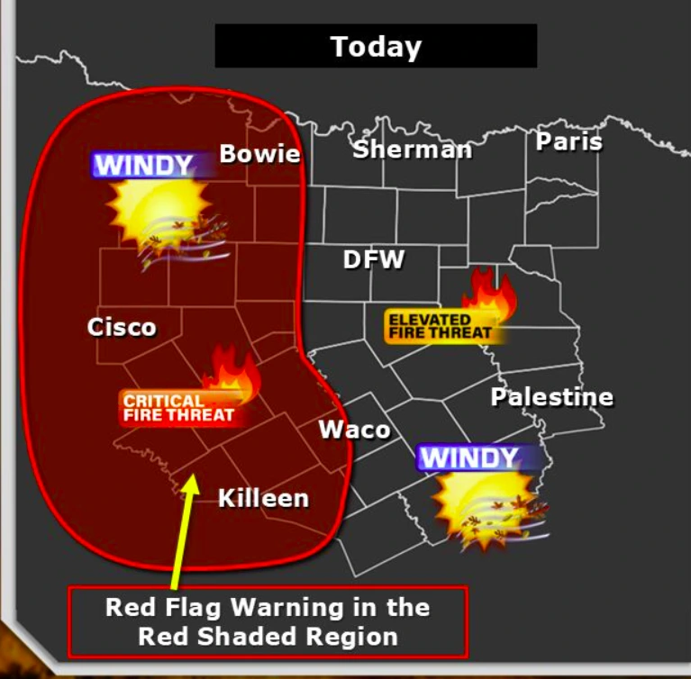
Central Texas under Critical Fire Weather Outlook
A Critical Fire Weather Outlook has been issued for over 93 240 km² (36 000 square miles) of central Texas on Friday, March 21, 2025, with gusty winds and low humidity expected to create dangerous fire conditions for approximately 1.5 million residents.

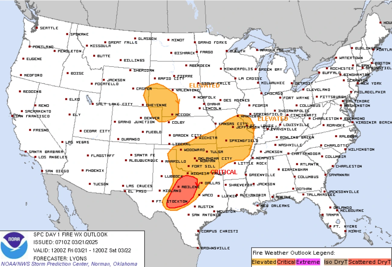
Critical Fire Weather Outlook map for March 21, 2025. Image credit: NWS
A Critical Fire Weather Outlook has been issued for much of central Texas for the afternoon and evening of Friday, March 21. Gusty winds and low humidity are expected near a cold front, supporting widespread fire weather concerns due to dry fuels.
An Elevated Fire Weather Outlook is in effect for much of the remaining central and northern Texas and nearly all of Oklahoma. The Critical Fire Weather Outlook covers an area of over 93 240 km² (36 000 square miles), affecting a population of approximately 1.5 million.
High-population areas in Texas under the Critical Fire Weather Outlook include Abilene, San Angelo, Weatherford, Benbrook, and Brownwood.
The Elevated Fire Weather Outlook also extends to parts of southwestern Illinois, covering large portions of Missouri and Arkansas. Portions of southeastern and northwestern Kansas, northeastern Colorado, western Nebraska, and southeastern Wyoming are also included.
A shortwave trough embedded in northwesterly winds will move from the central Rockies to the southern Plains. A weak surface low will move eastward over the Midwest, with a cold front pushing south into the Plains. This setup will result in gusty winds and low humidity, increasing the risk of fire weather in the central United States due to widespread dry vegetation.
Ahead of the cold front, southerly winds of 24–32 km/h (15–20 mph) are expected during the afternoon. Dewpoints in the range of 1.1–4.4 °C (30s °F) along the northwest Gulf Coast indicate dry air, with relative humidity (RH) dropping to 20–25 %. Widespread elevated to locally critical fire weather conditions are likely due to dry fuels and recent fire activity.
Northwesterly downslope winds gusting at 24–40 km/h (15–25 mph) will follow the cold front, with RH values of 15–25 % due to warming and drying effects. Elevated fire weather conditions are expected from the Nebraska Panhandle southward into the High Plains. Recent rain and snow have slightly reduced fuel dryness, but the risk remains sufficient for elevated fire weather.
References:
1 Day 1 Fire Weather Outlook – NOAA/SPC – March 21, 2025

I am an Assistant Editor and Severe Weather & Science Journalist at The Watchers, specializing in real-time severe weather coverage, geophysical event reporting, and research-driven scientific analysis. You can reach me at rishav(at)watchers(.)news.
Commenting rules and guidelines
We value the thoughts and opinions of our readers and welcome healthy discussions on our website. In order to maintain a respectful and positive community, we ask that all commenters follow these rules.