
Shallow M6.2 earthquake hits south of Panama
A strong earthquake registered by the USGS as M6.2 hit south of Panama at 14:50 UTC on March 21, 2025. The agency is reporting a depth of 10 km (6.2 miles). EMSC is reporting the same magnitude and depth.
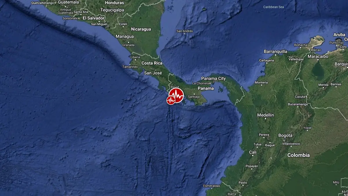
Image credit: TW/SAM, Google
The epicenter was located 112 km (70 miles) SE of Burica (population 1 360), and 132 km (82 miles) S of Pedregal (population 17 472), Chiriqui Province, Panama.
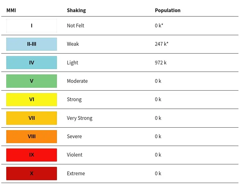
972 000 people are estimated to have felt weak shaking.
Based on all available data, there is no tsunami threat from this earthquake, NWS PTWC said.
The USGS issued a Green alert for shaking-related fatalities and economic losses. There is a low likelihood of casualties and damage.
Overall, the population in this region resides in structures that are a mix of vulnerable and earthquake-resistant construction. The predominant vulnerable building types are mud wall and informal (metal, timber, GI etc.) construction.
Recent earthquakes in this area have caused secondary hazards such as landslides and liquefaction that might have contributed to losses.
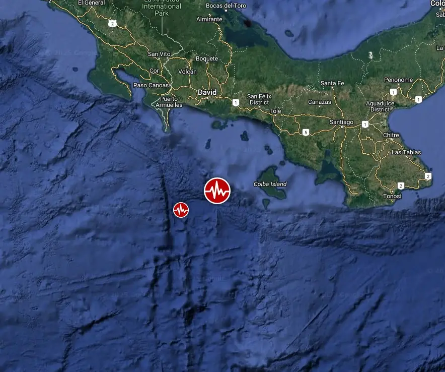
Estimated population exposure to earthquake shaking
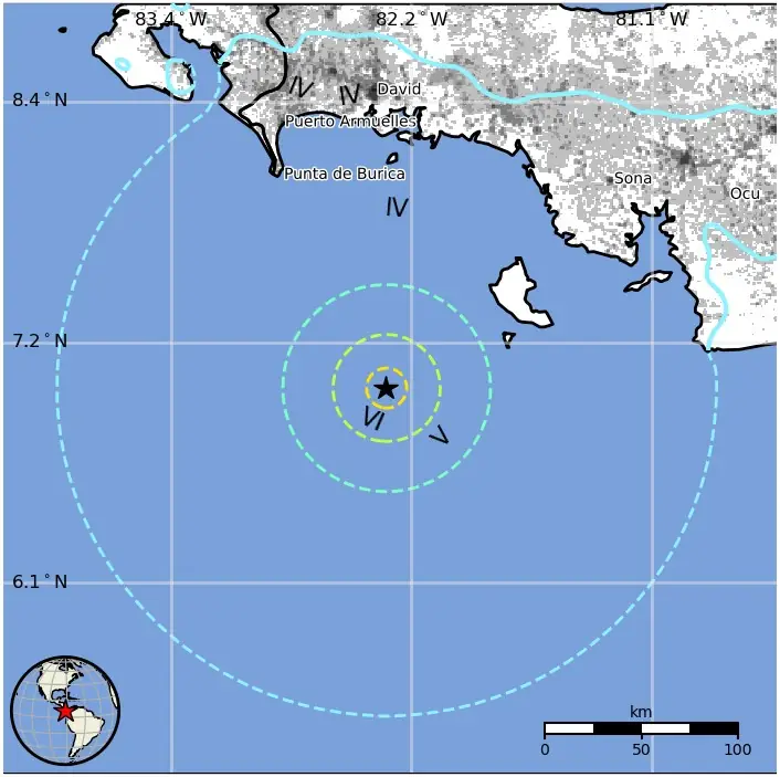
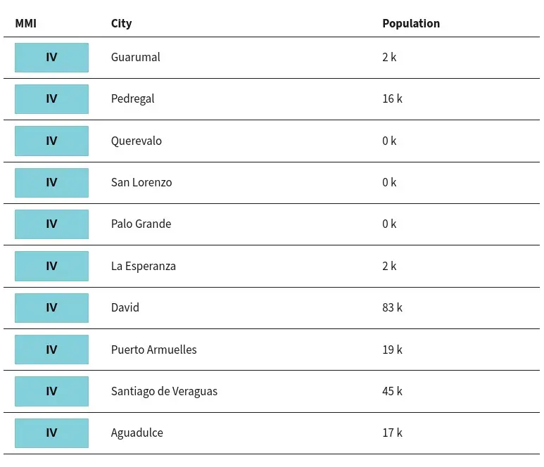
Selected cities exposed
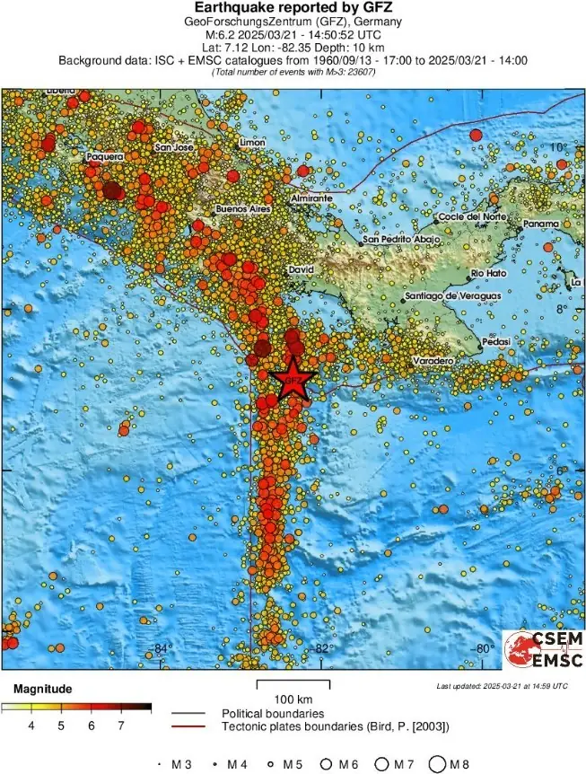
Regional seismicity
References:
1 M6.2 earthquake south of Panama – USGS – March 21, 2025
2 M6.2 earthquake south of Panama – EMSC – March 21, 2025

Teo Blašković founded The Watchers in 2011 and edited it until 2026, covering seismic and volcanic activity, extreme weather, space weather and near-Earth objects. Articles on this page are his archive.
Published in the last 24 hours
- In 1943, a flight instructor in Texas flew a two-seat training plane into the eye of a hurricane because he was curious, then landed and took the base weatherman up for a second pass Epicenter
- A soy sauce maker used fire to guide villagers through Japan’s 1854 tsunami, then funded a seawall that protected most of Hiro in 1946 Epicenter
- In 2013 a landslide fell onto Svínafellsjökull in southeast Iceland, leaving thicker ice at the foot of the slope; that ice is now moving away and the mountainside has shifted 1 to 3 cm. Epicenter
- Kīlauea's north vent threw lava about 660 feet (200 m) high for six hours on 5 November 2026; the summit is now reinflating, with the next episode forecast for 16 to 21 November. Epicenter
