
In 2013 a landslide fell onto Svínafellsjökull in southeast Iceland, leaving thicker ice at the foot of the slope; that ice is now moving away and the mountainside has shifted 1 to 3 cm.
Renewed movement at Svínafellsheiði above Svínafellsjökull in southeast Iceland remained relatively steady through November 13 after GNSS instruments measured about 2–4 cm (0.8–1.6 inches) of total displacement over recent weeks. The Icelandic Meteorological Office says the hazard to inhabited areas is currently low; one possible explanation is that a thicker mass of glacier ice preserved beneath debris from a 2013 landslide is now moving down-glacier and gradually away from the foot of the unstable slope.
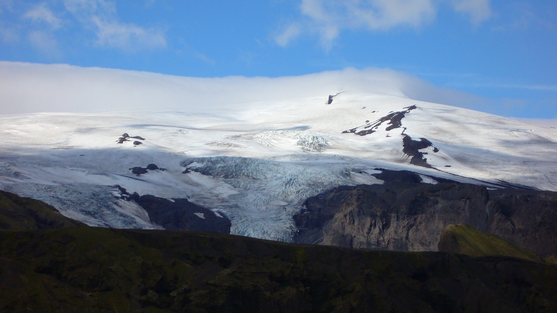
The monitoring system at Svínafellsheiði began detecting renewed deformation on September 23, the first significant movement recorded in the area since the monitoring network was installed in 2018. By November 1, GPS stations and extensometers had measured approximately 1–3 cm (0.4–1.2 inches) of deformation. GNSS instruments showed total displacement of about 2–4 cm (0.8–1.6 inches) over recent weeks by November 4.
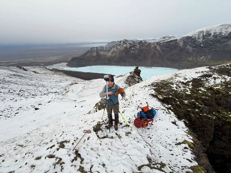
The instruments measure different components of the deformation. Extensometers, which record changes in the width of fractures, had accumulated approximately 4–7 mm (0.16–0.28 inches) of displacement in the upper part of the monitored area and around 14 mm (0.55 inches) in the lower part by November 4. Day-to-day GNSS displacement had become too small to distinguish confidently over short intervals, although slower movement remained detectable when measurements were compared over longer periods.
The Icelandic Meteorological Office reported on November 13 that movement over the preceding weeks had remained relatively steady, interrupted by occasional short pauses and periods of increased movement that may be associated with precipitation. During a November 12 field visit, survey points were measured, drone surveys were carried out and monitoring equipment was inspected to collect additional data and verify the monitoring system.
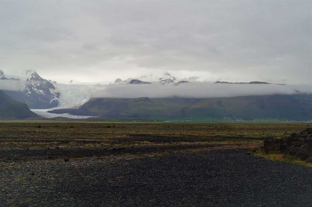
The renewed movement is occurring within an instability that predates the 2013 landslide. The Icelandic Meteorological Office describes a fracture system approximately 1.7 km (1.1 miles) long across the mountainside and says it formed around 15 to 20 years ago. Satellite observations and direct measurements recorded deformation between 2015 and 2017 before the movement slowed considerably.
Ben-Yehoshua et al. (2023) place the onset of the principal deformation between 2003 and 2007, during the period of most rapid glacier thinning in their 131-year reconstruction. The study describes the Svarthamrar slope instability as affecting approximately 0.9 km2 (0.35 mi2), with a minimum unstable rock volume estimated at 50–150 million m3 (1.8–5.3 billion ft3).
Those values describe the geological scale of the unstable mountainside. They do not mean that 50–150 million m3 of rock is currently moving, nor do they represent a forecast of an impending collapse.
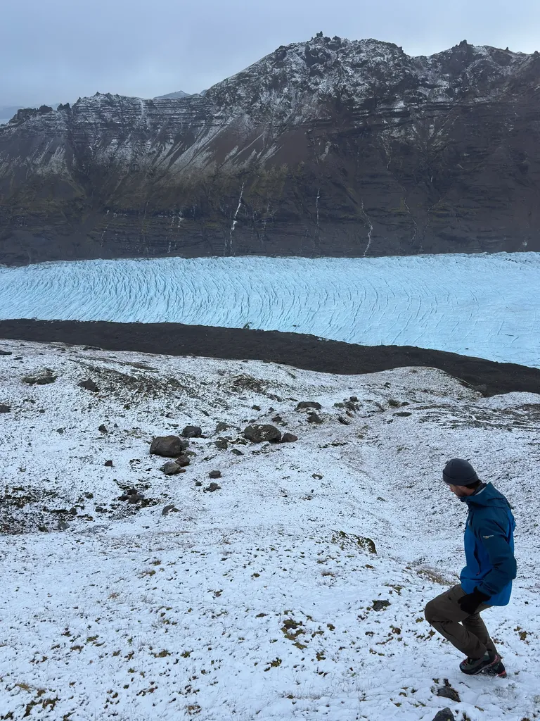
The 2013 event did not create the fracture system. Instead, the large debris avalanche changed conditions on Svínafellsjökull below the unstable slope by depositing a sheet of material across the glacier. Thick debris insulates glacier ice from energy at the surface and reduces ablation, allowing covered ice to remain thicker than nearby debris-free ice.
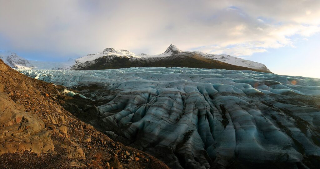
The 2023 study found that the debris prevented significant thinning of the covered part of the glacier after 2011 and estimated that the landslide material added about 12 million tonnes (13.2 million short tons) of load onto the subglacial slope. The surrounding glacier continued to thin as the debris-covered ice remained comparatively well preserved.
The Icelandic Meteorological Office now identifies that thicker ice as one possible part of the explanation for the renewed slope movement. The ice mass may have provided additional support at the foot of the mountainside, but glacier flow is carrying it down-glacier and progressively away from the slope. As the ice moves away, the amount of support it provides decreases.
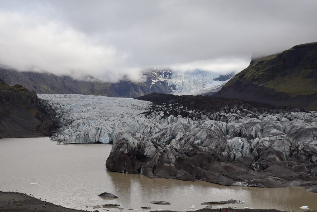
The agency has not established a single cause for the current deformation. Increased water pressure inside the mountain is another possible factor. Approximately 100 mm (3.9 inches) of precipitation was recorded over 24 hours in early October, followed later by another event of around 95 mm (3.7 inches), and extensometers began registering movement at about the same time.
The precipitation gauges are located at low elevations, so the amount that fell higher on the mountainside is uncertain. IMO therefore treats hydrological conditions, continued glacier thinning and the changing position of the thicker debris-covered ice as possible interacting factors rather than identifying one confirmed trigger.
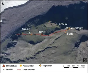
The deformation is localized to Svínafellsheiði. When the renewed movement was announced on November 1, no displacement had been detected at other GPS stations on or near Öræfajökull, and IMO reported no indications connecting the slope movement with changes in the volcano.
The movement itself does not indicate that a rock avalanche is imminent. IMO said on November 1 that the observed deformation did not require special response measures beyond increased monitoring, analysis and follow-up, a position reached in consultation with Civil Protection and South Iceland Police.
The agency’s current assessment considers the hazard to inhabited areas low. Its 2025 hazard assessment finds that the most likely rock-avalanche scenario would stop on Svínafellsjökull without reaching the lagoon at the glacier terminus or threatening inhabited areas below.
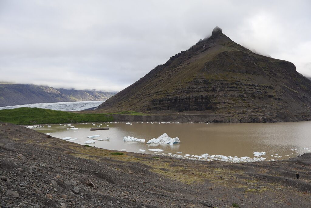
A larger runout cannot be excluded. IMO says a rockslide could reach the lagoon at the glacier terminus and trigger flooding that could threaten areas downstream, while the hazard on Svínafellsjökull itself would be considerable if landslides occurred from the slope. The lagoon scenario comes from hazard modelling and is not a prediction that such a failure will occur.
Future development remains uncertain. IMO says the movement may gradually subside, continue, or eventually lead to failures involving part or all of the unstable area. An increase in movement is expected before a landslide, but the nature and duration of any precursory activity remain uncertain.
Monitoring continues around the clock using GNSS/GPS instruments, extensometers, fixed survey points and field observations. The Icelandic Meteorological Office and the University of Iceland are continuing to reassess the slope as new measurements become available.
References:
1 Movement continues to be detected at Svínafellsheiði – Icelandic Meteorological Office – November 13, 2026
2 Svínafellsheiði – Icelandic Meteorological Office – November 1–10, 2026
3 Ben-Yehoshua, D., Sæmundsson, Þ., Erlingsson, S., Helgason, J. K., Hermanns, R. L., Magnússon, E., Ófeigsson, B. G., Belart, J. M. C., Hjartardóttir, Á. R., Geirsson, H., Guðmundsson, S., Hannesdóttir, H., Pálsson, F., Drouin, V. J. P., & Bergsson, B. H. (2023). The destabilization of a large mountain slope controlled by thinning of Svínafellsjökull glacier, SE Iceland. Jökull, 73. DOI: 10.33799/jokull2023.73.001

The Watchers Staff covers earthquakes, volcanoes, severe weather, space weather and other natural events. Published since 2011, The Watchers reports on a changing planet and the science behind it.
Published in the last 24 hours
- A crack up to 6 m (20 ft) wide is splitting the summit of the Hochvogel in the Allgäu Alps; 12 years of measurements now put the loose block at about 400,000 cubic metres, half the peak. Epicenter
- Kīlauea's north vent threw lava about 660 feet (200 m) high for six hours on 5 November 2026; the summit is now reinflating, with the next episode forecast for 16 to 21 November. Epicenter
- Hayli Gubbi in Ethiopia's Afar erupted on 23 November 2025, its first historically documented eruption; a year later scientists have traced it to magma from Erta Ale that travelled more than 30 km underground. Epicenter
- Typhoon Cempaka spun up over the western North Pacific on 7 November 2026; it is now the 32nd typhoon of the year, more than any year this century, one past the 31 counted in 2013. Epicenter
