
Area of earthquake locations extending from deep beneath Ta’u Island volcano to about 10 km (6 miles), American Samoa
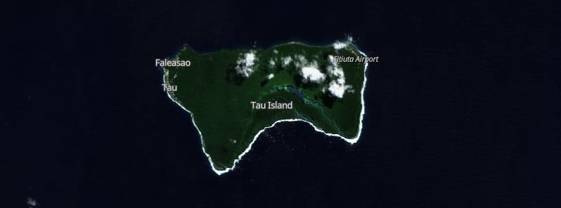
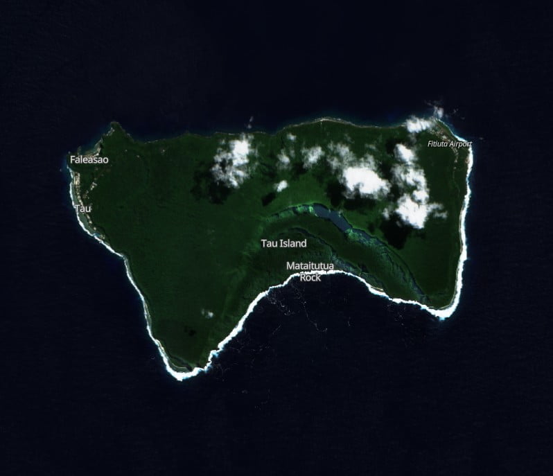
Featured image: Ta'u Island on August 19, 2022. Credit: Copernicus EU/Sentinel-2, EO Browser, The Watchers
The earthquake swarm that started under Ta’u Island volcano, American Samoa, at the end of July 2022 continues with no significant change.
Preliminary data analysis suggests a wide area of possible earthquake locations is extending from deep beneath Ta’u Island to shallower depths about 10 km (6 miles) to the north.1
The source of the earthquakes has not moved within the earth since monitoring began 3 weeks ago – the source position has remained constant. Seismologists continue to examine data and refine locations.
In 24 hours to 03:13 UTC on September 2, the USGS seismic network detected 27 earthquakes that were large enough to be felt by people on the Manuʻa Islands.
The largest event has a preliminary magnitude of 3.2 and occurred at 14:49 UTC on September 1. Many small earthquakes undetectable by humans also continue.
No volcanic activity was observed in available satellite data from the previous 24 hours.
It is still unclear if this earthquake unrest will escalate to a volcanic eruption and exactly where an eruption might occur.
An eruption could pose significant hazards to residents of American Samoa – these hazards include volcanic gases, volcanic ash, low-level localized explosions of lava, lava flows, earthquake shaking, and tsunami.
Geological summary
The 10 km (6.2 miles) wide Ta’u Island, located at the E end of the Samoan islands, is ringed by sea cliffs. It is the emergent portion of the large Lata shield volcano.
A major flank collapse event around 22 ka resulted in the steep scarps on the southern side of the island. Two smaller shields were constructed along rift zones at the NW and NE tips of the island.
The NW corner of the island has a tuff-cone complex that ejected large dunite xenoliths and coral blocks. Numerous Holocene post-caldera cones occur at the summit and on the flanks.2
References:
1 HAWAIIAN VOLCANO OBSERVATORY DAILY UPDATE – U.S. Geological Survey – Friday, September 2, 2022, 03:13 UTC
2 Ta’u Island – Geological summary – GVP
I'm a dedicated researcher, journalist, and editor at The Watchers. With over 20 years of experience in the media industry, I specialize in hard science news, focusing on extreme weather, seismic and volcanic activity, space weather, and astronomy, including near-Earth objects and planetary defense strategies. You can reach me at teo /at/ watchers.news.
Commenting rules and guidelines
We value the thoughts and opinions of our readers and welcome healthy discussions on our website. In order to maintain a respectful and positive community, we ask that all commenters follow these rules.