
Shallow M5.9 earthquake hits Moro Gulf, Philippines
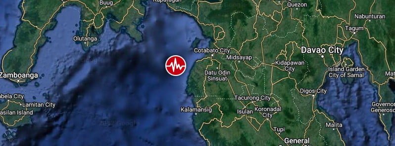
Image credit: TW/SAM, Google
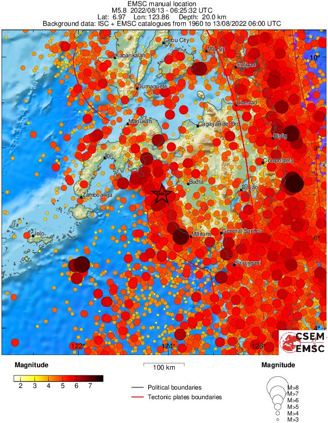
A strong and shallow earthquake registered by the PHIVOLCS as M5.9 hit Moro Gulf, Philippines at 06:25 UTC on August 13, 2022. The agency is reporting a depth of 1 km (0.62 miles). The USGS is reporting M5.8 at a depth of 15 km (9.3 miles), EMSC M5.8 at a depth of 20 km (12.4 miles).
The epicenter was located about 25.4 km (15.8 miles) WNW of Gadung (population 2 456), 37.2 km (23.1 miles) WNW of South Upi (population 12 538), and 48.3 km (30 miles) NNW of Kalamansig (population 12 821), Philippines.
PHIVOLCS said damage is expected as well as aftershocks.
The USGS issued a Green alert for shaking-related fatalities and economic losses. There is a low likelihood of casualties and damage.
Overall, the population in this region resides in structures that are a mix of vulnerable and earthquake-resistant construction. The predominant vulnerable building types are unknown/miscellaneous types and heavy wood frame construction.
Recent earthquakes in this area have caused secondary hazards such as landslides that might have contributed to losses.
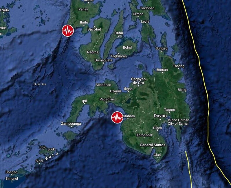
Regional seismicity
I'm a dedicated researcher, journalist, and editor at The Watchers. With over 20 years of experience in the media industry, I specialize in hard science news, focusing on extreme weather, seismic and volcanic activity, space weather, and astronomy, including near-Earth objects and planetary defense strategies. You can reach me at teo /at/ watchers.news.
Commenting rules and guidelines
We value the thoughts and opinions of our readers and welcome healthy discussions on our website. In order to maintain a respectful and positive community, we ask that all commenters follow these rules.