
Cyclone Fili strengthening north of New Zealand, forecast to bring a variety of weather hazards
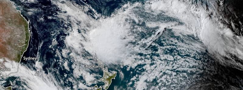
Featured image: Ex-Tropical Cyclone Fiji at 03:00 UTC on April 11, 2022. Credit: JMA/Himawari-8, RAMMB, CIRA, TW
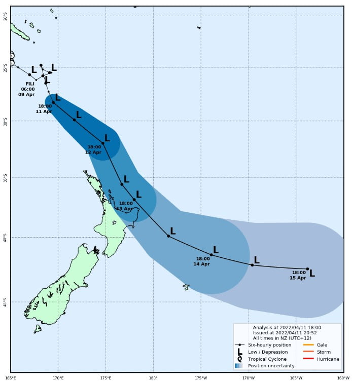
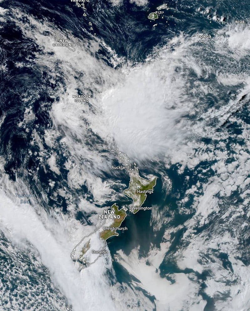
Ex-Tropical Cyclone “Fili” is strengthening north of New Zealand on Monday, April 11, 2022. The storm is expected to bring a variety of weather hazards on Tuesday and Wednesday, April 12 and 13, particularly to the NE corner of the North Island. Parts of the region could receive well over a month’s worth of rain.
- Ex-Tropical Cyclone “Fili” is expected to approach the upper North Island on Tuesday, April 12 then move southeast across East Cape on Wednesday, before moving away to the east of New Zealand on Thursday.
- Heavy rain and/or severe gales are expected for many parts of the North Island as the system tracks southeastwards during Tuesday and Wednesday, and very large waves are expected to affect northeast and eastern coasts.
- This will be a significant weather event and people are advised to keep up to date with the latest official Severe Weather Watches and Warnings issued by NZ Met Service.
Strong, gusty winds will begin to affect Northland on Tuesday, April 12, moving down the North Island from nighttime (LT) through Wednesday.1
Power cuts will be possible, particularly along the coast and in exposed/elevated areas in the northeast corner of the island.
Soaking rain will move southward tomorrow, with the heaviest falls expected about already sodden northern Hawke’s Bay and Gisborne where well over a month’s worth of rain may cause more flooding.
Wave heights of over 5 m (16.4 feet) in the NE North Island will make for rough coastal sea conditions with the potential for beach erosion along the last coast on Wednesday night.
Storm impacts will be short but sharp, NIWA said, adding that the storm will push well east of the mainland on Thursday, April 14.
“This will be a significant weather event,” New Zealand’s Met Service said, adding they’ll be constantly monitoring developments.
“There remains some uncertainty regarding the exact track and timing of Cyclone Fili, and people are strongly urged to stay up to date with the latest Warnings, forecasts, and official advice.”2
“Also, a front will bring rain to the west coast of the South Island tonight and Tuesday morning. A Warning remains in force for Fiordland, and a watch for Westland.”
References:
1 NIWA Weather Services – April 11, 2022
2 NZ Met Service – Tropical Cyclone Activity – April 11, 2022
I'm a dedicated researcher, journalist, and editor at The Watchers. With over 20 years of experience in the media industry, I specialize in hard science news, focusing on extreme weather, seismic and volcanic activity, space weather, and astronomy, including near-Earth objects and planetary defense strategies. You can reach me at teo /at/ watchers.news.
Commenting rules and guidelines
We value the thoughts and opinions of our readers and welcome healthy discussions on our website. In order to maintain a respectful and positive community, we ask that all commenters follow these rules.