
Major late-season winter storm to impact U.S.
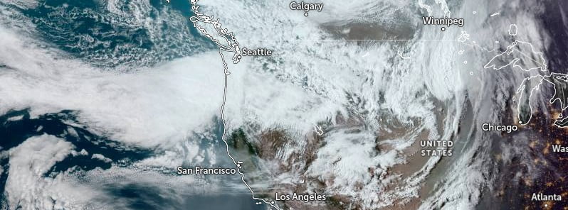
Image credit: NOAA/GOES-West, TW
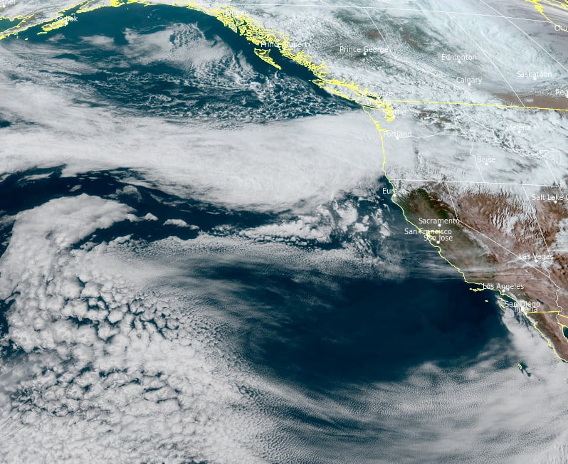
A significant winter storm will bring heavy snow and strong winds to the Cascades through Monday, April 11, 2022, then the northern Intermountain West through northern Plains Monday night into Thursday, April 14.
“A deep area of low pressure will move into the Pacific Northwest today, bringing with it a substantial plume of Pacific moisture,” NWS forecaster Kebede noted on April 11.1
Rain showers and isolated thunderstorms are expected along the coast and inland low-lying areas over the next couple of days, Kebede said, adding that a few feet of snow will blanket the Oregon Cascades as well.
This system will deepen as it moves farther inland, setting the stage for an intense late-season winter storm to impact the Rockies and Northern Plains.
Heavy snow and high winds are forecast to spread into the Rockies and Northern Plains this evening, April 11. Additionally, over 30 cm (1 foot) of snow is likely to accumulate between eastern Montana and central North Dakota on Tuesday.
Blizzard-like conditions are possible for this area due to strong winds coupling with high snow rates.
Power outages and difficult travel conditions are likely.
Winter Storm Watches, Warnings and Advisories are in effect for the southern Cascades, Rockies and the Northern Plains.
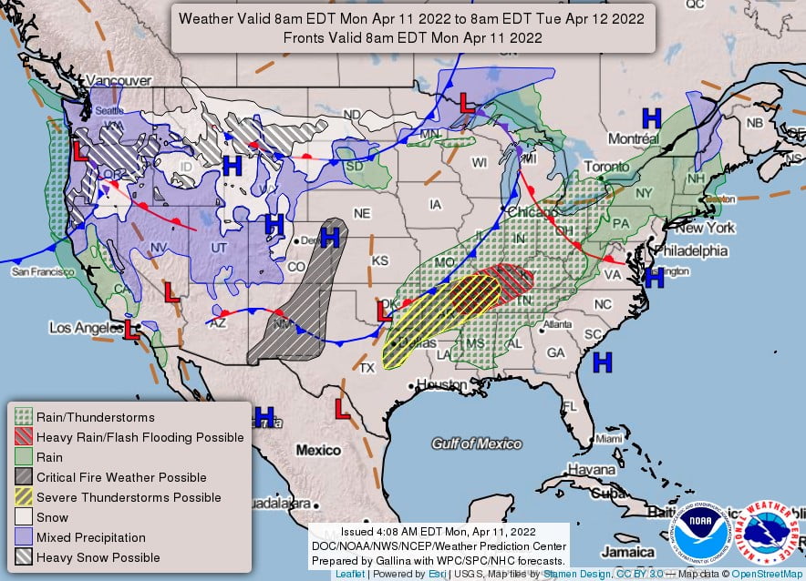
The winter storm will continue to deepen and become more dynamic as it enters the Great Plains on Tuesday, Kebede said.
Rain and thunderstorms are expected to expand across the Plains and Mississippi Valley from Tuesday evening, April 12 to Wednesday morning.
Thunderstorms are possible over much of this area where the Storm Prediction Center has a slight and embedded Enhanced Risk of severe thunderstorms.
Heavy rainfall may focus around Louisiana and the greater Lower Mississippi Valley on Tuesday where a Slight Risk of Excessive Rainfall is in effect.
Dry conditions beneath this low pressure system will exacerbate an ongoing extreme drought over the Southwest and Southern/Central Plains. This, combined with high winds and warmer than normal temperatures, will contribute to a Critical Risk of Fire Weather through midweek.
There is an Extreme Risk of Fires for parts of the Texas/Oklahoma panhandle and into southern Kansas on Tuesday.
References:
1 Short Range Forecast Discussion – NWS Weather Prediction Center College Park MD – 341 AM EDT Mon Apr 11 2022
I'm a dedicated researcher, journalist, and editor at The Watchers. With over 20 years of experience in the media industry, I specialize in hard science news, focusing on extreme weather, seismic and volcanic activity, space weather, and astronomy, including near-Earth objects and planetary defense strategies. You can reach me at teo /at/ watchers.news.
Commenting rules and guidelines
We value the thoughts and opinions of our readers and welcome healthy discussions on our website. In order to maintain a respectful and positive community, we ask that all commenters follow these rules.