
Major flood warnings issued as Sydney records a month’s worth of rain in a day, Australia
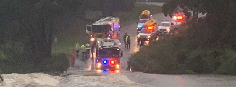
Image credit: NSW SES
Sydney, Australia is experiencing the third major flooding event this year, forcing authorities to issue evacuation orders for thousands of residents. Flood warnings for minor to major flooding in the Hawkesbury-Nepean and Georges rivers have been issued by the Australian Bureau of Meteorology (BOM), with major flooding possible for Menangle, Liverpool and Milperra this afternoon.
Sydney received nearly a month’s worth of April rain (126.5 mm / 4.98 inches) overnight Thursday, April 7, 2022, causing rivers to rise, turning streets into rivers and forcing thousands to evacuate.
A man swept away by floods in the city’s northwest was rescued by emergency crews, media reported, while television footage showed vehicles struggling to cross waterlogged streets, fallen power lines and trees, and debris floating in rivers.1
“This is a highly dynamic situation. These events are moving exceptionally quickly,” New South Wales emergency services Acting Commissioner Daniel Austin said. “Exceptionally sharp, short bursts of rain” have been creating flash flooding almost every hour.”
According to data provided by BOM, Rose Bay in Sydney recorded 167.2 mm (6.58 inches) of rain in 24 hours on April 7 while the suburb of Centennial Park recorded 163 mm (6.41 inches) and Sydney Airport 125.5 mm (4.94 inches).
So far this year, Sydney has received 1 227 mm (48.3 inches), which is more than its average annual rainfall of 1 213 mm (47.7 inches).
Over the next 24 hours, many coastal towns could get up to 180 mm (7 inches) more as heavy rainfall continues to impact southern and central NSW coast and adjacent ranges including the South Coast, Illawarra, Metropolitan and southern Hunter districts.
Rainfall is expected to intensify around coastal areas of Wollongong today, continue on Friday, April 8 and then ease on Saturday, April 9.2
A flood watch has been issued for many other catchments in New South Wales.
Heavy rainfall and thunderstorms over saturated catchment areas increase the risk of flooding in rivers, creeks and streams, flash flooding and landslips, BOM said, urging affected communities to stay up to date with the latest Bureau warnings.
This is the third intense weather system to hit eastern Australia in just 6 weeks, with several parts of northern New South Wales and southeast Queensland receiving record rains and Sydney registering its wettest March on record.
References:
1 Sydney orders thousands to evacuate as heavy rains cause flash floods – CNN
2 Major flood warnings current as heavy rainfall continuing in south-east New South Wales – BOM (April 7, 2022)
I'm a dedicated researcher, journalist, and editor at The Watchers. With over 20 years of experience in the media industry, I specialize in hard science news, focusing on extreme weather, seismic and volcanic activity, space weather, and astronomy, including near-Earth objects and planetary defense strategies. You can reach me at teo /at/ watchers.news.
Commenting rules and guidelines
We value the thoughts and opinions of our readers and welcome healthy discussions on our website. In order to maintain a respectful and positive community, we ask that all commenters follow these rules.