
Strong and shallow M6.1 earthquake hits Myanmar-India border region
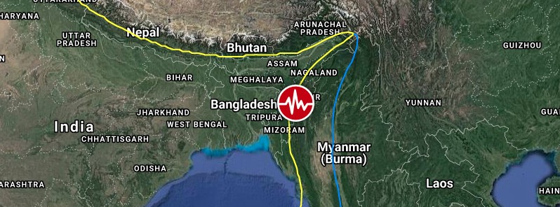
Image credit: TW/SAM, Google
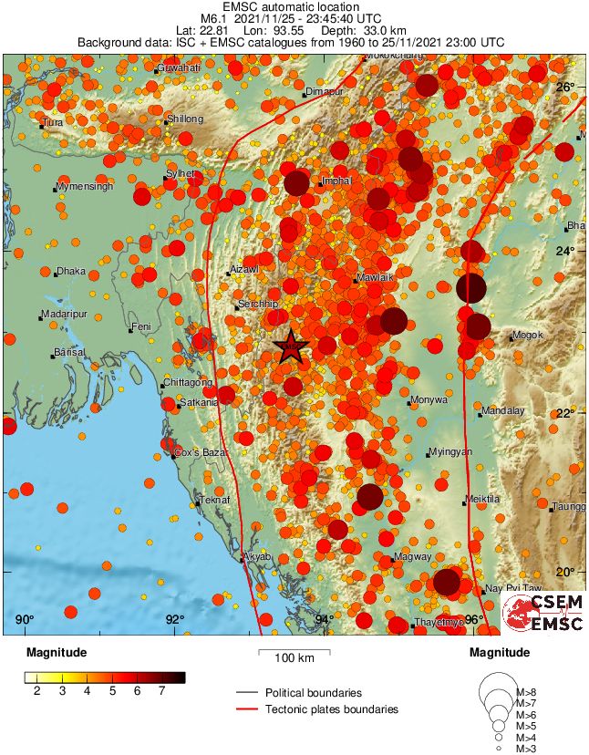
A strong and shallow earthquake registered by the USGS as M6.1 hit the Myanmar-India border region at 23:45 UTC on November 25, 2021. The agency is reporting a depth of 32 km (19 miles). EMSC is reporting M6.1 at a depth of 33 km (20 miles).
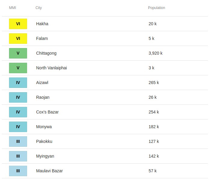
The epicenter was located about 19 km (12 miles) NNW of Hakka (population 20 000), and 63 km (40 miles) ENE of Saiha (population 22 654), India.
There are 1.3 million people living within 100 km (62 miles) and 160 000 within 50 km (31 miles)
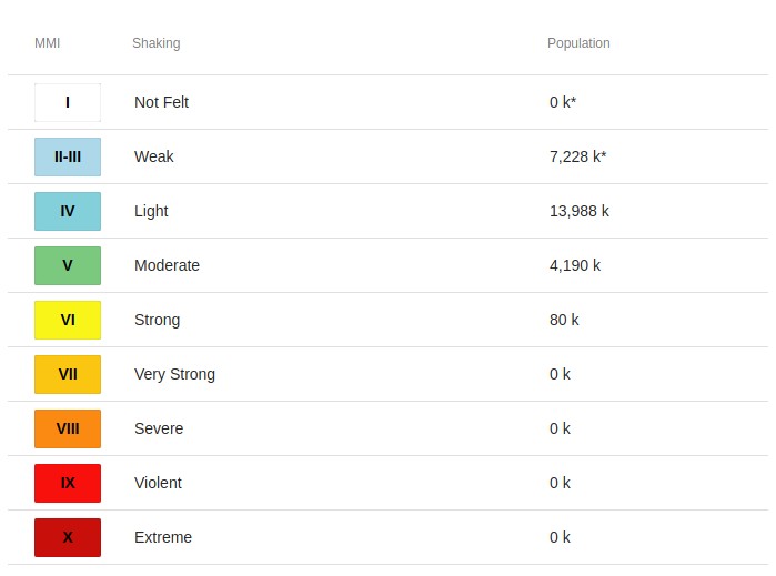
80 000 people are estimated to have felt strong shaking and 4 190 000 moderate.
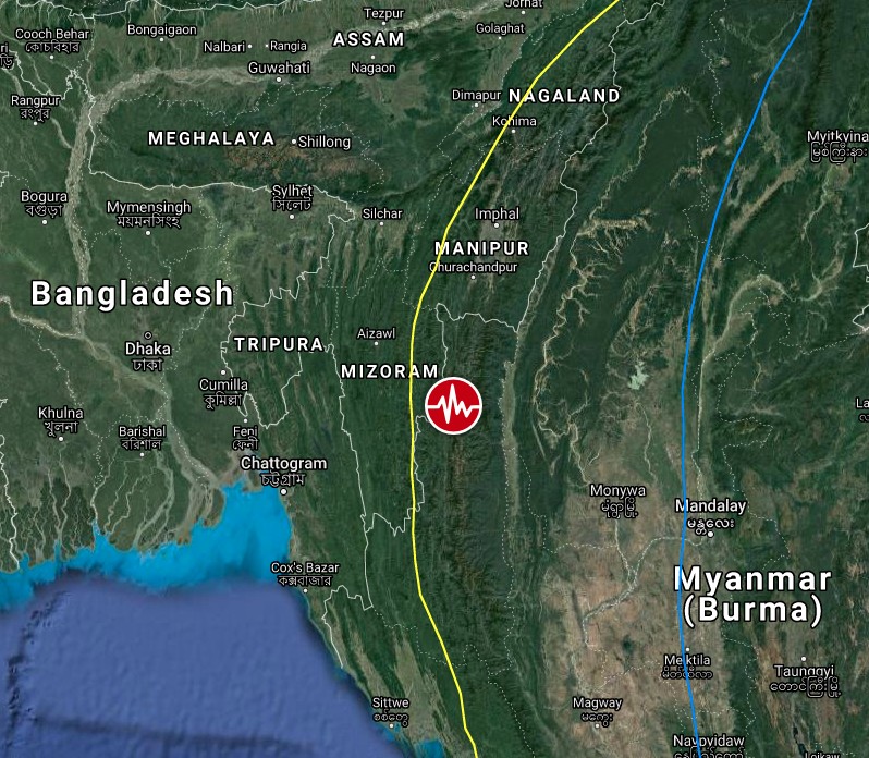
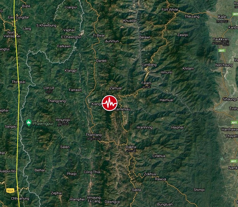
Image credit: TW/SAM, Google
The USGS issued a Green alert for shaking-related fatalities and economic losses. There is a low likelihood of casualties and damage.
Overall, the population in this region resides in structures that are vulnerable to earthquake shaking, though resistant structures exist. The predominant vulnerable building types are adobe block with wood and rubble/field stone masonry construction.
Recent earthquakes in this area have caused secondary hazards such as landslides that might have contributed to losses.
Estimated population exposure to earthquake shaking
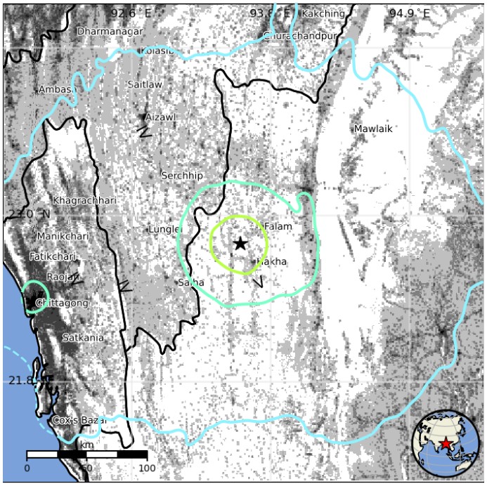
Selected cities exposed
Regional seismicity
I'm a dedicated researcher, journalist, and editor at The Watchers. With over 20 years of experience in the media industry, I specialize in hard science news, focusing on extreme weather, seismic and volcanic activity, space weather, and astronomy, including near-Earth objects and planetary defense strategies. You can reach me at teo /at/ watchers.news.
Commenting rules and guidelines
We value the thoughts and opinions of our readers and welcome healthy discussions on our website. In order to maintain a respectful and positive community, we ask that all commenters follow these rules.