
Shallow M5.8 earthquake hits Assam, India
A shallow M5.8 earthquake of struck Udalguri district, Assam, at 16:41 LT (11:11 UTC) on September 14, 2025, according to the India Meteorological Department (IMD). The agency reported a depth of around 5 km (3 miles). The USGS registered it as M5.5 at a depth of 29 km (18 miles).
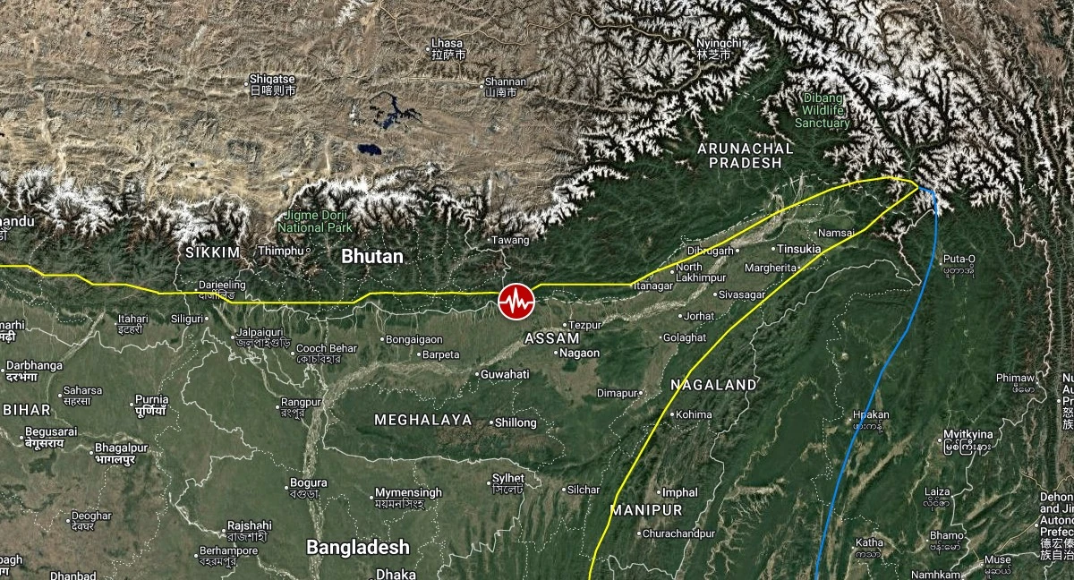
Epicenter of M5.8 earthquake in Assam, India on September 14, 2025. Credit: TW/SAM, Google
The epicenter was located 11 km (6.8 miles) NNE of Khārupatia (population 18 599), 19 km (12 miles) SSE of Udalguri (population 15 935), 25 km (15 miles) NE of Mangaldai (population 23 871), and 30 km (19 miles) WSW of Dhekiajuli (population 21 271), Assam.
The USGS issued a Yellow alert for shaking-related fatalities and economic losses. Some casualties and damage are possible and the impact should be relatively localized. Past yellow alerts have required a local or regional level response.
Estimated economic losses are less than 1% of GDP of India.
Shaking was reported in nearby areas, including other parts of northeastern India, North Bengal, and neighboring Bhutan. No immediate reports of casualties or property damage have been confirmed, local authorities said.

Overall, the population in this region resides in structures that are vulnerable to earthquake shaking, though resistant structures exist. The predominant vulnerable building types are adobe block with wood and rubble/field stone masonry construction.
Recent earthquakes in this area have caused secondary hazards such as landslides that might have contributed to losses.
Liquefaction triggered by this earthquake is estimated to be significant in severity and (or) spatial extent, affecting close to 100 000 people.

According to the IMD’s preliminary analysis, the quake was located near the Kopili Fault and closer to the April 28, 2021 M6.4 Sonitpur earthquake. The preliminary fault plane solution derived from moment tensor inversion suggests a strike-slip fault.
The historical and instrumental earthquake records (NCS catalogue) show that the region experiences moderate to large earthquakes. Notable events include the M6.4 earthquake on April 28 2021, the M6.4 Bhutan earthquake on September 21 2009, and the M6.0 Assam earthquake on July 29 1960.
In addition to the major events, earthquakes originating in Assam and the surrounding region are frequently felt with intensities ranging from slight to strong. Their occurrence is primarily associated with tectonic sources in the Himalaya, including the Himalayan Frontal Thrust (HFT), Main Boundary Thrust (MBT), Main Central Thrust (MCT), as well as the Kopili and Dhubari faults.

Seismological and geological evidence indicates that the region is highly active, classified in the highest seismic hazard zone V. According to the seismic zoning map of the Bureau of Indian Standards (BIS), Assam lies entirely within this zone.
The recent earthquake was widely felt across Assam and neighboring states, with intensities ranging from II to VI on the Modified Mercalli Intensity (MMI) scale within approximately 0–300 km (<185 miles) of the epicenter.
Estimated population exposure to earthquake shaking


Selected cities exposed

Regional seismicity

References:
1 M5.8 earthquake in Assam, India – IMD – September 14, 2025
2 M5.5 earthquake in Assam, India – USGS – September 14, 2025
3 M5.5 earthquake in Assam, India – EMSC – September 14, 2025

I am an Assistant Editor and Severe Weather & Science Journalist at The Watchers, specializing in real-time severe weather coverage, geophysical event reporting, and research-driven scientific analysis. You can reach me at rishav(at)watchers(.)news.
Commenting rules and guidelines
We value the thoughts and opinions of our readers and welcome healthy discussions on our website. In order to maintain a respectful and positive community, we ask that all commenters follow these rules.