
High level of volcanic gases measured close to the eruption site at Fagradalsfjall, Iceland
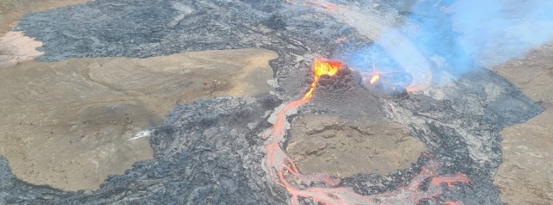
Image credit: Icelandic Civil Protection and Emergency Management. Acquired March 21, 2021.
A volcanic eruption in Geldingadalur near Fagradalsfjall on Iceland's Reykjanes Peninsula continues since March 19, 2021. Lava fountain activity is still low and mapping of the lava flow is in progress. While no volcanic ash has been detected, a high level of volcanic gases has been measured close to the eruption site. The public is advised to stay away from the area.
The Aviation Color Code for the Reykjanes Peninsula remains at Red, signifying an eruption in progress.
Specialists went yesterday to perform gas measurements at the eruption site. There are indications that gas emission is slightly lower than the day before, however, gas concentrations close to the lava flow were measured above the danger threshold.
SO2 concentration close to the volcano can surpass over 9 000 µg/m3, and CO2 can also gather in valleys in the landscape, the Icelandic Met Office (IMO) said on March 23.
The health protection limit is 350 µg/m3.
IMO is advising residents and visitors to leave the area before 17:00, keeping away from valleys and following the marked path.
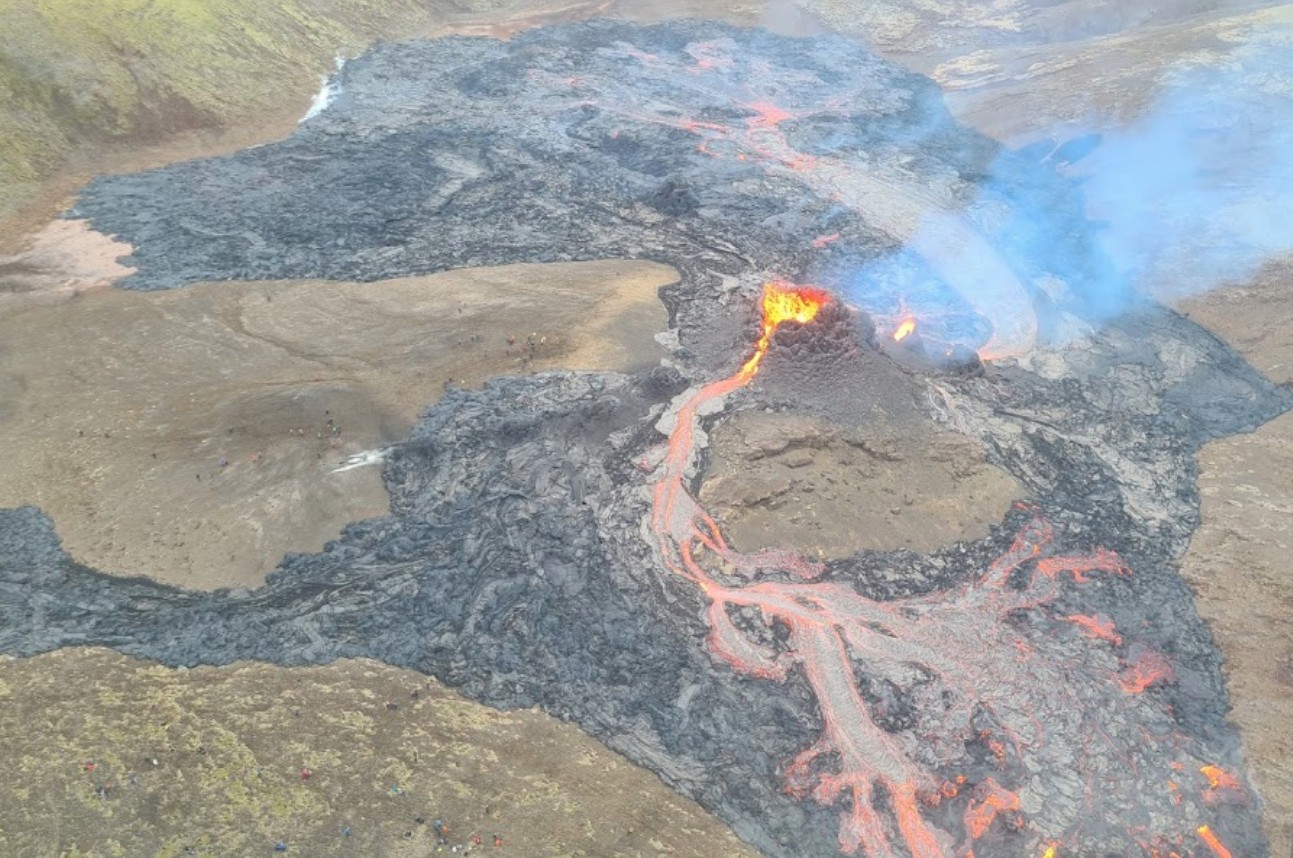
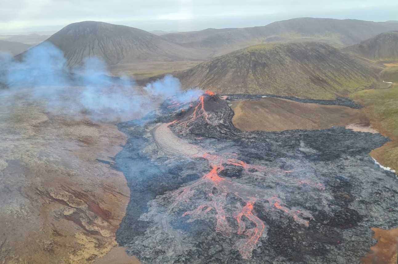
Image credit: Icelandic Civil Protection and Emergency Management. Acquired March 21, 2021
The eruption fissure is about 500 – 700 m (1 640 – 2 300 feet) long.
— Jersquall (@Jersquall) March 22, 2021
Fagradalsfjall today! Images captured 10 minutes apart over 4 hours on Sunday 21st March 2021. Source images are taken from https://t.co/1JK80TQGMM #geographyteacher pic.twitter.com/Gh0kvhUMeM
— internetgeography.net (@InternetGeog) March 21, 2021
My friend took this pic.twitter.com/5T0lEkciom
— Mark redgwell (@Blackprojects) March 22, 2021
Have a look at this taken by a friend of a friend pic.twitter.com/GVV1JakWPs
— Mark redgwell (@Blackprojects) March 22, 2021

A lot of people visited the eruption area, taking amazing images and videos but on March 22 the police closed the eruption area due to a significant increase in SO2 gas emissions and bad weather.
Live feed:
Due to the ongoing seismic activity, people are advised to avoid steep terrain as rocks and boulders can fall and chances of landslides are increased.
Geological summary
The Krýsuvík-Trölladyngja volcanic system is described by the Catalogue of Icelandic Volcanoes as an approximately 50 km (31 miles) long composite fissure swarm trending about N38°E, including a 30 km (18 miles) long swarm of fissures, with no central volcano.
It is one of the volcanic systems arranged en-echelon along the Reykjanes Peninsula west of Kleifarvatn lake.
The Fagradalsfjall and Krýsuvík fissure swarms are considered splits or secondary swarms of the Krýsuvík–Trölladyngja volcanic system.
Small shield volcanoes have produced a large portion of the erupted volume within the system.
Several eruptions have taken place since the settlement of Iceland, including the eruption of a large basaltic lava flow from the Ogmundargigar crater row around the 12th century.
The latest eruption, identified through tephrochronology, took place during the 14th century.
I'm a dedicated researcher, journalist, and editor at The Watchers. With over 20 years of experience in the media industry, I specialize in hard science news, focusing on extreme weather, seismic and volcanic activity, space weather, and astronomy, including near-Earth objects and planetary defense strategies. You can reach me at teo /at/ watchers.news.
What are the gas concentrations? I am a geologist and yes, I have visited Iceland.
Updated. The official data was not available at the time of press. “SO2 concentr. close to the volcano can go over 9 000 µg/m3, and gather in valleys/dells in the landscape.” IMO