
Soufriere volcano continues to exude magma, steam observed, St. Vincent and The Grenadines
Featured image: Soufriere volcano on January 6, 2021. Credit: UWI-SRC
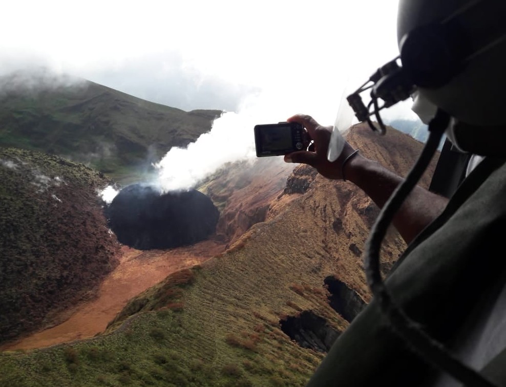
The UWI-SRC Team conducted a successful helicopter reconnaissance of the La Soufriere Volcano on January 6, 2021. The volcano continues to exude magma and the Alert level remains at Orange since December 28, 2020.
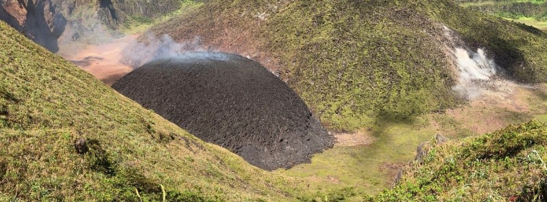
The volcano continues to exude magma on the surface, steam can still be observed from the Belmont Observatory and the new dome also continues to increase in size, SRC said.
People living in areas close to the volcano should expect strong sulphur smells for several days to weeks, depending on changes in wind direction.
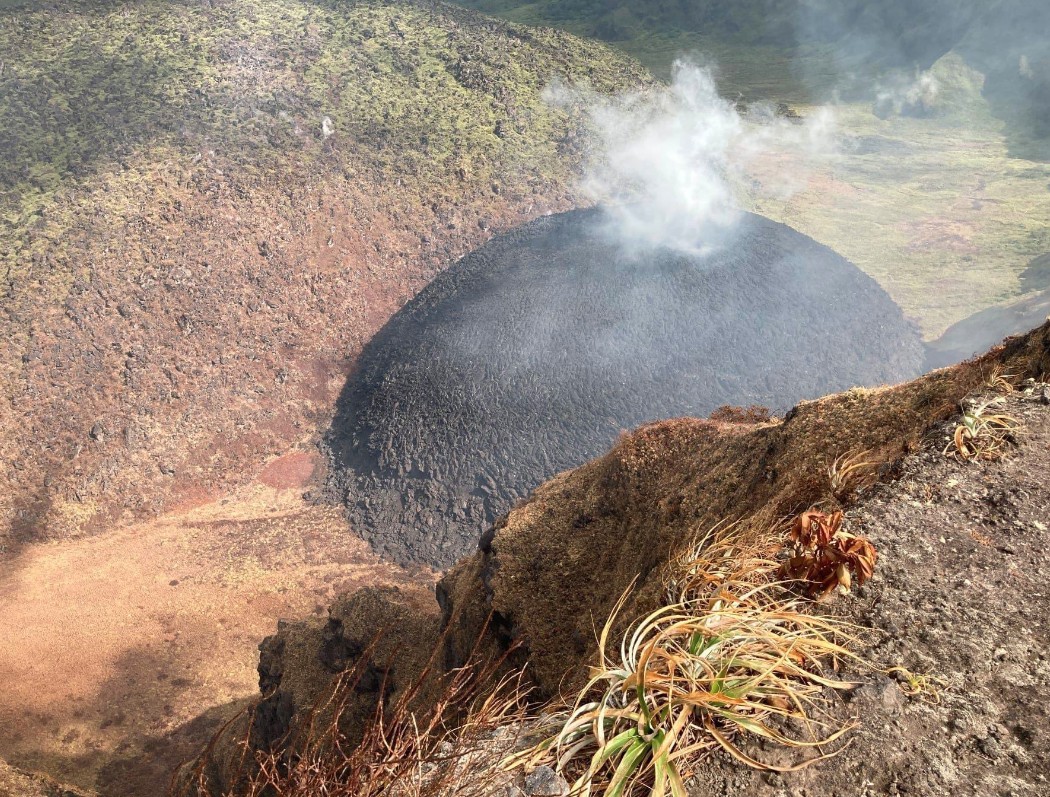
The dome consists of a rounded mass comprised of individual, mainly lenticular-shaped massive blocks of black lava.
It is steaming and emitting sulphur smelling volcanic gases from its top centre, the area from which the lava is being extruded.
As it grows radially outwards its outer edges become oversteepened producing small hot rock falls.
The volcano poses a significant danger to those at the crater rim. Public access to the volcano is restricted.
The video below shows the new growing dome viewed from its western side.
Video credit: Professor Richard Robertson, UWI-SRC
The team also scouted possible new seismic station sites to better monitor the latest activity. Plans are underway to install cameras at the crater rim for scientific observation.
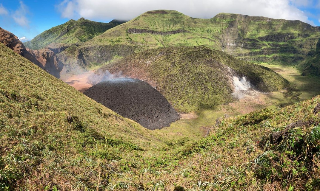
Soufriere volcano lava dome on January 5, 2021. Credit: UWI-SRC
Soufriere volcano lava dome on January 5, 2021. Credit: UWI-SRC
Soufriere volcano lava dome on January 5, 2021. Credit: UWI-SRC, Richard Robertson
The National Emergency Management Organisation (NEMO) met with residents of Sandy Bay and surrounding communities on January 6 to update them on the present situation and to review the Community Volcano Emergency Plan. On Saturday, January 9, NEMO will meet with residents of Georgetown and surrounding areas at the Georgetown Secondary School at 15:00 LT.
The National Emergency Management Organisation is reminding the public that no evacuation order or notice has been issued.
NEMO continues to appeal to the public to desist from visiting the La Soufriere Volcano until the scientists advise that it is safe to do so.
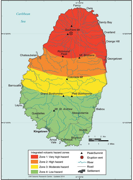
Volcanic Hazard Map – St. Vincent.
The map only shows hazard zone on land. However, lahars and pyroclastic falls, flows and surges will also impact areas offshore to varying degrees, and as such, the hazard zones must be envisaged as extending some distance offshore.
Hazard Zone 1 (Red Zone) – Very High Hazard:
This includes all areas expected to experience maximum damage in the short term and is the zone where all hazardous events have their greatest influence. It is defined by the zone of expected total destruction from pyroclastic flows, surges, and mudflows and by the zone of maximum expected damage from all projectiles. This zone is likely to experience more than 30 cm (12 inches) of ash. During the course of an eruption, this zone would be unsuitable for human habitation.
Hazard Zone 2 (Orange Zone) – High Hazard:
This includes all areas of moderate pyroclastic flow and surge hazard, areas within the 5 km (3.1 miles) projectile zone, and areas likely to experience between 10 and 30 cm (4 – 12 inches) of ashfall. These areas will be affected in a similar manner as Zone 1 during large scale eruptions.
Hazard Zone 3 (Yellow Zone) – Moderate Hazard:
This zone will be free from the effects of flows and surges but will be affected by 5 to 10 cm (2 – 4 inches) thick ashfalls, minor earthquakes and lightning strikes. This zone will experience significantly less physical damage than Zones 1 and 2.
Hazard Zone 4 (Green Zone) – Low Hazard:
This zone includes areas likely to be relatively safe from hazardous events, except for minor ashfall of less than 5 cm (2 inches). Crop damage and disruption of water supply due to ashfall will be the main effect but other physical damage will be minimal.
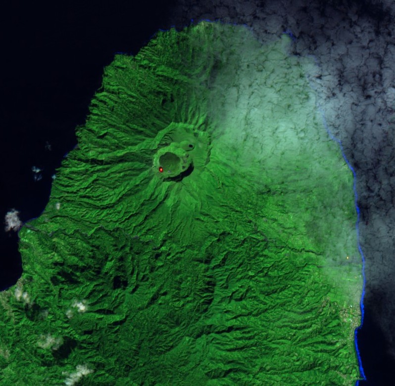
Image credit: Copernicus EU/Sentinel-2, TW. Acquired January 8, 2021 (False Color)
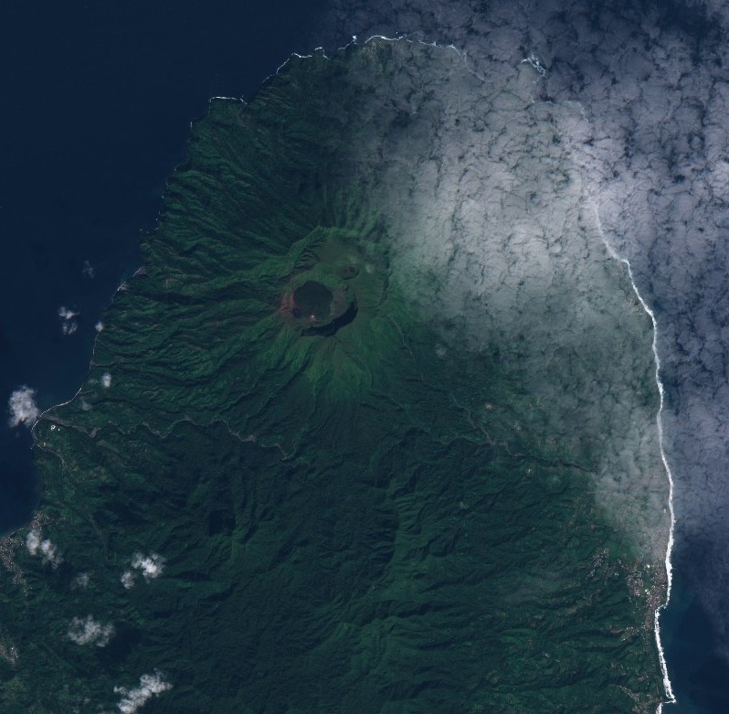
Image credit: Copernicus EU/Sentinel-2, TW. Acquired January 8, 2021 (Natural Color)
Geological summary
Soufrière St. Vincent is the northernmost and youngest volcano on St. Vincent Island. The NE rim of the 1.6 km (1 mile) wide summit crater is cut by a crater formed in 1812.
The crater itself lies on the SW margin of a larger 2.2 km (1.3 miles) wide Somma crater, which is breached widely to the SW as a result of slope failure.
Frequent explosive eruptions since about 4 300 years ago produced pyroclastic deposits of the Yellow Tephra Formation, which blanket much of the island.
The first historical eruption took place in 1718; it and the 1812 eruption produced major explosions.
Much of the northern end of the island was devastated by a major eruption in 1902 that coincided with the catastrophic Mont Pelée eruption on Martinique.
A lava dome was emplaced in the summit crater in 1971 during a strictly effusive eruption, forming an island in a lake that filled the crater prior to an eruption in 1979.
The lake was then largely ejected during a series of explosive eruptions, and the dome was replaced with another.
I'm a dedicated researcher, journalist, and editor at The Watchers. With over 20 years of experience in the media industry, I specialize in hard science news, focusing on extreme weather, seismic and volcanic activity, space weather, and astronomy, including near-Earth objects and planetary defense strategies. You can reach me at teo /at/ watchers.news.
Commenting rules and guidelines
We value the thoughts and opinions of our readers and welcome healthy discussions on our website. In order to maintain a respectful and positive community, we ask that all commenters follow these rules.