
Shallow M6.2 earthquake hits near Tanaga Volcano, Andreanof Islands, Alaska
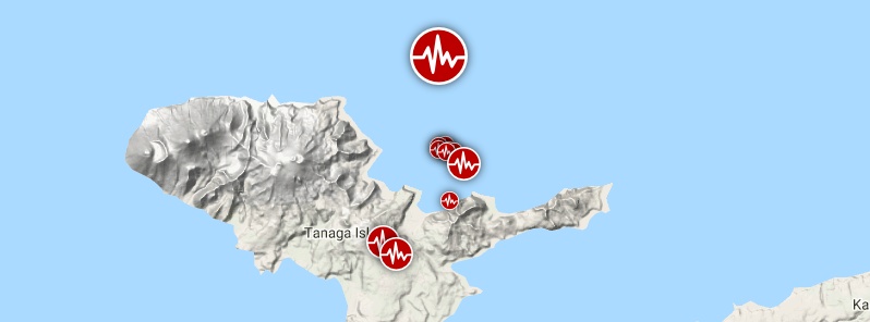
Image credit: Google, TW/SAM
A strong and shallow earthquake registered by the USGS as M6.2 hit near Tanaga Volcano, Andreanof Islands, Alaska at 05:53 UTC on January 23, 2020 (19:53 LT, January 22). The agency is reporting a depth of 10 km (6.2 miles). EMSC is reporting M6.3 at a depth of 10 km. The last eruption of this volcano took place in 1914.
The epicenter was located 82.3 km (51 miles) W of Adak, Alaska.
There are about 100 people living within 100 km (62 miles).
1 000 people are estimated to have felt light shaking.
The USGS issued a green alert for shaking-related fatalities and economic losses. There is a low likelihood of casualties and damage.
Overall, the population in this region resides in structures that are resistant to earthquake shaking, though vulnerable structures exist. The predominant vulnerable building types are unreinforced brick masonry and reinforced masonry construction.
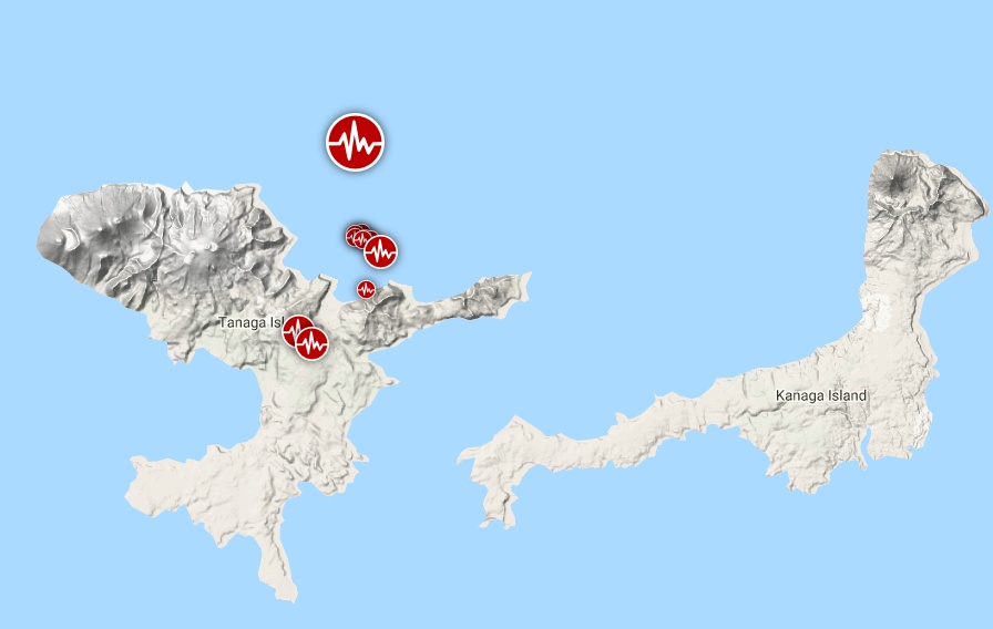
Image credit: Google, TW/SAM
The USGS registered 11 earthquakes in this area from 14:44 UTC on January 22 to 06:49 UTC on January 23. Magnitudes ranged from 2.7 to 6.2.
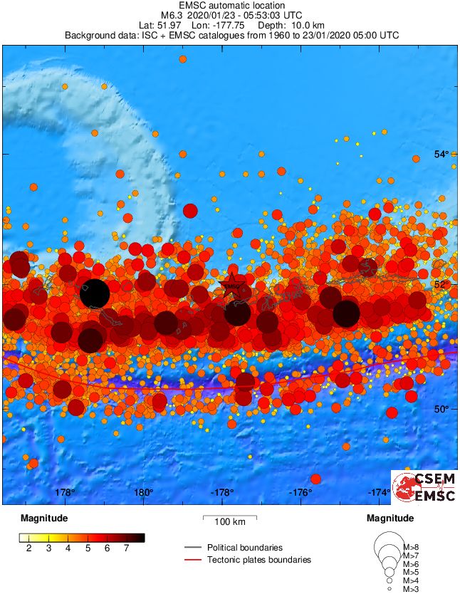
Regional seismicity
Geological summary
Tanaga volcano, the second largest volcanic center of the central Aleutians, is central and highest of three youthful stratovolcanoes oriented along a roughly E-W line at the NW tip of Tanaga Island.
Ridges to the east and south represent the rim of an arcuate caldera formed by the collapse of an ancestral edifice during the Pleistocene.
Most Holocene eruptions originated from the Tanaga volcano itself, which consists of two large cones, the western of which is the highest, constructed within a caldera whose 400-m-high (1 312 feet) rim is prominent to the SE.
At the westernmost end of the complex is conical Sajaka, a double cone that may be the youngest of the three volcanoes. Sajaka One volcano collapsed during the late Holocene, producing a debris avalanche that swept into the sea, after which the Sajaka Two cone was constructed within the collapse scarp.
This volcano is located within the Aleutian Islands, a UNESCO Biosphere Reserve property.
I'm a dedicated researcher, journalist, and editor at The Watchers. With over 20 years of experience in the media industry, I specialize in hard science news, focusing on extreme weather, seismic and volcanic activity, space weather, and astronomy, including near-Earth objects and planetary defense strategies. You can reach me at teo /at/ watchers.news.
Commenting rules and guidelines
We value the thoughts and opinions of our readers and welcome healthy discussions on our website. In order to maintain a respectful and positive community, we ask that all commenters follow these rules.