
Severe storm hits New Zealand, marking the start of summer in the country
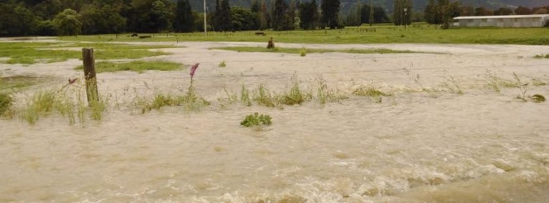
Image credit: Nelson Tasman Civil Defence
A severe storm hit parts of New Zealand on Tuesday, December 3, 2019, bringing heavy rain and strong winds. The lower North Island and portions of the South Island were among the most affected areas.
Otago residents said they witnessed a tornado, rising up to around 60 m (197 feet) and lasting for about 45 seconds. About 20 trees were uprooted.
MetService forecaster Aidan Psyelman said it was difficult to confirm if it had been a tornado swirling across Lake Dunstan, suggesting that it may have been a very strong gust.
Heavy downpour resulted in widespread flooding as well, including in the Inangahua Junction and State Highway 60 while high winds disrupted several flights and delayed sea travel.
Wind gusts had reached 105 km/h (65 mph) at Wellington Airport, and 137 km/h (85 mph) at the peak of Mount Kaukau.
Around 03:51 UTC, Metlink has announced a large number of bus service delays and cancelations across Wellington due to "adverse weather conditions".
Fallen trees were seen in Haitaitai, Makara, Strathmore, Island Bay, and Thorndon.
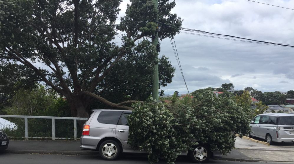
Image credit: @KenQuarrie/Twitter
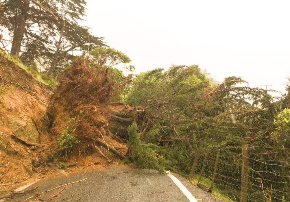
Image credit: @KenQuarrie/Twitter
FINAL UPDATE: 3:10 PM
The road is now open with the trees now clear of the road.^SM https://t.co/bwlyIWMvWn— NZTA Canterbury/WC (@NZTACWC) December 3, 2019
According to MetService meteorologist Lews Ferris, forecast winds for Wednesday, December 4, could have gusts at 90 km/h (56 mph).
"[Wednesday] does look like another windy one for Wellington, with the northerly wind picking up in the afternoon," Ferris said.
Wellington and the rest of the North Island will not be as wet, but further rain is expected in the South Island, particularly West Coast, with thunderstorms likely and gusts to around 100 km/h (62 mph).
"Strong northwesterly winds are also forecast to affect the Canterbury High Country with a Wind Watch currently in place," Ferris added.
Warnings for strong winds are in place in Nelson and Canterbury.
A front heading up the South Island will dump more rain and bring stronger winds, gusting up to 140 km/h (87 mph) in exposed places.
The same front is expected to cause extreme weather conditions across the country, affecting different regions in various ways.
Thunderstorms, hail, and 100 km/h (62 mph) gusts are set to hit the West Coast to Wednesday, December 4, said MetService.
NZ Transport Agency warned commuters venturing over the Remutaka Hill to take precautions as gusts will also slam the road.
SH1 AKL HARBOUR BRIDGE – STRONG WINDS – 1:50PM
Due to strong winds on the Auckland Harbour Bridge, extra care is required especially for high-sided vehicles and motorcycles. ^MF pic.twitter.com/rO1wclMLAW— NZTA Akld & Nthlnd (@NZTAAkl) December 3, 2019
Commenting rules and guidelines
We value the thoughts and opinions of our readers and welcome healthy discussions on our website. In order to maintain a respectful and positive community, we ask that all commenters follow these rules.