
Heavy rainfall and flash flooding threat over the Desert Southwest, U.S.
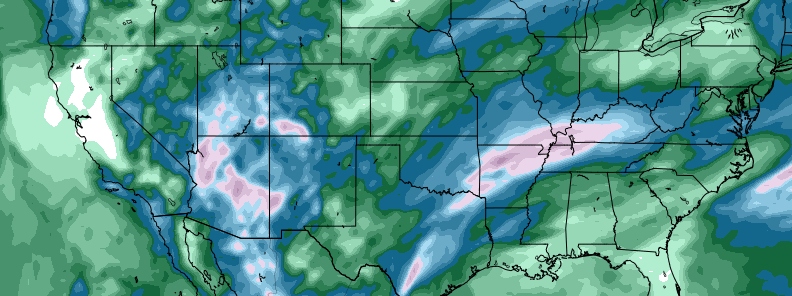
Image credit: GFS, TropicalTidbits
Tropical moisture from the remnants of Tropical Cyclone "Raymond" will be transporting northward into the Desert Southwest into the path of a strong closed upper low west of the Baja Peninsula on Tuesday, November 19, 2019.
As this frontal system progresses through the Great Basin/Four Corners region, temperatures will drop significantly while showers and thunderstorm activity increases across southern California, Arizona and New Mexico into southern Utah by midday Tuesday.
Moderate to heavy rain is expected for much of Arizona and will quickly elevate the risk for flash flooding, NWS forecasters said.
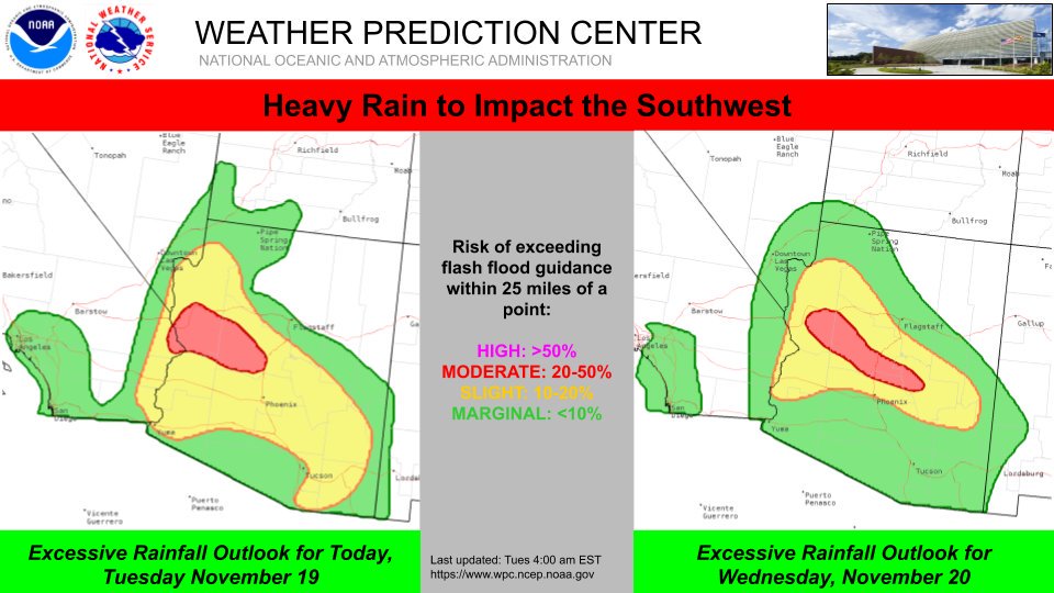
Weather Prediction Center has a Moderate Risk for excessive rainfall in effect for portions of Arizona through Thursday morning where 25 – 75 mm (1 – 3 inches) of rain are forecast through Wednesday afternoon.
During this time the daily maximum temperatures will range from 5 to 11 °C (10 to 20 °F) cooler than average across this section of the country.
I'm a dedicated researcher, journalist, and editor at The Watchers. With over 20 years of experience in the media industry, I specialize in hard science news, focusing on extreme weather, seismic and volcanic activity, space weather, and astronomy, including near-Earth objects and planetary defense strategies. You can reach me at teo /at/ watchers.news.
Commenting rules and guidelines
We value the thoughts and opinions of our readers and welcome healthy discussions on our website. In order to maintain a respectful and positive community, we ask that all commenters follow these rules.