
Tropical Cyclone “Kyarr” drops to 915 hPa, breaks record for the lowest pressure TC in the Arabian Sea
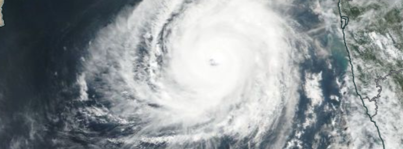
Image credit: NASA/NOAA Suomi NPP/VIIRS
Tropical Cyclone "Kyarr" continued intensifying over the weekend, eventually reaching 915 hPa and breaking the record as the lowest pressure tropical cyclone in the Arabian Sea on record.
The National Center of Meteorology (NCM) issued alerts for UAE residents regarding Kyarr which is expected to move west-northwest to the center of the Arabian Sea.
NCM reported on October 27 that Kyarr is deepening into Category 4 with wind speed around the center 220 to 230 km/h (137 to 143 mph).
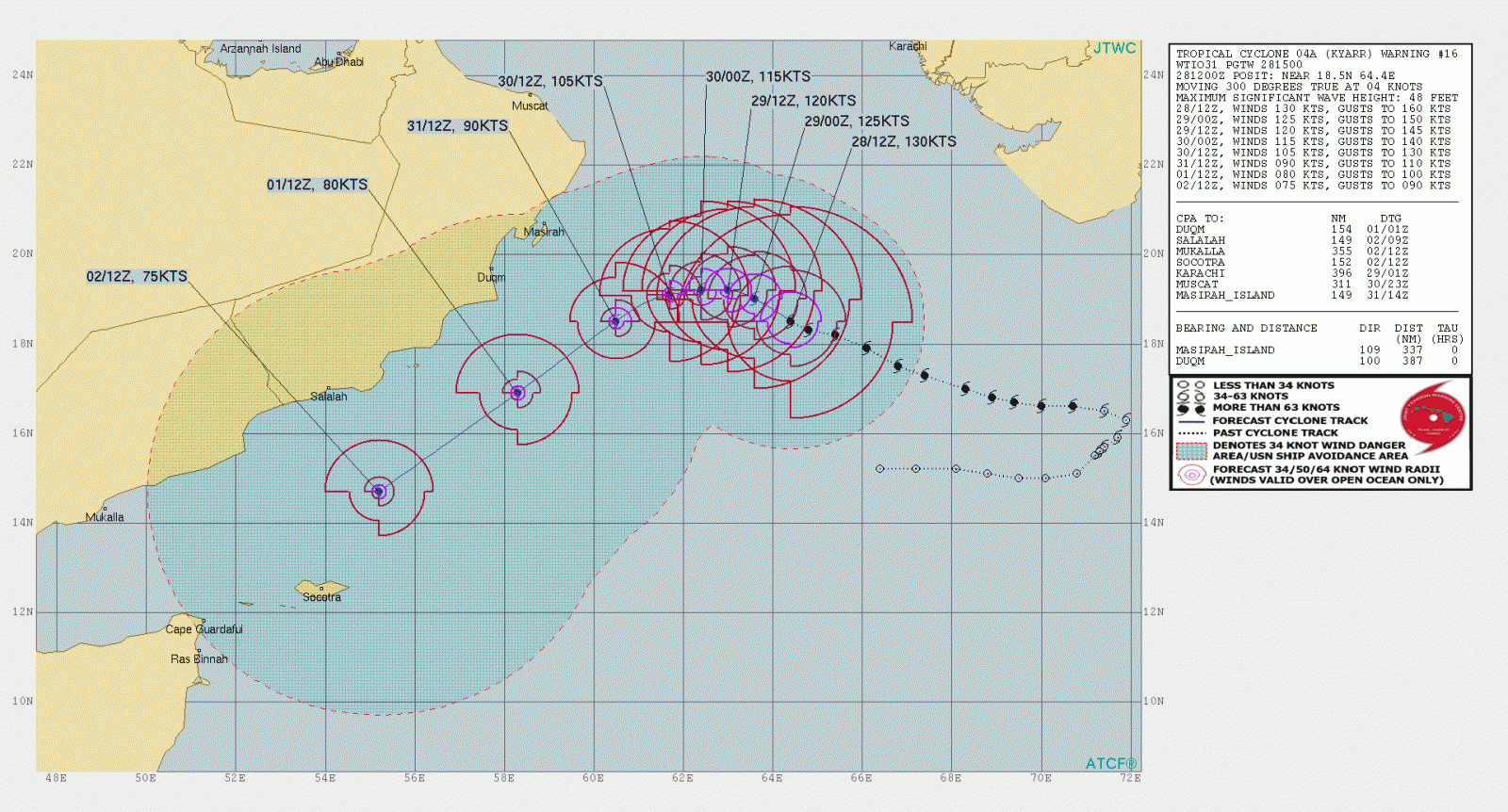
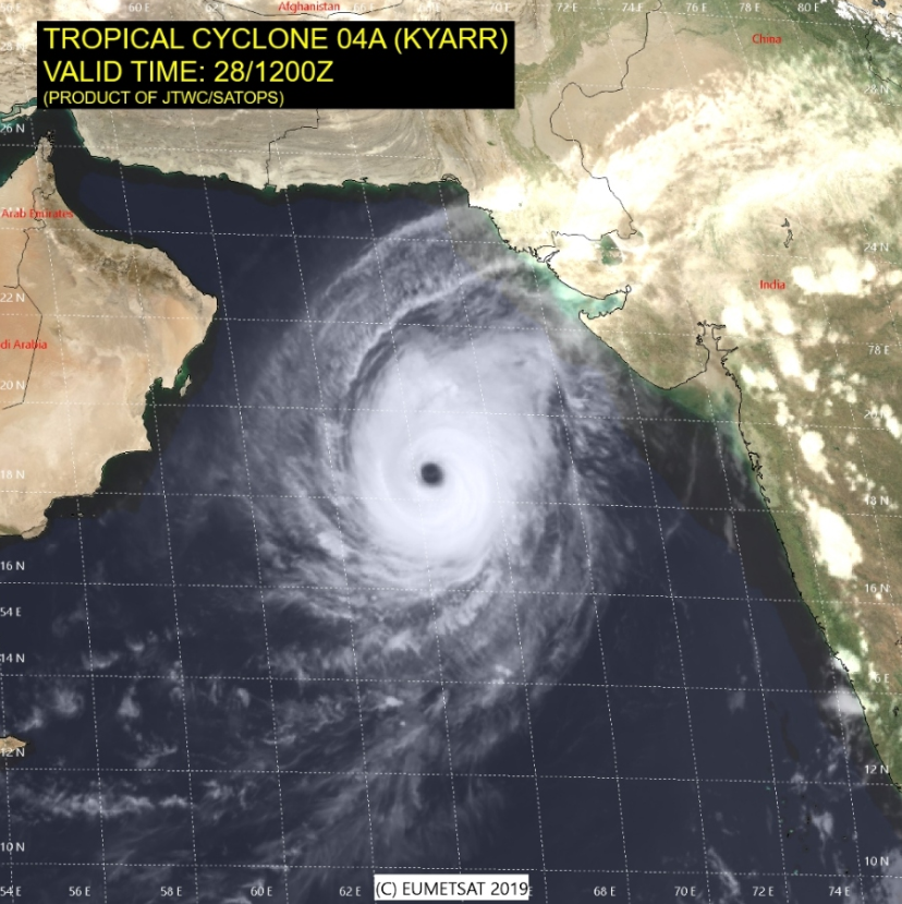
Image credit: JTWC/SATOPS
تحول الاعصار المداري #كيار من الدرجة الأولى إلى الدرجة الرابعة بسرعة رياح حول مركزه تصل 220 – 230 كم/س
Tropical cyclone cat.1 #Kyarr deepening into Tropical cyclone cat.4 with wind speed around the center 220 – 230 km/hr pic.twitter.com/2hH7SDJhWt— المركز الوطني للأرصاد (@NCMS_media) October 27, 2019
Super Cyclonic Storm #Kyarr has the lowest pressure on record in the Arabian Sea, with a central pressure of just 915hPa.
Estimated winds are joint strongest on record, alongside Cyclone #Gonu pic.twitter.com/JPBwQ77yh7
— Met Office (@metoffice) October 27, 2019
Kyarr is expected to further intensify over the next 24 hours to Category 5 with an estimated winds speed of 255 to 265 km/h (158 to 165 mph).
Residents have been advised to take caution as NCM said there will be rough seas and storm surges in some areas during the period of high tide, starting Monday night, through Tuesday, October 29, and Wednesday, October 30.
The Directorate-General of Meteorology in Oman has already issued an alert for 3 to 5 meters (10 to 16 feet) high waves expected to sweep the shoreline in the following days. The roaring waves are expected to impact the eastern and central regions of the country, including the Dhofar Governorate.
Alert for sea status over the next days:Rough sea with max. wave height(3-5 m) is expected to continue along coasts of South Al Sharqiya, Al Wusta and Dhofar with chances of sea water inundation over low level coastal areas.And Mod/Rough (2-3 m) over Oman sea coasts.
#Kyarr pic.twitter.com/r7pl7xG8CH— الأرصاد العمانية (@OmanMeteorology) October 27, 2019
مستجدات الحالة المدارية #كيار في #بحر_العرب
Latest update about tropical cyclone #Kyaar in
#Arabian_Sea pic.twitter.com/NsKlnQo9Nc— الأرصاد العمانية (@OmanMeteorology) October 27, 2019
The cyclone is very likely to intensify to a very severe cyclonic storm, said the Indian Meteorological Department (IMD). "It is very likely to move west-northwest-wards towards Oman coast during the next 5 days. It is very likely to intensify into a Very Severe Cyclonic Storm during the next six hours and further intensify into an extremely severe cyclonic storm during the subsequent 24 hours."
IMD has forecast light to moderate rainfall in most areas with heavy downpours at isolated places over coastal districts of Karnataka, Goa, and south Konkan during the next 12 hours.
Image credit: Joint Typhoon Warning Center (JTWC)
As of 03:00 UTC on October 28, Tropical Cyclone "Kyarr" was about 540 km (336 miles) West-southwest of Mumbai and 1 500 km (932 miles) east of Salalah (Oman), with a maximum sustained surface wind speed of 230 to 240 km/h (143 to 149 mph), gusting to 265 km/h (165 mph).
"The fishermen are also advised not to venture into the east-central Arabian Sea till 28th and into the west-central Arabian Sea from 28th to 31st October 2019," IMD warned.
"Indian Coast Guard has rescued 19 fishermen and escorted more than 2100 fishing boats to safety at various ports on the west coast in the wake of Cyclone Kyarr."
The 2019 North Indian Ocean #cyclone season has now generated more Accumulated Cyclone Energy than any other North Indian Ocean cyclone season on record (since 1972). #Kyarr #hurricanehttps://t.co/GS9ik1rD4l pic.twitter.com/FVIIhKjidO
— Philip Klotzbach (@philklotzbach) October 27, 2019
"The sea condition is very likely to be very high over the east-central Arabian Sea around the system center during the next six hours and phenomenal thereafter. It is very likely to become phenomenal around the system center over the west-central Arabian Sea from 28th to 31st October."
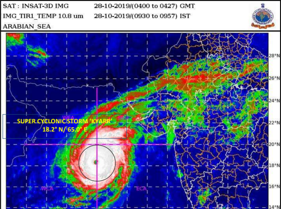
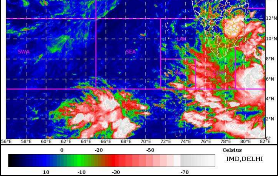
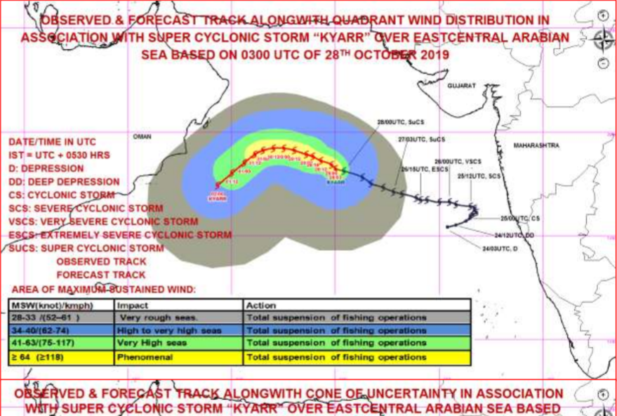
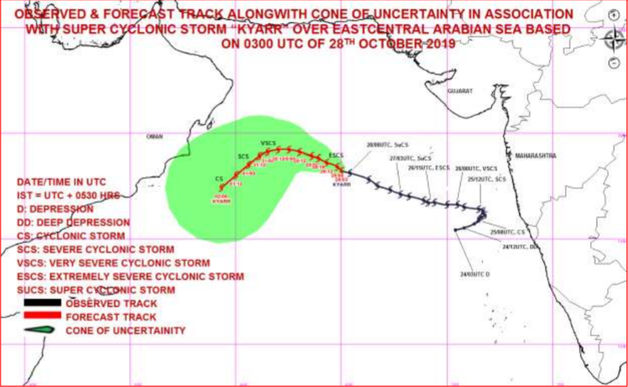
Image credit: Regional Specialized Meteorological Center-Tropical Cyclones, New Delhi Tropical Cyclone Advisory Bulletin No. 26
Commenting rules and guidelines
We value the thoughts and opinions of our readers and welcome healthy discussions on our website. In order to maintain a respectful and positive community, we ask that all commenters follow these rules.