
Tropical Cyclone “Shaheen-Gulab” heading toward landfall in Oman
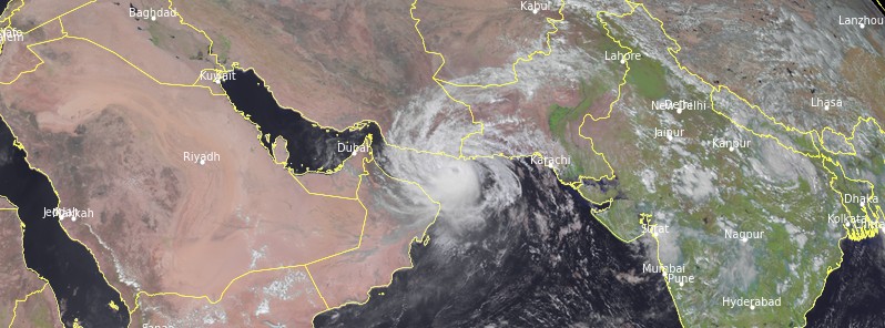
Featured image: Tropical Cyclone "Shaheen-Gulab" at 09:15 UTC on October 2, 2021. Credit: EUMETSAT/Meteosat-8, RAMMB/CIRA, TW
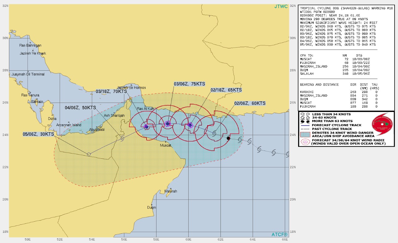
Tropical Cyclone "Shaheen-Gulab" is expected to make landfall in northern Oman late October 3 or early October 4, 2021 (UTC), with maximum sustained winds near 130 km/h (80 mph). The cyclone formed from the remnants of Tropical Cyclone "Gulab" at 21:00 on September 30.
At 06:00 UTC on October 2, the center Shaheen was located about 210 km (130 miles) ESE of Chabahar Port, Iran, and about 370 km (230 miles) ENE of Muscat, Oman.
Its maximum 3-minute sustained winds were 110 km/h (70 mph), with gusts up to 130 km/h (80 mph), while maximum 1-minute sustained winds were 110 km/h (70 mph). The minimum central barometric pressure was 986 hPa and the system was moving WNW at 12 km/h (7.5 mph).
The cyclone is forecast to continue tracking generally WNW over the next 12 hours, then turn west and ultimately southwest over the next 36 hours.
The system is expected to make landfall along the eastern coast of Oman, near Sohar, JTWC said.
Oman's National Multi Hazard Early Warning Center said Shaheen is expected to directly impact the coastal areas from Muscat to north Al Batinah governorates starting Sunday morning (LT), October 3, with strong winds and heavy rains ranging from 200 to 600 mm (7.9 – 23.6 inches), causing severe flash floods over Governorates of North AL Batinah, South AL Batinah, Muscat, AL Dhahira, AL Burami and AL Dakhliya and may extend to the Governorates of Musandam, North AL Sharqiya and South AL Sharqiya.
Sea condition is expected to be very rough over the coastal areas between South Al-Sharqiya to Musandam Governorates with maximum wave height between 8 and 12 m (26 – 39 feet).
In addition, storm surge might cause seawater inundation over low-level coastal areas.
The sea will be rough along the rest of Omani coasts with a maximum wave height between 3 and 5 m (9.8 – 16.4 feet).
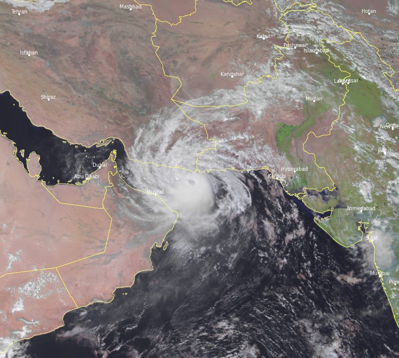
Tropical Cyclone "Shaheen-Gulab" at 09:15 UTC on October 2, 2021. Credit: EUMETSAT/Meteosat-8, RAMMB/CIRA, TW
Shaheen formed from the remnants of Tropical Cyclone "Gulab" on September 30.
Before the remnants of Gulab entered the Arabian Sea on September 29, the storm caused heavy damage in Andra Pradesh and left several people dead.
Gulab downed trees, disrupted communications and electricity, and flooded buildings across the state. 282 mm (11.1 inches) of rain was registered in the city of Vizig, making it the 2nd wettest September on record, behind 2005. Two people in the city drowned.
As Gulab weakened into a deep depression, it entered Telangana and Chhattisgarh dumping enormous amounts of heavy rainfall, Weather.com reported.
In Telangana especially Hyderabad, flash flooding caused disruption in traffic and severe hardships to the residents. Two people were washed away by an overflowed stream. Because of the above situation, the government of Telangana declared a holiday for all government offices, schools, and institutions.
I'm a dedicated researcher, journalist, and editor at The Watchers. With over 20 years of experience in the media industry, I specialize in hard science news, focusing on extreme weather, seismic and volcanic activity, space weather, and astronomy, including near-Earth objects and planetary defense strategies. You can reach me at teo /at/ watchers.news.
Commenting rules and guidelines
We value the thoughts and opinions of our readers and welcome healthy discussions on our website. In order to maintain a respectful and positive community, we ask that all commenters follow these rules.