
Tropical Cyclone “Gulab” to make landfall over Andhra Pradesh and south Odisha coast, India
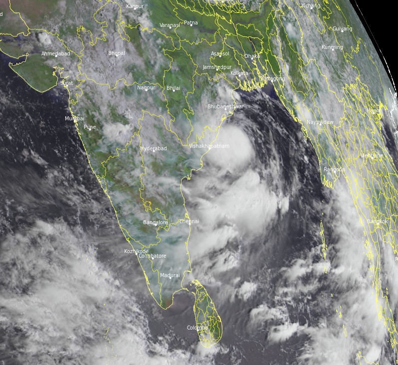
Featured image: Tropical Cyclone "Gulab" at 03:45 UTC on September 21, 2021. Credit: EUMETSAT/Meteosat-8, RAMMB/CIRA, TW
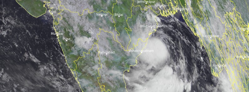
Tropical Cyclone "Gulab" formed in the Bay of Bengal at 15:00 UTC on September 24, 2021, as the third named storm of the 2021 North Indian Ocean cyclone season. The cyclone is moving W toward India with landfall expected on Sunday, September 26, 2021, over Andra Pradesh – Odisha border region.
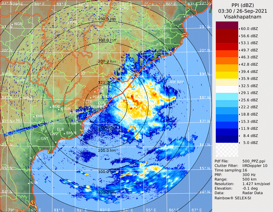
At 06:00 UTC on September 6, the center of Cyclonic Storm "Gulab" was located about 140 km (86 miles) ESE of Gopalpur, Odisha, and about 190 km (118 miles) ENE of Kalingapatnam, Andrash Pradesh.
Gulab's maximum 1- and 3-minute sustained winds were 75 km/h (45 mph), with gusts up to 95 km/h (60 mph). Its minimum central barometric pressure was 994 hPa, and the system was moving westwards at 17 km/h (11 mph).
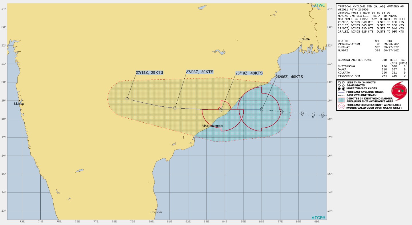
The storm is expected to move nearly westward and cross north Andhra Pradesh – south Odisha coasts between Kalingapatnam and Gopalpur, as a Cyclonic Storm with maximum sustained wind speed of 75 – 85 km/h (45 – 53 mph) to 95 km/h (60 mph), by midnight of today (LT), September 26, 2021.1
The landfall process will commence from the late evening of today (LT), the India Meteorological Department (IMD) said.
Tropical Cyclone "Gulab" at 03:45 UTC on September 21, 2021. Credit: EUMETSAT/Meteosat-8, RAMMB/CIRA, TW
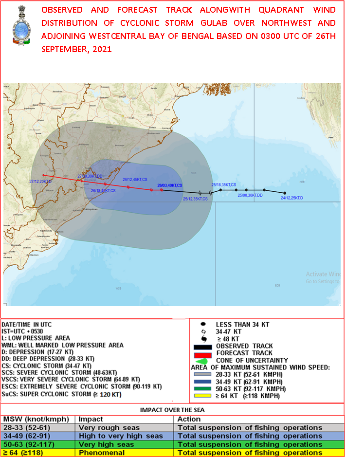
Light to moderate rainfall is expected at most places on September 26, with heavy to very heavy falls at a few places and extremely heavy falls at isolated places very likely over south Odisha and north coastal Andhra Pradesh.
Heavy to very heavy rainfall at isolated places is also likely over Telangana and heavy rainfall at isolated places over north interior Odisha and Chhattisgarh.
Light to moderate rainfall is forecast at most places with heavy to very heavy and extremely heavy falls at isolated places very likely over south Chhattisgarh, Telangana, and Vidarbha on September 27.
Heavy to very heavy falls are expected at isolated places over Odisha and heavy rainfall at isolated places over coastal West Bengal and North Chattisgarh.
Gale wind speeds reaching 75 – 85 km/h (45 – 53 mph) gusting to 95 km/h (60 mph) are very likely to prevail over Northwest and adjoining Westcentral Bay of Bengal until the late-night September 26.
Sea condition will be ‘high’ over Northwest and adjoining Westcentral Bay of Bengal and along and off Odisha, West Bengal, and North Andhra Pradesh till late night / early morning of tomorrow and improve gradually thereafter.
Sea condition will be rough to very rough over east-central and adjoining northeast Bay of Bengal on September 26.
Storm surge warning: Tidal wave of about 0.5 m (1.6 feet) height above the astronomical tide likely to inundate low-lying areas of Srikakulam, Vizianagaram, Ganjam districts during the time of landfall.
The fishermen are advised not to venture into the east-central and adjoining northeast Bay of Bengal and the Andaman Sea on September 26; and into the northwest and adjoining west-central Bay of Bengal and along and off Odisha, West Bengal and North Andhra Pradesh coasts until September 27.
Post Landfall outlook for south Odisha, north Andhra Pradesh, south Chhattisgarh, and adjoining Telangana:
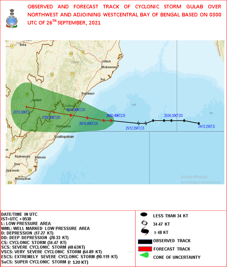
After the landfall, the system is likely to maintain the cyclonic storm intensity with a slight weakening of wind speed during the subsequent 6 hours over south Odisha and adjoining north coastal Andhra Pradesh.
Gulab is expected to weaken gradually into a Depression during the subsequent 12 hours.
Expected impact
- Damage to thatched huts.
- Minor damage to power and communication lines due to breaking of branches and uprooting of trees.
- Major damage to Kutcha and minor damage to Pucca roads.
- Sea water inundation in low-lying areas after erosion of Kutcha embankments.
- Localized Flooding of roads, inundation, and water logging in low-lying areas and closure of underpasses mainly in urban areas of the above region.
- Occasional reduction in visibility due to heavy rainfall.
- Disruption of traffic in cities due to waterlogging in roads. Possibilities of damage to the vulnerable structure.
- Localized Landslides/Mudslides
- Damage to standing crops and horticulture including paddy, banana, papaya trees and orchards due to inundation and strong winds.
- It may lead to riverine flooding in some river catchments (for riverine flooding please visit Web page of CWC).
Action suggested
- Complete suspension of fishing operations, onshore and off-shore activities over the above region until the morning of September 27.
- Stay indoors and in safe places.
- Avoid staying in vulnerable structures.
- Avoid going to areas that face waterlogging problems often.
- Check for traffic congestion on your route before leaving for your destination.
- Follow any traffic advisories that are issued in this regard.
- Follow IMD warnings for updates.
References:
1 India Meteorological Department (Ministry of Earth Sciences) – TIME OF ISSUE: 1245 HOURS IST DATED: 26.09.2021
I'm a dedicated researcher, journalist, and editor at The Watchers. With over 20 years of experience in the media industry, I specialize in hard science news, focusing on extreme weather, seismic and volcanic activity, space weather, and astronomy, including near-Earth objects and planetary defense strategies. You can reach me at teo /at/ watchers.news.
Commenting rules and guidelines
We value the thoughts and opinions of our readers and welcome healthy discussions on our website. In order to maintain a respectful and positive community, we ask that all commenters follow these rules.