
Tropical Storm “Tapah” (Nimfa) heading toward Korean Peninsula and Japan

Featured image: Severe Tropical Storm "Tapah" at 07:20 UTC on September 20, 2019. Credit: JMA/Himawari-8
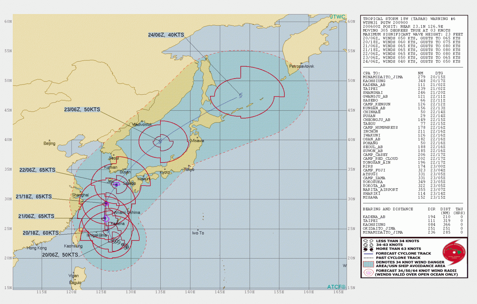
Tropical Storm "Tapah" formed on September 18 from remnants of Tropical Depression "Marilyn" as the 17th named storm of the 2019 Pacific typhoon season. The storm is heading toward the Korean Peninsula and Japan, with forecast track taking it through the Korean Strait into the Sea of Japan.
As of 06:00 UTC on September 20, Severe Tropical Storm "Tapah" (known as Nimfa in the Philippines) was located about 395 km (245 miles) south of Kadena Air Base, Okinawa, Japan.
Its maximum sustained winds were 95 km/h (60 mph), with gusts of 130 km/h (80 mph), and a minimum central pressure of 985 hPa.
Upper level analysis shows that Tapah is under an area of favorable vertical wind shear and remains in an area of warm sea surface temperatures while maintaining strong equatorward outflow to offset the vertical wind shear.

Severe Tropical Storm "Tapah" at 07:20 UTC on September 20, 2019. Credit: JMA/Himawari-8
Tapah is forecast to turn to a NNW track as it recurves around the subtropical ridge to the northeast. The system will steadily intensify, reaching its peak intensity of 120 km/h (75 mph) by 09:00 UTC on September 21.
Tapah will maintain this intensity through 09:00 UTC on September 22 after which increasing vertical wind shear will begin to erode the system as it tracks NE through the Korean Strait and into the Sea of Japan. Additionally, land interaction will continue to weaken the system through 09:00 on September 23.
The system will transition into an extratropical cyclone prior to making landfall in Hokkaido, Japan.

Teo Blašković founded The Watchers in 2011 and edited it until 2026, covering seismic and volcanic activity, extreme weather, space weather and near-Earth objects. Articles on this page are his archive.
Published in the last 24 hours
- Cyclone Akvan weakens after landfall near Gopalpur; more than 300 000 evacuated in Odisha, India
- High Risk of excessive rainfall covers Florida’s Space Coast as St. Johns River near Cocoa reaches 5.67 m
- Four small asteroids will pass close to Earth from November 21 to 23
- A broad low over southeastern Florida and the northwestern Bahamas has a 30 percent chance of subtropical or tropical development within 48 hours and a 50 percent chance within 7 days, the National Hurricane Center says
