
Tropical Depression Three moving NW between Florida and the Bahamas
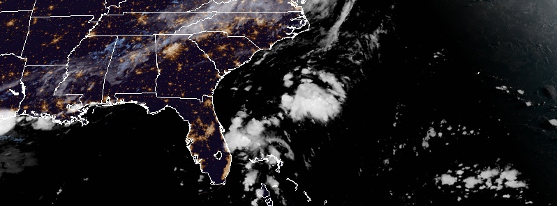
Image credit: NOAA/GOES-East
Tropical Depression Three formed in the Bahamas at 21:00 UTC (17:00 EDT) on July 22, 2019, 195 km (120 miles) E of Palm Beach, Florida. The system was moving NW at 20 km/h (13 mph).
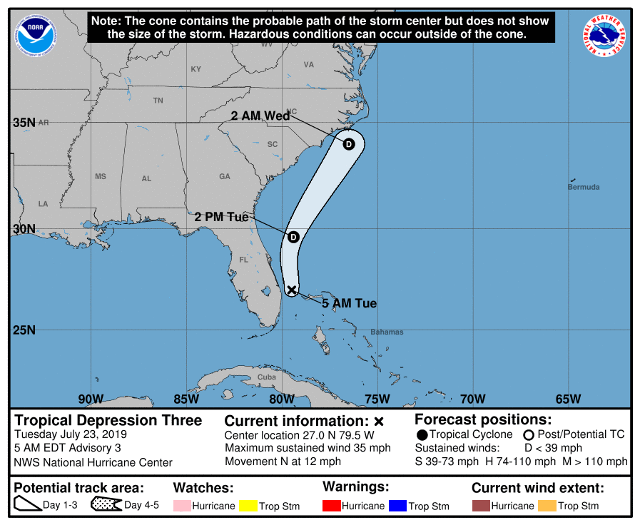
At 09:00 UTC (05:00 EDT) on July 23, the center was located about 70 km (40 miles) ENE of West Palm Beach and 90 km (55 miles) NW of Freeport, Grand Bahama Island. It had maximum sustained winds of 55 km/h (35 mph) and a minimum central pressure of 1 012 hPa.
The depression was moving N at 19 km/h (12 mph) and this general motion is forecast to continue through this afternoon (EDT).
A motion toward NNE with an increase in forward speed is expected tonight, followed by a turn toward the northeast on Wednesday, July 24.
On the forecast track, the center of the depression should remain offshore the coast of SE United States through Wednesday when it is expected to dissipate.
Rainfall amounts of 25 – 50 mm (1 – 3 inches) are expected across the Bahamas through the rest of the day.
The model below shows Total Accumulated Precipitation through August 3. Credit: GFS/TropicalTidbits
An Air Force Reserve reconnaissance aircraft will investigate the depression later this morning to provide a better estimate of the cyclone's intensity.
"Although significant strengthening of the depression is not expected, it is certainly possible that the cyclone could briefly reach tropical storm status in the 12-to-24-hour period when the system will be accelerating and the vertical wind shear decreases to less than 5 knots (9 km/h, 5 mph)," NWS forecaster Stewart noted 09:00 UTC.
"However, in the event that the cyclone should become a tropical storm, the rapid northeastward motion will act to keep the strongest winds to the east of the center, well offshore of the U.S. coastal areas. By Wednesday afternoon, the combination of strong southwesterly vertical wind shear and interaction with an approaching cold front is expected to result in rapid weakening and dissipation of the cyclone. The official intensity forecast is similar to the previous advisory and shows dissipation by 36 hours."
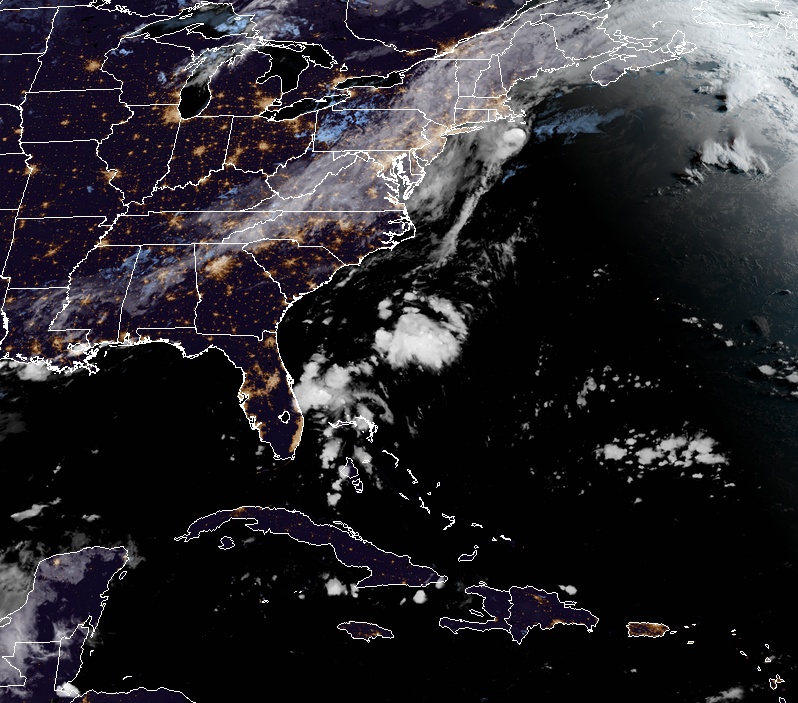
Tropical Depression Three at 10:00 UTC on July 23, 2019. Credit: NOAA/GOES-East
I'm a dedicated researcher, journalist, and editor at The Watchers. With over 20 years of experience in the media industry, I specialize in hard science news, focusing on extreme weather, seismic and volcanic activity, space weather, and astronomy, including near-Earth objects and planetary defense strategies. You can reach me at teo /at/ watchers.news.
Commenting rules and guidelines
We value the thoughts and opinions of our readers and welcome healthy discussions on our website. In order to maintain a respectful and positive community, we ask that all commenters follow these rules.