
Gujarat to escape fury of Very Severe Cyclone “Vayu” but red alert remains
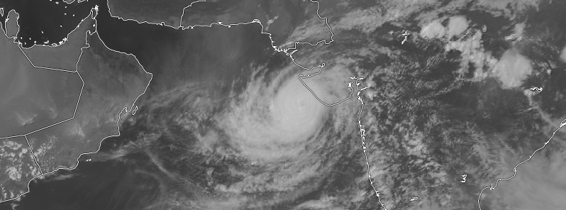
Featured image: Tropical Cyclone "Vayu" at 13:00 UTC on June 13, 2019. Credit: UW-CIMSS, TW
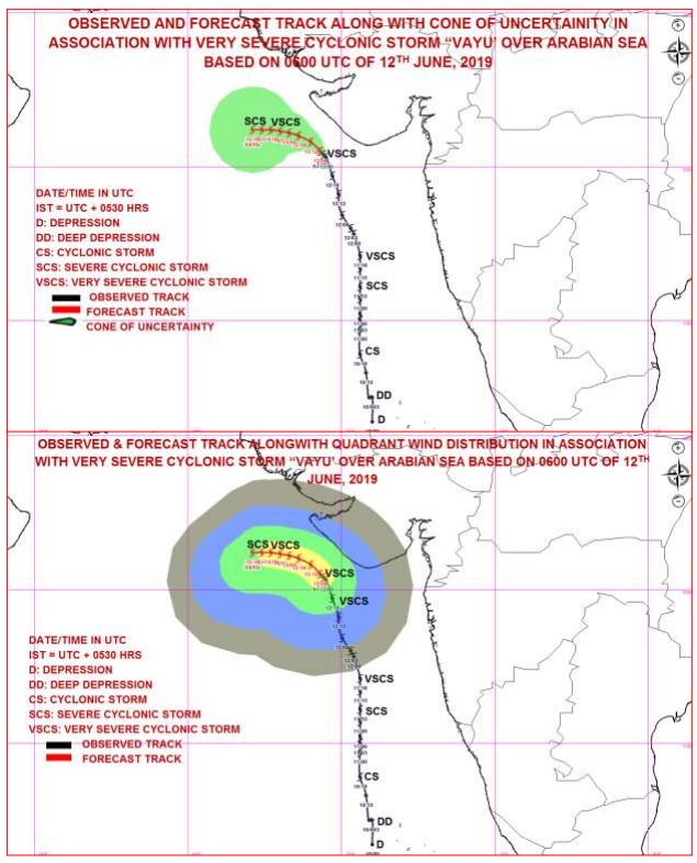
Very Severe Cyclone "Vayu" is changing course and is no longer expected to make landfall over Gujarat, India.
However, as it would move in close proximity of Saurashtra coast, heavy to very heavy rains would lash Porbandar, Dwarka, Okha Junagarh, Jamnagar today.
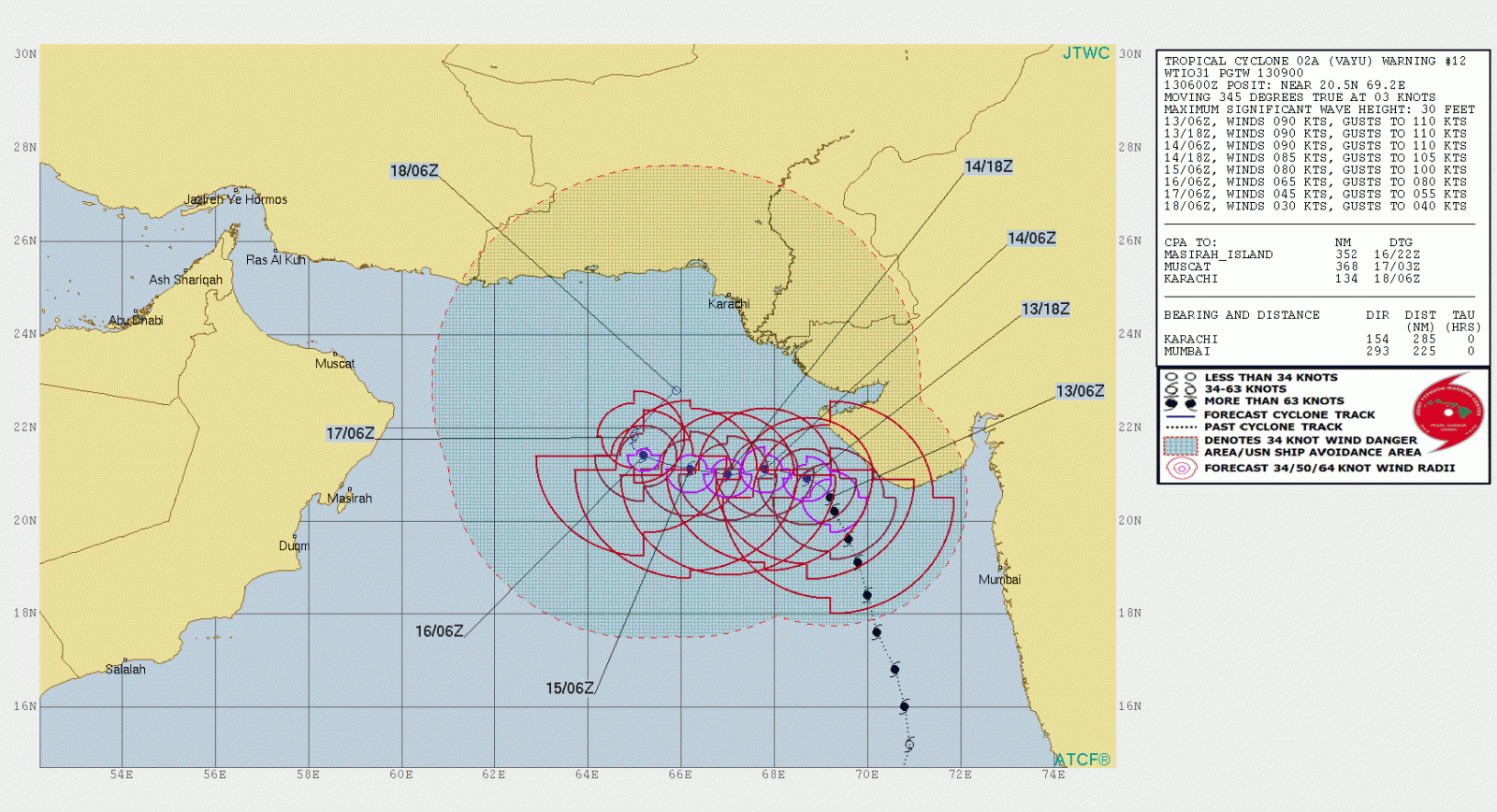
As of 06:00 UTC on June 13, the center of Very Severe Cyclonic Storm "Vayu" about 170 km (105 mph) SSW of Diu, 120 km (75 miles) WSW of Veraval and 130 km (80 miles) S of Porbandar, Gujarat. It was moving at a speed of 5 km/h (3.1 mph), according to RSMC New Delhi.
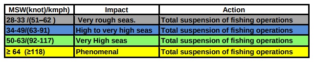
"It is very likely to move north-northwestwards for some time and then northwestwards skirting the Saurashtra coast affecting Gir Somnath, Diu, Junagarh, Porbandar and Devbhoomi Dwarka districts of Gujarat state with wind Speed 90 – 100 km/h (56 – 62 mph) gusting to 110 km/h (68 mph) during next 12 hours.
I'm a dedicated researcher, journalist, and editor at The Watchers. With over 20 years of experience in the media industry, I specialize in hard science news, focusing on extreme weather, seismic and volcanic activity, space weather, and astronomy, including near-Earth objects and planetary defense strategies. You can reach me at teo /at/ watchers.news.
Commenting rules and guidelines
We value the thoughts and opinions of our readers and welcome healthy discussions on our website. In order to maintain a respectful and positive community, we ask that all commenters follow these rules.