
Powerful eruption at Manam volcano, ash to 16.7 km (55 000 feet) a.s.l., P.N.G.
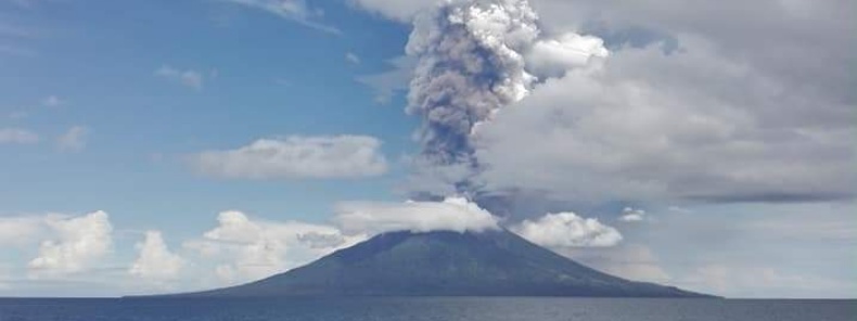
Featured image: Manam volcano on December 8, 2018. Credit: Scott Waide
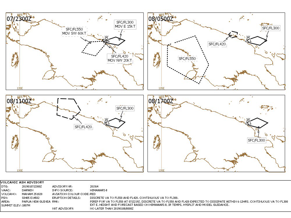
A powerful eruption started at Manam volcano, Papua New Guinea around 21:00 UTC on January 7, 2019. The Aviation Color Code was raised to Red. Volcanic ash dissipated by 06:15 UTC, January 8.
According to the Darwin VAAC, satellite imagery suggest volcanic ash cloud rose up to 16.7 km (55 000 feet) above sea level, the center reported 22:59 UTC. "Discrete volcanic ash to 16.7 km (55 000 feet) a.s.l. and 12.8 km (42 000 feet) a.s.l. expected to dissipate within 6 to 12 hours. Continuous VA to 9.1 km (30 000 feet) is extending east. Height and forecast based on Himawari-8, IR temps, HYSPLIT and model guidance."
Volcanic ash is difficult to discern due to a meteorological cloud, the center reported 03:59 UTC, January 8. However, the eruption is thought to be on-going to 9.1 km (30 000 feet) a.s.l., extending northeast. Volcanic ash to 16.7 km (55 000 feet) and 12.8 km (42 000 feet) has now dissipated.
Satellite imagery at 06:15 UTC indicated volcanic ash has dissipated. While hotspot remains visible, volcanic ash advisory was terminated.
This was the highest plume produced by the volcano since 2015 when VA rose to 19.8 km (65 000 feet) a.s.l.
The last time a powerful eruption took place at Manam volcano was on December 8, 2018. Heavy ashfall was reported falling on the island and blocking out sunlight.
Volcanic ash rose up to 13.7 km (45 000 feet) above sea level, according to the Darwin VAAC, forcing authorities to raise the Aviation Color Code to Red.
Geological summary
The 10-km-wide (6.2 miles) island of Manam, lying 13 km (8 miles) off the northern coast of mainland Papua New Guinea, is one of the country's most active volcanoes. Four large radial valleys extend from the unvegetated summit of the conical 1 807-m-high (5 928 feet) basaltic-andesitic stratovolcano to its lower flanks.
These "avalanche valleys" channel lava flows and pyroclastic avalanches that have sometimes reached the coast. Five small satellitic centers are located near the island's shoreline on the northern, southern, and western sides.
Two summit craters are present; both are active, although most historical eruptions have originated from the southern crater, concentrating eruptive products during much of the past century into the SE valley.
Frequent historical eruptions, typically of mild-to-moderate scale, have been recorded since 1616. Occasional larger eruptions have produced pyroclastic flows and lava flows that reached flat-lying coastal areas and entered the sea, sometimes impacting populated areas. (GVP)
I'm a dedicated researcher, journalist, and editor at The Watchers. With over 20 years of experience in the media industry, I specialize in hard science news, focusing on extreme weather, seismic and volcanic activity, space weather, and astronomy, including near-Earth objects and planetary defense strategies. You can reach me at teo /at/ watchers.news.
Commenting rules and guidelines
We value the thoughts and opinions of our readers and welcome healthy discussions on our website. In order to maintain a respectful and positive community, we ask that all commenters follow these rules.