
M6.1 earthquake hits eastern Papua, Indonesia
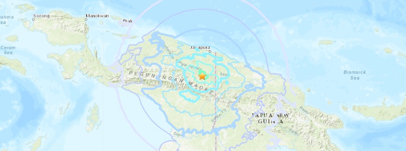
Image credit: USGS
A strong earthquake registered by the USGS as M6.1 hit eastern Papua, Indonesia at 09:42 UTC on December 16, 2018. The agency is reporting a depth of 61.1 km (37.9 miles). EMSC is reporting M6.1 at a depth 68 km (42.2 miles).
The epicenter was located 65.1 km (40.4 miles) ESE of Elelim, 149.4 km (92.8 miles) SSW of Abepura (population 62 248), and 158.8 km (98.7 miles) SSW of Jayapura (population 134 895), Papua, Indonesia.
There are about 220 000 people living within 100 km (62 miles).
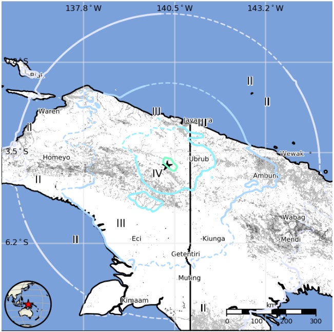
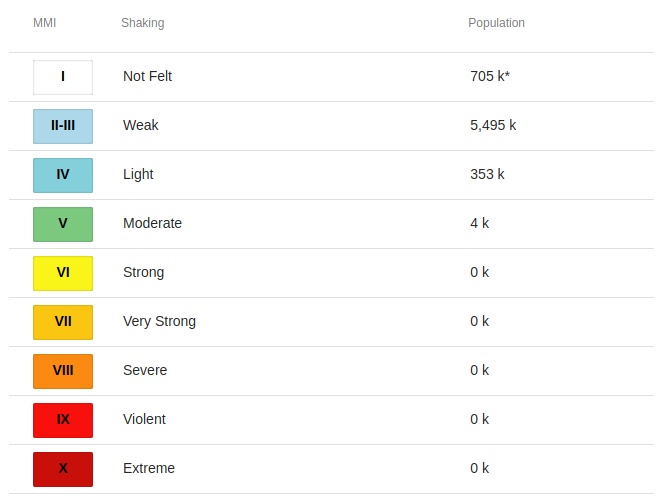
Some 4 000 people are estimated to have felt moderate shaking, 353 000 light, and 5 495 000 weak.
Estimated population exposure to earthquake shaking
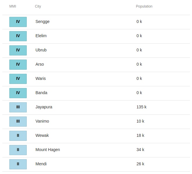
Selected cities exposed
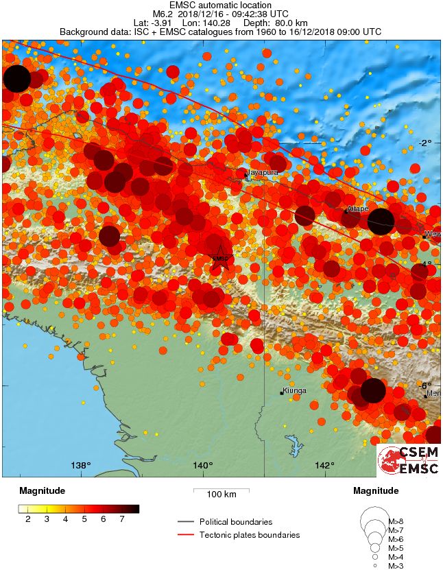
Regional seismicity
I'm a dedicated researcher, journalist, and editor at The Watchers. With over 20 years of experience in the media industry, I specialize in hard science news, focusing on extreme weather, seismic and volcanic activity, space weather, and astronomy, including near-Earth objects and planetary defense strategies. You can reach me at teo /at/ watchers.news.
Commenting rules and guidelines
We value the thoughts and opinions of our readers and welcome healthy discussions on our website. In order to maintain a respectful and positive community, we ask that all commenters follow these rules.