
Kirk regenerates into a tropical storm, heading toward northern Windward Islands

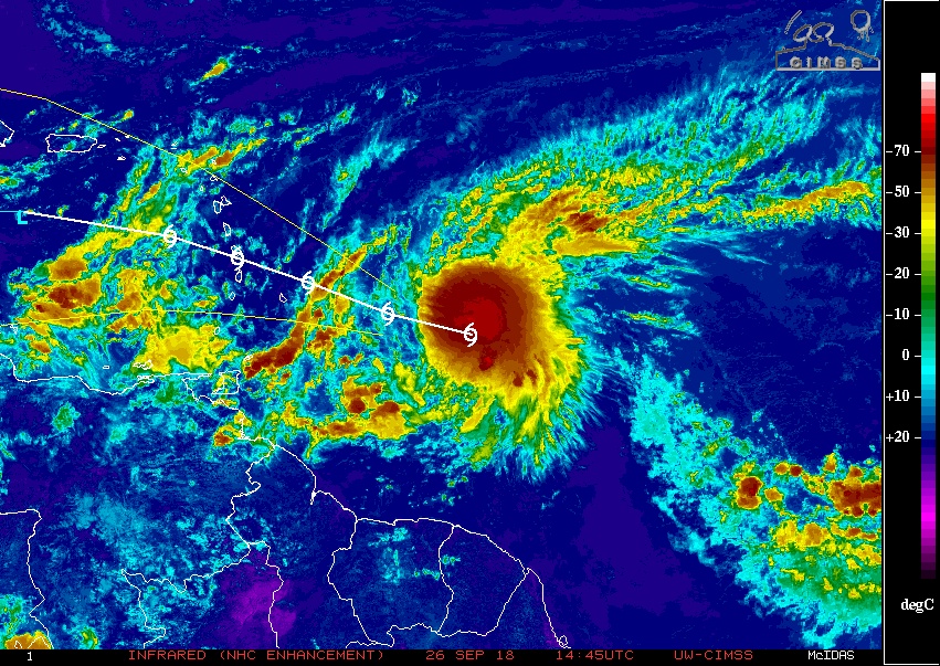
Featured image: Tropical Storm "Kirk" at 15:00 UTC on September 26, 2018. Credit: NOAA/GOES-East
Kirk has regenerated into a tropical storm at 09:00 UTC on Wednesday, September 26, 2018, prompting authorities to issue tropical storm warnings and watches for portions of the Lesser Antilles. Tropical Storm Warning is in effect for Barbados, St. Lucia, Dominica, Martinique and Guadeloupe. Tropical Storm Watch is in effect for St. Vincent and the Grenadines.
Interests elsewhere in the central and northern Lesser Antilles should monitor the progress of Kirk as additional warnings or watches could be issued later today.
At 15:00 UTC (11:00 AST), the center of Tropical Storm "Kirk" was located about 575 km (360 miles) ESE of Barbados and 780 km (485 miles) ESE of Martinique. It had maximum sustained winds of 85 km/h (50 mph) and was moving W at 30 km/h (18 mph). Miniumum central pressure was 1 002 hPa.
A westward to west-northwestward motion is expected over the next few days.
On the forecast track, the center will move over the Lesser Antilles within the Tropical Storm Warning area Thursday night, September 27 (AST).
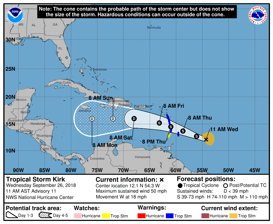
Little change in strength is forecast until Kirk crosses the Lesser Antilles, followed by weakening over the eastern Caribbean Sea.
Tropical storm conditions are expected to first reach the warning area by Thursday afternoon, September 27, making outside preparations difficult or dangerous, NHC said. Tropical storm conditions are possible within the watch area by Thursday afternoon or evening.

Tropical Storm "Kirk" at 15:00 UTC on September 26, 2018. Credit: NOAA/GOES-East
Kirk is expected to produce total rainfall totals of 101.6 – 152.4 mm (4 to 6 inches) with maximum totals up to 254 mm (10 inches) across the northern Windward and southern Leeward Islands from Barbados and St. Lucia northward across Martinique and Dominica.
These rains may produce life-threatening flash floods and mudslides.

Teo Blašković founded The Watchers in 2011 and edited it until 2026, covering seismic and volcanic activity, extreme weather, space weather and near-Earth objects. Articles on this page are his archive.
Published in the last 24 hours
- In April 2014, golden-winged warblers in the mountains of Tennessee, songbirds weighing about as much as four dimes, fled their breeding grounds a day or two before a tornado outbreak and flew hundreds of miles south, while the scientists tracking them sheltered in a Waffle House Epicenter
- After record Nordic heatwave, Swedish researchers to recreate indoor heat to study older adults Epicenter
- San Juan River cuts through 300-million-year-old rocks while retaining its winding course in Utah Epicenter
- Britain appointed a Minister for Drought in August 1976, and it rained so much afterward that by November MPs were calling him the Minister of Flood Epicenter

those are the Southern Windward Is.
Below those are the Leeward Is.
It will be strong winds for places by Martinique etc….