
Very deep M6.7 earthquake under Flores Sea, Indonesia
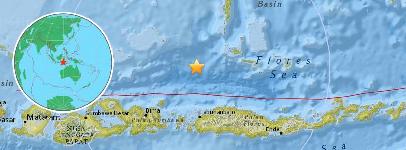
Image credit: USGS, EMSC
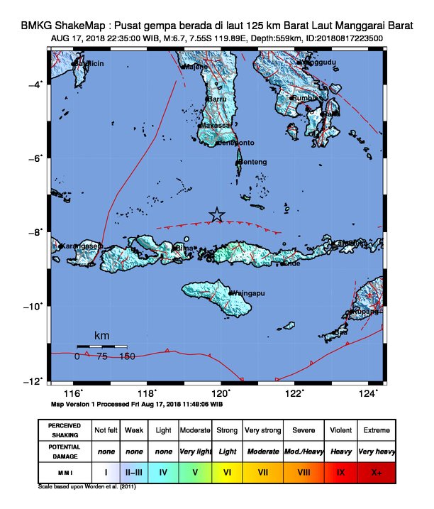
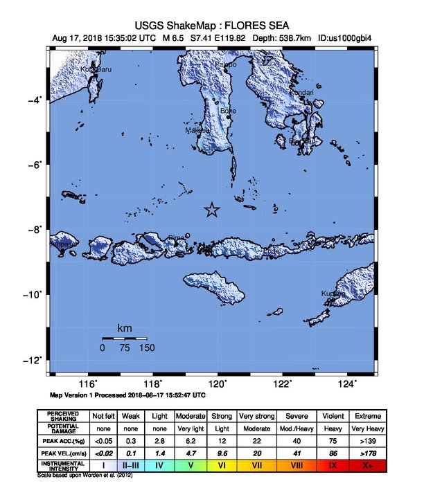
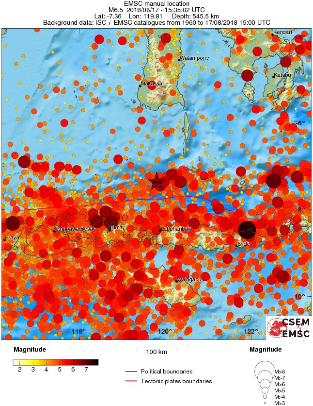
A very deep earthquake registered by the BMKG as M6.7 hit under the Flores Sea, Indonesia at 15:35 UTC on August 17, 2018. The agency is reporting a depth of 559 km (347 miles). USGS is reporting M6.5 at a depth of 538.7 km (334 miles). EMSC is reporting M6.1 at a depth of 546 km (339 miles). This earthquake can have a low humanitarian impact based on the magnitude and the affected population and their vulnerability.
According to the USGS, the epicenter was located 109.3 km (67.9 miles) NNW of Kampungbajo, 120 km (74.5 miles) N of Labuan Bajo (population 188 724), 150.3 km (93.4 miles) NNW of Ruteng (population 34 569) and 167 km (103.8 miles) NE of Bima (population 66 970), Indonesia.
The quake had no tsunami potential, BMKG said.
There are about 3 000 people living within 100 km (62 miles).
Some 26 659 000 people are estimated to have felt weak shaking.
The USGS issued a green alert for shaking-related fatalities and economic losses. There is a low likelihood of casualties and damage.
Overall, the population in this region resides in structures that are vulnerable to earthquake shaking, though resistant structures exist. The predominant vulnerable building types are unreinforced brick with concrete floor and precast concrete frame with wall construction.
Recent earthquakes in this area have caused secondary hazards such as landslides that might have contributed to losses.
Regional seismicity
I'm a dedicated researcher, journalist, and editor at The Watchers. With over 20 years of experience in the media industry, I specialize in hard science news, focusing on extreme weather, seismic and volcanic activity, space weather, and astronomy, including near-Earth objects and planetary defense strategies. You can reach me at teo /at/ watchers.news.
Commenting rules and guidelines
We value the thoughts and opinions of our readers and welcome healthy discussions on our website. In order to maintain a respectful and positive community, we ask that all commenters follow these rules.