
Mount Shinmoe erupts again, ashfall reported, Japan
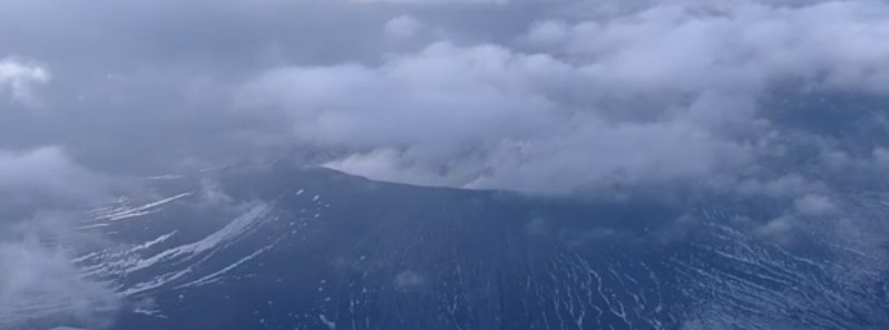
Featured image: Shinmoedake volcano on October 11, 2017. Credit: NHK
Japanese Shinmoedake volcano in Kyushu started erupting again around 02:00 UTC on March 1, 2018 (11:00 local time). After six years of quiescence, this volcano roared back to life on September 7, 2017, coating nearby cities and towns with a thin layer of ash.
The Japanese Meteorological Agency (JMA) said volcanic tremors on Mount Shinmoe in the Kirishima mountain range, bordering Kagoshima and Miyazaki prefectures, started around 08:15 JST today (00:15 UTC).
Volcanic ash is not identifiable in satellite images and webcams cannot confirm it due to a meteorological cloud, but ashfall was confirmed in the town of Takaharu, located east of the mountain. According to Kyodo, the town officials confirmed the presence of fallen ash, while residents also reported the sighting of ash. There were no immediate reports of injuries or property damage, according to police.
11:10ころ高原町役場の方が,県道祓川高崎線を通行した時に灰が降ってきたとのこと.フロントガラスにちょっとだけ火山灰が付いている.風向きから考えて桜島ではない. pic.twitter.com/U5FflrWR84
— Ryusuke IMURA (@tigers_1964) March 1, 2018
JMA said it will dispatch its officials to the area to probe the situation.
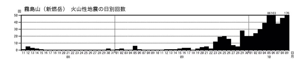
Earthquakes under Shinmoedake volcano before eruption on October 10, 2017
Shinmoedake started erupting for the first time in six years at 20:34 UTC on October 10 (05:34 JST, October 11), prompting JMA to raise the volcanic alert level to 3 for the first time since October 2013.
Alert Level 3 is still in place. It means residents and tourists are not allowed to approach the mountain within 2 km (1.2 miles) due to the possibility of flying rocks and pyroclastic flows.
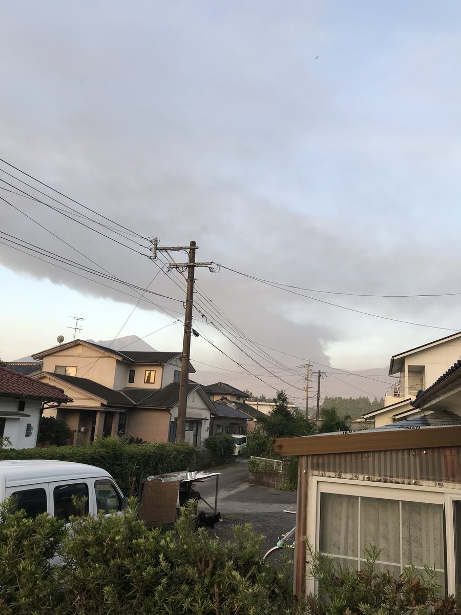
Ash plume rising from Shinmoedake volcano on October 11, 2017. Credit: 谷山天一(たにやまひろかず)
Geological summary
Kirishimayama is a large group of more than 20 Quaternary volcanoes located north of Kagoshima Bay. The late-Pleistocene to Holocene dominantly andesitic group consists of stratovolcanoes, pyroclastic cones, maars, and underlying shield volcanoes located over an area of 20 x 30 km (12.4 – 18.6 miles). The larger stratovolcanoes are scattered throughout the field, with the centrally located, 1700-m-high (5 577 feet) Karakunidake being the highest.
Onamiike and Miike, the two largest maars, are located SW of Karakunidake and at its far eastern end, respectively. Holocene eruptions have been concentrated along an E-W line of vents from Miike to Ohachi, and at Shinmoedake to the NE. Frequent small-to-moderate explosive eruptions have been recorded since the 8th century. (GVP)
I'm a dedicated researcher, journalist, and editor at The Watchers. With over 20 years of experience in the media industry, I specialize in hard science news, focusing on extreme weather, seismic and volcanic activity, space weather, and astronomy, including near-Earth objects and planetary defense strategies. You can reach me at teo /at/ watchers.news.
Commenting rules and guidelines
We value the thoughts and opinions of our readers and welcome healthy discussions on our website. In order to maintain a respectful and positive community, we ask that all commenters follow these rules.