
How glaciers disappeared from Scotland at the end of the last Ice Age
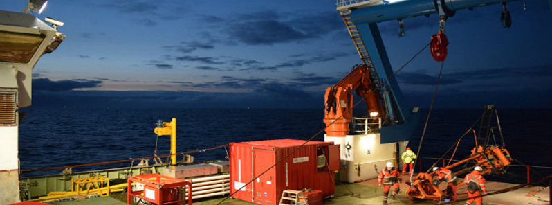
Image credit: University of Stirling
Research led by a Stirling academic, Dr. Tom Bradwell, has revealed how glaciers disappeared from Scotland at the end of the last Ice Age.
Bradwell led a research team in taking samples offshore around the north-west of Scotland, and Shetland. The activity was part of the £3.7m (4.85 US$), five-year Natural Environment Research Council-funded Britice-Chrono project, which collected and dated material to help pinpoint precisely when and how the last British-Irish ice sheet disappeared.
The team collected dozens of sediment cores from the seabed, before conducting high-resolution X-ray scans to reveal previously unseen clues about the ice sheet which covered the region between 20 000 and 14 000 years ago.
"This is the first time that we’ve taken continuous high-quality sediment cores from beneath a former ice stream, in some of the deepest waters around the British Isles, some of which are still uncharted," Bradwell said.
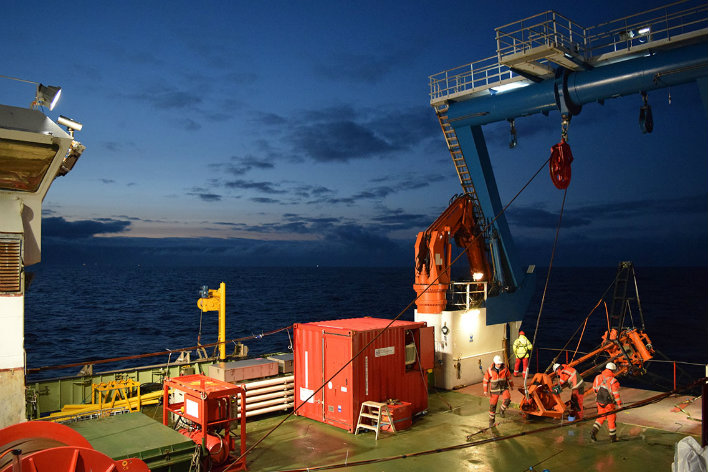
Dr. Tom Bradwell led a research team in taking samples offshore around the north-west of Scotland, and Shetland.
"Radiocarbon dates from shells found in these cores place the ice sheet margin in the Minch 20 000 years ago. By 16 000 years ago the ice was back on land; and by 14 000 years ago virtually all the ice in Scotland had melted.
"It’s vital that we understand how the last British ice sheet grew and the style and rate at which it receded. At the moment, we see massive ice shelves breaking up around West Antarctica, but we don’t know how long this will go on for.
"Working on former ice sheets, like the one that covered Scotland, allows us to view the whole ice-sheet growth and decay cycle, rather than just get a ‘snapshot’ in time.
"The similarities between what we see happening in West Antarctica today and what we see on the seabed around Scotland are striking.
"We’re pretty sure that these new cores will give us the information we need to accurately say, for the first time, when and why it happened.”
The cores were collected using the British Geological Survey’s Vibrocorer system, which is capable of operating in up to 6 000 m (3.7 miles) of water. During the study, the Vibrocorer was lowered from the research ship onto the seabed where it then collected micro-fine layers of mud, silt, sand and larger glacial debris in plastic tubes, up to 6 m (19.7 feet) into the seabed.
Provided by University of Stirling
Commenting rules and guidelines
We value the thoughts and opinions of our readers and welcome healthy discussions on our website. In order to maintain a respectful and positive community, we ask that all commenters follow these rules.